
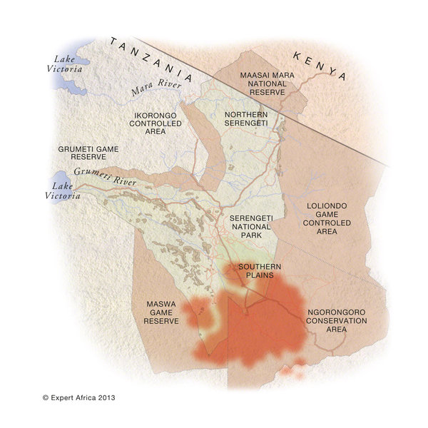


January: herds spread to graze across the southern Serengeti's lush short-grass plains
February: they spread out across the short-grass plains; most calf in a 2-3 week window
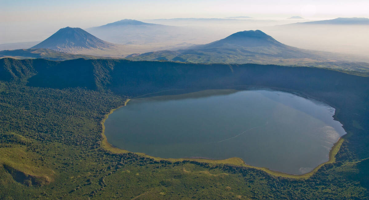
March: still spread over the short-grass plains of the southern Serengeti, Loliondo and NCA
April: the herds start migrating north, through Moru Kopjes and Seronera areas
May: the migration heads north through Seronera towards the Western Corridor
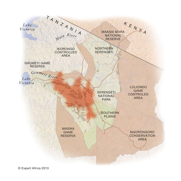
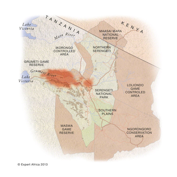
June: herds mass in the western corridor, bunching before crossing the Grumeti River
July: some cross the Grumeti & head through Grumeti Reserve; others head north in the park
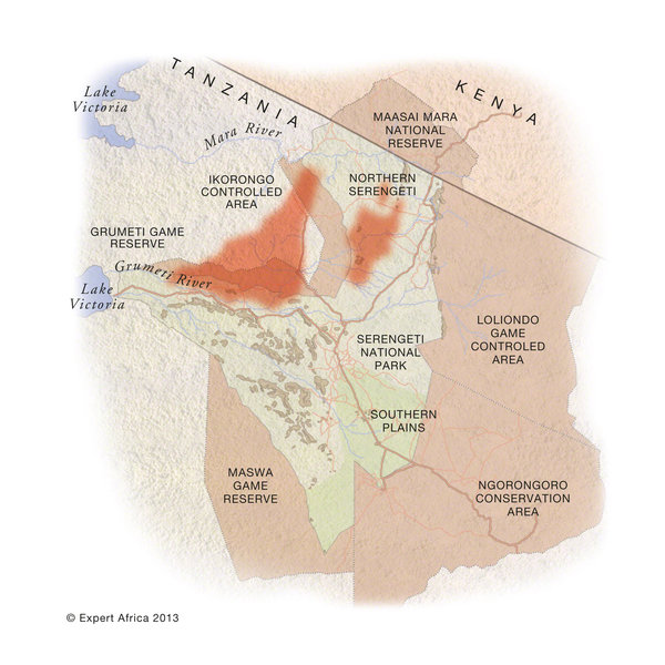
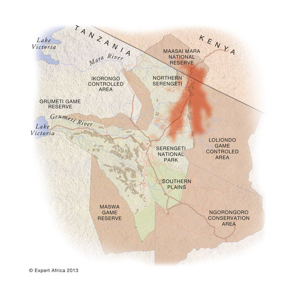
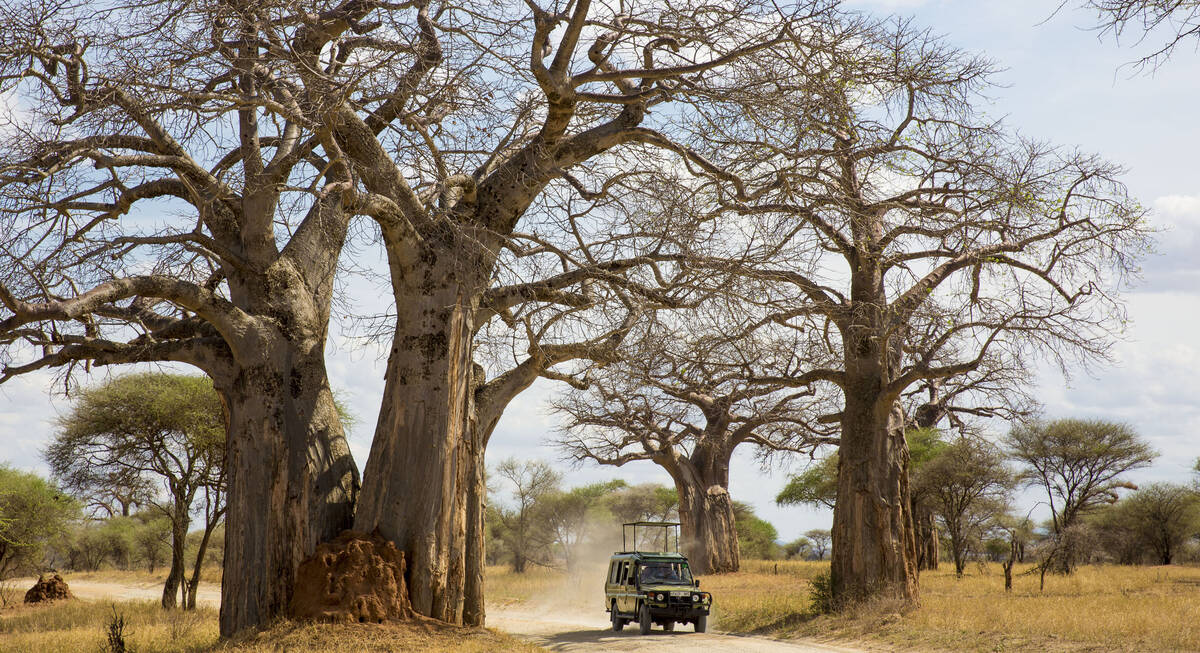
August: herds pass through Ikorongo and into the far north-west of the national park
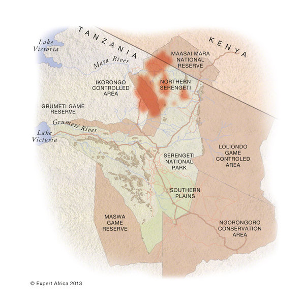
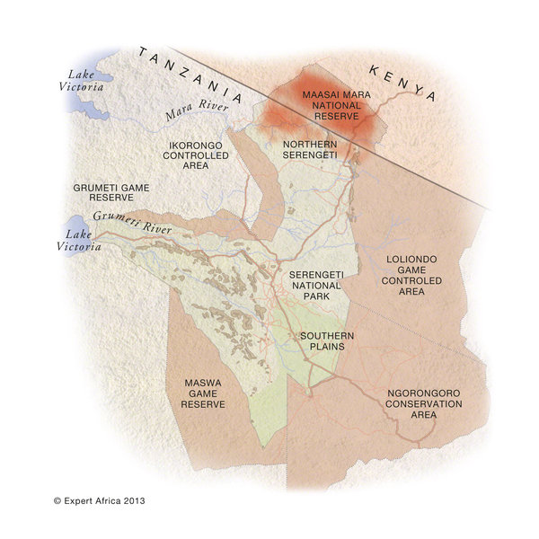
September: herds in the north of Serengeti National Park & in Kenya's Maasai Mara
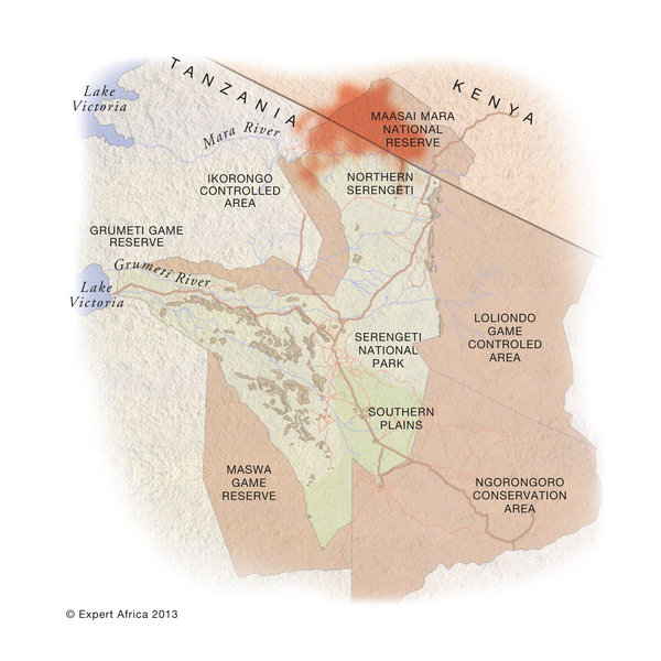
October: grazing in the far north of the Serengeti - and across in the Mara
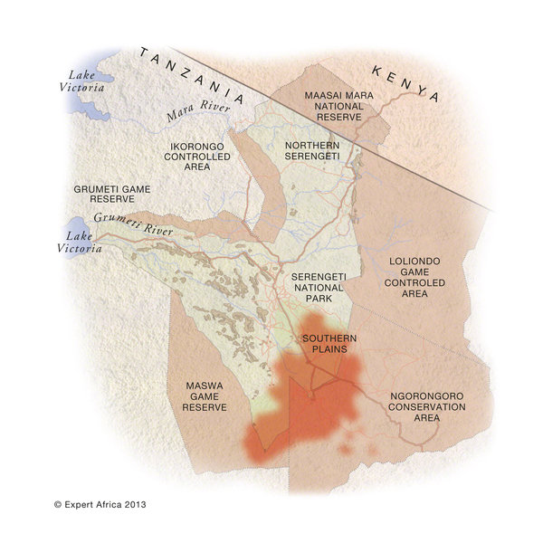
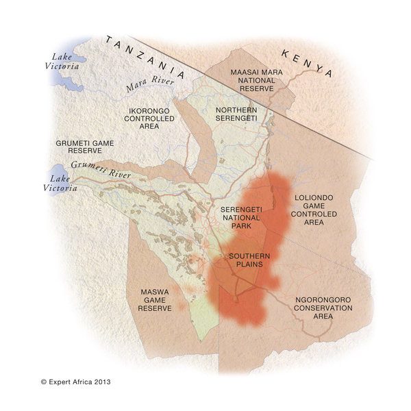
November: moving south through Loliondo, on the east side of the Serengeti National Park
December: arriving on the east side of the short-grass plains, in time for the rains
Great wildebeest migration: a video tutorial
We've made this video, with moving maps and real footage, to help you to understand the great wildebeest migration.
More information on this wildebeest migration
For more information on the Serengeti migration area and the Serengeti's wildebeest migration, see also:► Interactive Google map of the Serengeti, showing safari camps and lodges.
► Detailed map of the Serengeti like the one above, but with camps & lodges located.
► Our written area-by-area guide to the Serengeti, including the camps and lodges.
Other great African migrations
► The zebra migration in BotswanaThe maps of the Tanzanian migration on this page are originals. They have been commissioned by and drawn up for Expert Africa. They are protected under our copyright. They must not be copied or reproduced without our written permission. If you wish to use them, please contact us. We generally look favourably on requests for educational or charity use, provided that clear acknowledgements and credits are given.
To deter unauthorised use, these maps have been digitally watermarked and can be traced.
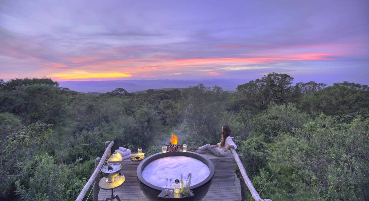
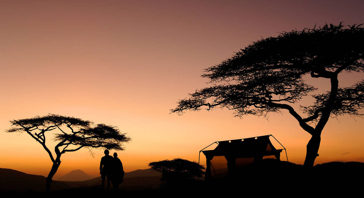
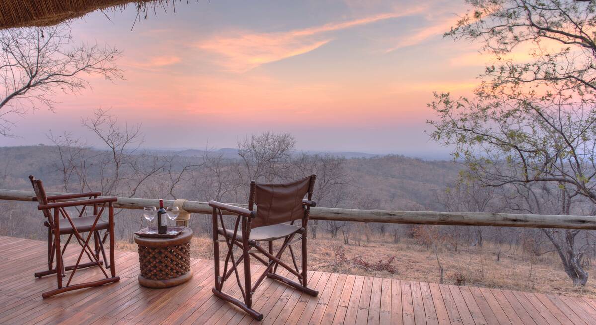
Our top picks for holidays to Tanzania
We'll always tailor-make your Safari for you. Here are some of our favourites to inspire you.
Marabou Stork Fly-in Safari
13 days • 5 locations
KILIMANJARO AIRPORT TO DAR ES SALAAM AIRPORT
Four luxurious camps enable exploration of Tanzania’s north and southern regions. With a range of land- and water-based activities available throughout, decidedly comfortable accommodation and applicable long-stay discounts, this adventurous safari is excellent value.
US$16,050 - US$23,210 per person
Flufftail Guided Safari
10 days • 3 locations
KILIMANJARO AIRPORT TO KILIMANJARO AIRPORT
Stay in three unique camps as you safari across the Ngorongoro Crater and the iconic Serengeti Plains with your private guide and 4WD vehicle: a trip of comfort and autonomy, with excellent wildlife.
US$11,410 - US$16,860 per person
Firefinch Drive-Fly Safari
9 days • 3 locations
KILIMANJARO AIRPORT TO KILIMANJARO AIRPORT
Enjoy a combination of privately guided and shared game drives during this good-value exploration of northern Tanzania. Explore game-dense regions from three comfortable bases which offer a variety of activities.
US$7,440 - US$10,740 per person
Jackal Fly-in Safari
8 days • 2 locations
DAR ES SALAAM AIRPORT TO DAR ES SALAAM AIRPORT
Enjoy a range of activities on this luxury fly-in safari. Explore the remoter regions of Ruaha National Park and Nyerere National Park with phenomenal guides during stays at two impressively comfortable camps that remain perfectly in keeping with their surroundings.
US$7,740 - US$9,960 per person
Chimpanzee Fly-in Safari
8 days • 3 locations
KILIMANJARO AIRPORT TO KILIMANJARO AIRPORT
Combining two of the remotest parks in Tanzania, this safari can deliver extraordinary wildlife viewing in Katavi, and East Africa's best chimp treks, on the shores of Lake Tanganyika.
US$10,130 - US$14,810 per person
Tinkerbird Fly-in Safari
8 days • 4 locations
KILIMANJARO AIRPORT TO KILIMANJARO AIRPORT
Explore Tanzania’s famous northern circuit in Tarangire National Park, the Ngorongoro Conservation Area and the Serengeti National Park. Four smart sister camps offer a high level of care, first-class guiding and a wide range of activities.
US$10,340 - US$15,100 per person
Secretary Bird Fly-in Safari
8 days • 4 locations
KILIMANJARO AIRPORT TO KILIMANJARO AIRPORT
Chosen for comfort and relaxation as much as for its range of activities, this safari makes for a leisurely trip featuring stunning accommodation and swift access to many of northern Tanzania’s best wildlife regions.
US$12,110 - US$16,740 per person
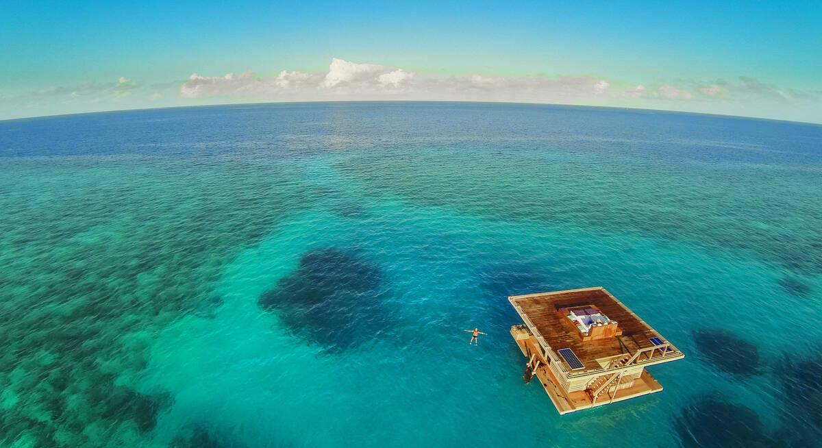
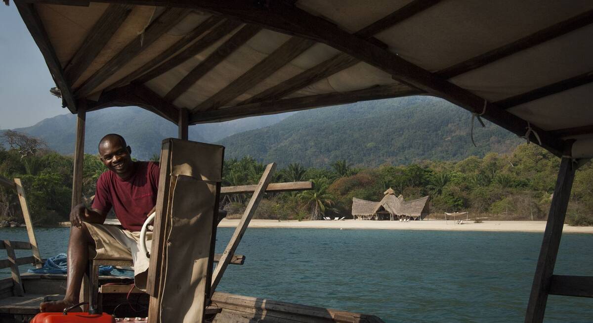
Jasmine Beach Holiday
8 days • 1 locations
DAR ES SALAAM AIRPORT TO DAR ES SALAAM AIRPORT
Relax on Pemba Island’s Manta Resort, a laidback and remote beach retreat with superb views. Enjoy a range of land- and water-based activities, and spend a night in the unique underwater bedroom for a truly special experience.
US$2,710 - US$4,100 per person
Topi Fly-in Safari
7 days • 2 locations
DAR ES SALAAM AIRPORT TO DAR ES SALAAM AIRPORT
Explore Nyerere National Park and Ruaha National Park from two luxurious, colonially styled camps. Chosen for their access to good game viewing and thrilling remoteness, these camps also offer a range of varied safari activities.
US$6,540 - US$6,870 per person
Yellow Baboon Fly-In Safari
7 days • 2 locations
DAR ES SALAAM AIRPORT TO DAR ES SALAAM AIRPORT
Two authentic bushcamps offer access to Ruaha’s remote wildernesses through walking safaris, day and night 4WD drives and fly-camping. Explore in almost utter isolation, with superb guiding to heighten your immersion in nature.
US$7,950 - US$9,220 per person
