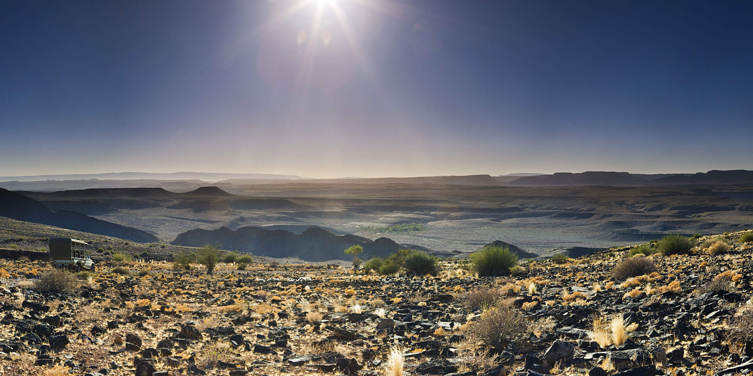
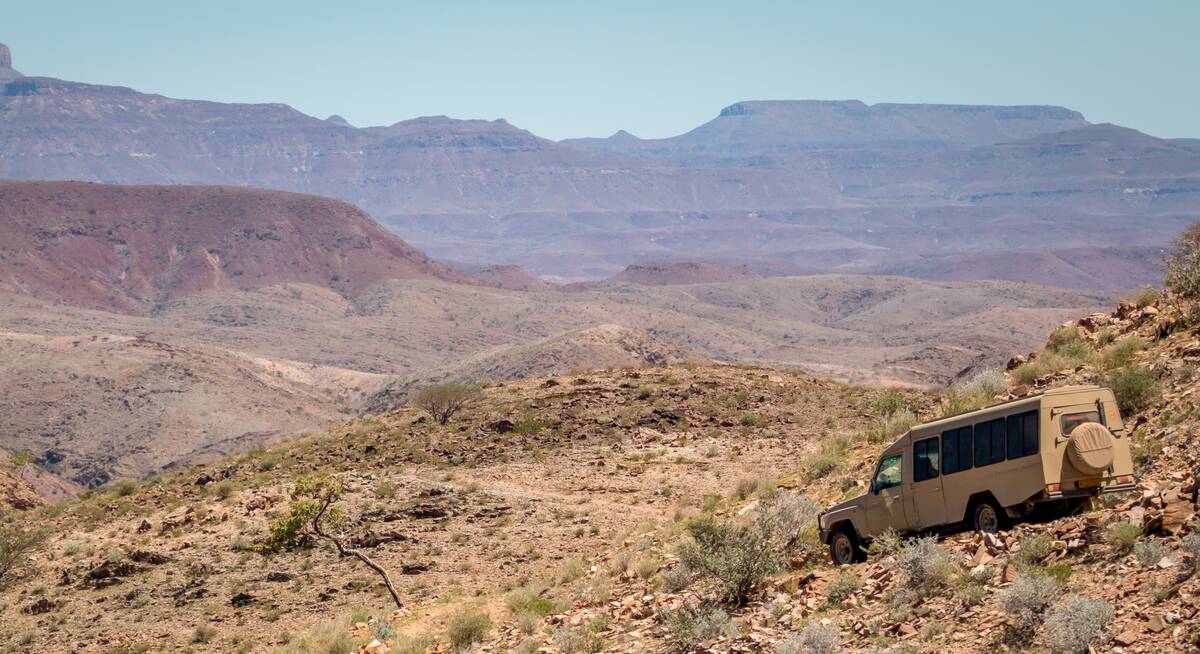
Damaraland
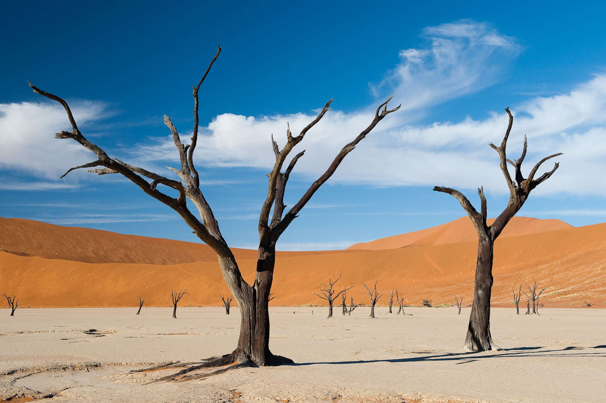
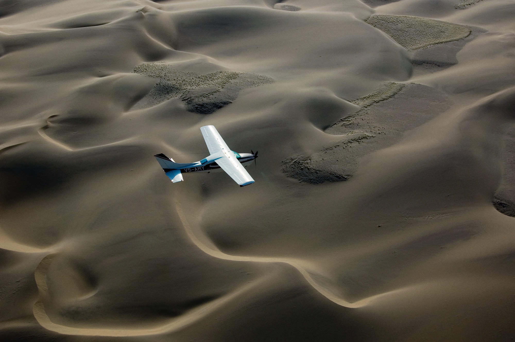
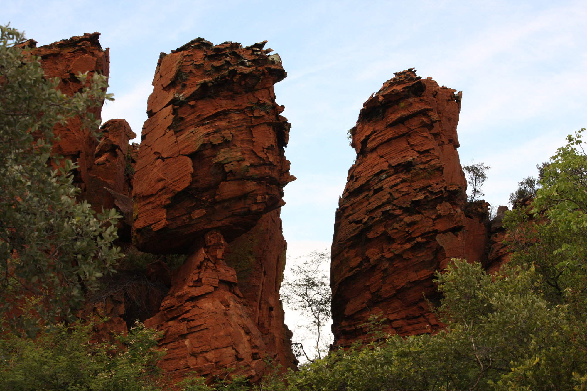
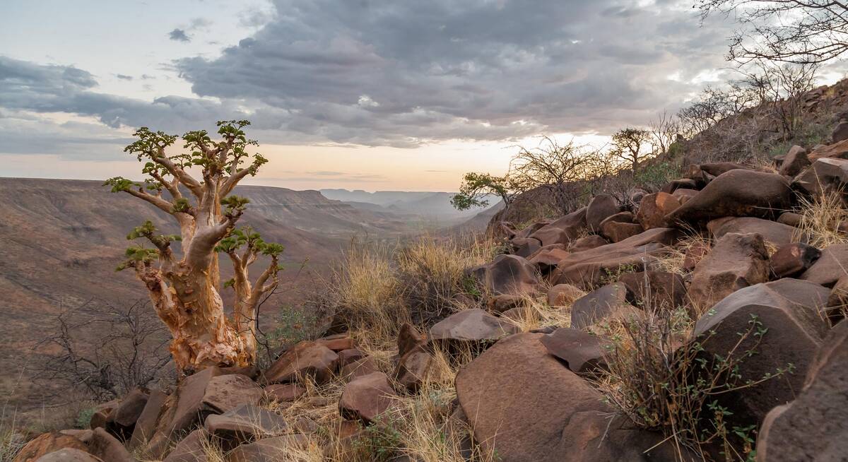
Craggy mountains and table-flat plateaux unfolding towards deep-red kopjes and oft-dry plains: rocks are the key to Damaraland’s scenic beauty.
With no permanent rivers, few inhabitants and a smattering of wildlife, this is a place to unwind, to watch and to wonder.
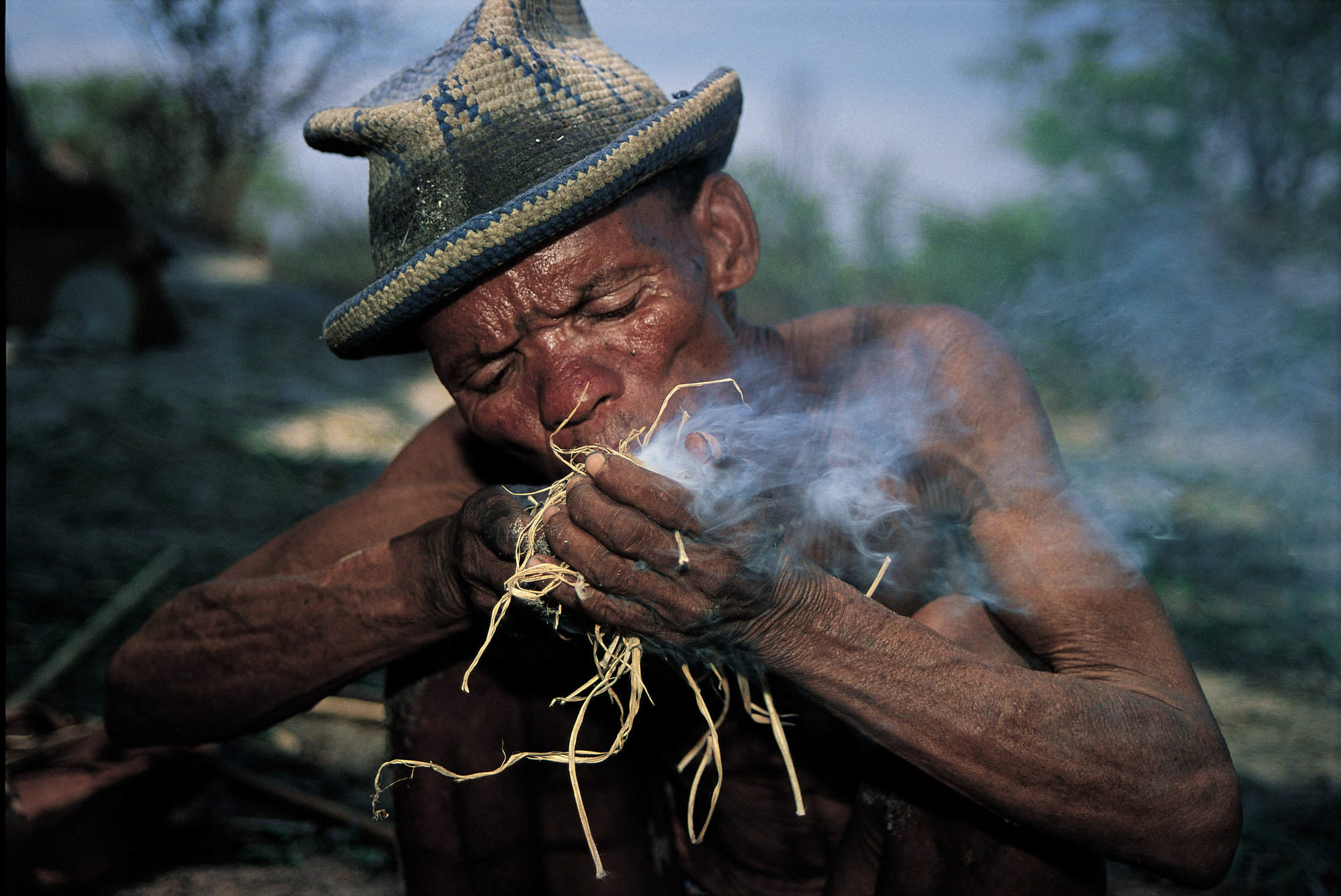
In the south, these hills have been home to the San for millennia, their paintings adorning rockfaces from the Brandberg Massif – Namibia’s highest mountain – to the outstanding World Heritage “art gallery” at Twyfelfontein. Spitzkoppe, too, has its own secret stash, hidden among the deep-red kopjes that rise up into the spectacular “Matterhorn of Africa”.
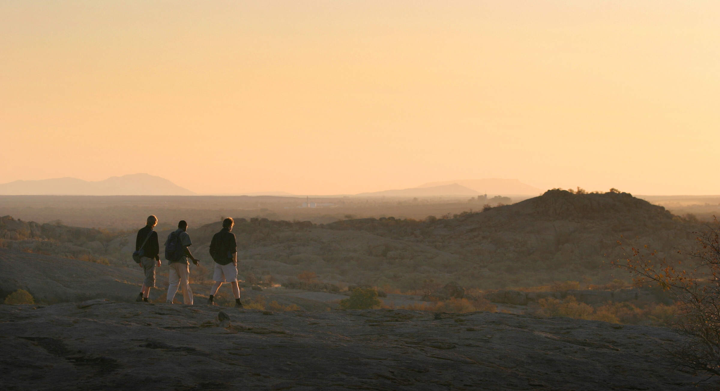
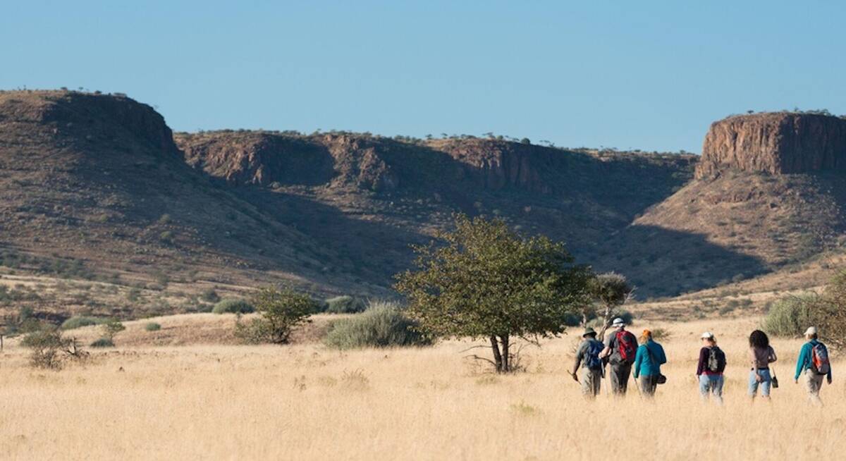
It’s a landscape made for walking, from gentle sunset ambles and more challenging half-day hikes to technical ascents suited only to the experienced climber. Leopards, although rarely seen, inhabit these hills; klipspringers jump nimbly across impossible drops, and high above, snake eagles and vultures circle in search of prey.
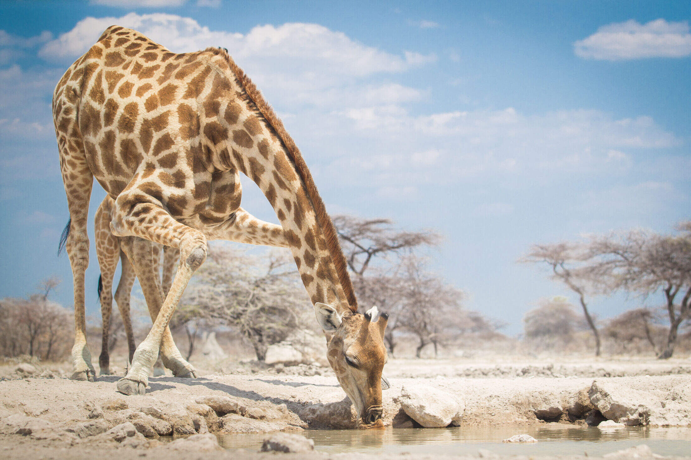
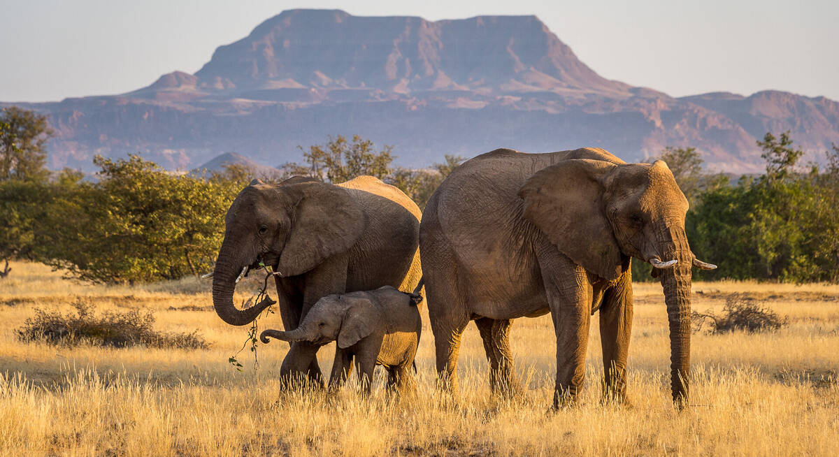
As the year wears on, desert-adapted elephants are drawn to the Huab River, whose last vestiges of life-giving water before the rains are crucial to their survival. Waterbirds such as the hamerkop take full advantage, while bee-eaters add a touch of colour, and out on the plains, the smart-looking Rüppell’s korhaan comes into its own.
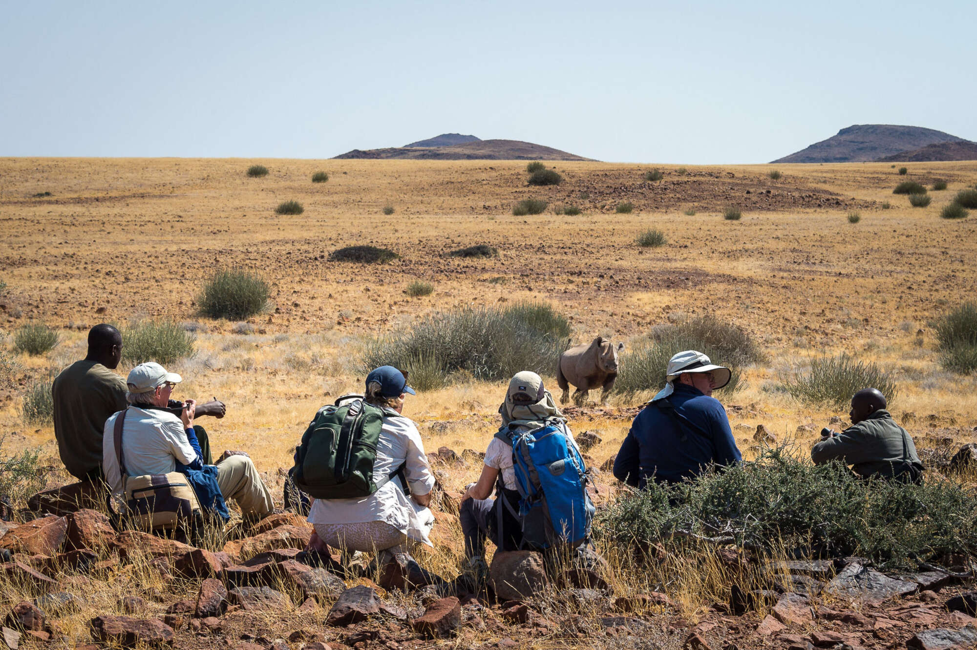
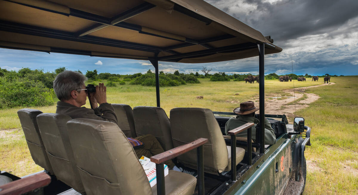
Further north, where ancient lava fields rise up above the plains, vegetation increases – and with it the wildlife: both resident individuals and migrant herds. This is the realm of the black rhino, watched over by a handful of lodges whose guides specialise in tracking these antediluvian creatures on foot – a heart-stopping, unmissable adventure.
Damaraland was in the forefront of a new generation of partnerships, with some of its lodges now owned and run jointly with the community. It’s a win-win situation that brings training, jobs and a sustainable future to the people, while for the visitor, it adds a personal dimension to an already exceptional trip.

Safaris visiting Damaraland
Just ideas, we'll always tailor-make a trip for you
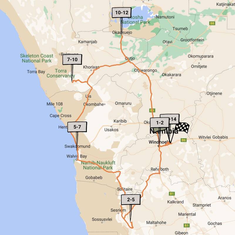
Chongololo Self-drive Safari
21 days • 11 locations • 1 country
WINDHOEK AIRPORT TO WINDHOEK AIRPORT
This self-drive safari focuses on the best walking experiences in Namibia. Get your boots ready for the apricot dunes of the Namib Desert and the ancient hills of Damaraland.
Visiting Central Highlands, Namib-Naukluft and 4 other areas
US$5,880 - US$7,300 per person

Hartebeest Self-drive Safari
16 days • 8 locations • 1 country
WINDHOEK AIRPORT TO WINDHOEK AIRPORT
This self-drive safari focuses on the best cultural experiences in Namibia. Visit a Himba village and enjoy three days living with the San Bushmen interspersed with some excellent wildlife watching.
Visiting Bushmanland, Central Highlands and 3 other areas
US$3,440 - US$4,210 per person
Hoopoe Fly-in Safari
11 days • 4 locations • 1 country
WINDHOEK AIRPORT TO WINDHOEK AIRPORT
This relaxed fly-in safari reveals Namibia at its best. Generous timings and a wide choice of activities help travellers to enjoy the best of the country’s most spectacular areas.
Visiting Windhoek, Namib-Naukluft and 2 other areas
US$5,980 - US$8,970 per person

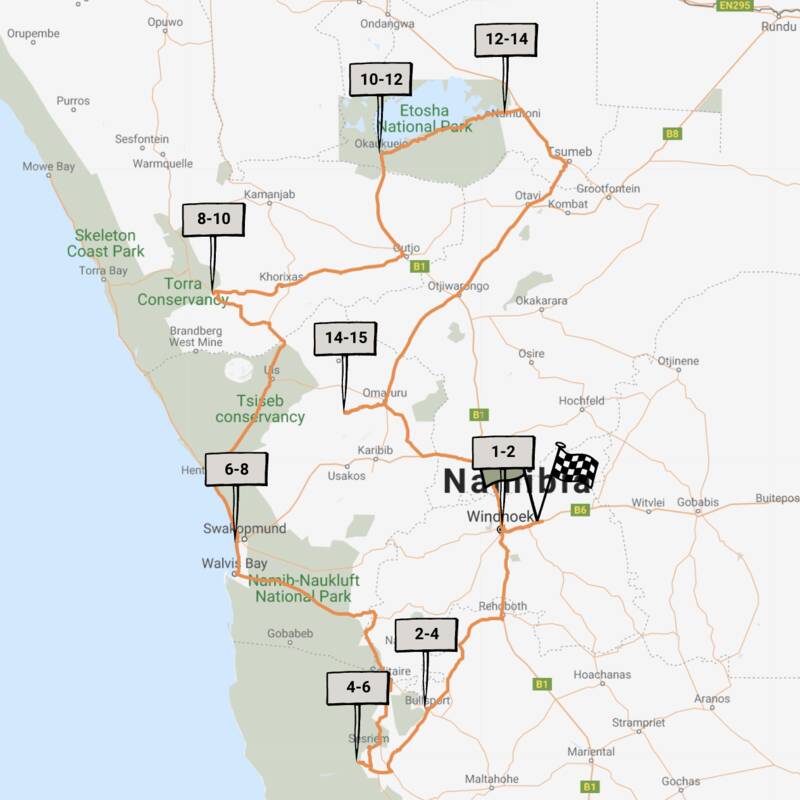
Dune Lark Fly & Drive Safari
14 days • 8 locations • 1 country
WINDHOEK AIRPORT TO WINDHOEK AIRPORT
A combination fly-in self-drive exploration of Namibia, with quick, easy and scenic flights in and out of Sossusvlei before a classic road trip adventure of the country’s rugged north.
Visiting Okonjima, Namib-Naukluft and 4 other areas
US$4,420 - US$5,680 per person
Black-faced Impala Guided Safari
13 days • 6 locations • 1 country
WINDHOEK AIRPORT TO WINDHOEK AIRPORT
A unique mix of luxury and adventure in our original, and perhaps most varied, destination on a privately guided Namibian overland safari. Perfect for families, friends or couples travelling together.
Visiting Windhoek, Namib-Naukluft and 3 other areas
US$4,760 - US$6,270 per person
Caracal Self-drive Safari
14 days • 8 locations • 1 country
WINDHOEK AIRPORT TO WINDHOEK AIRPORT
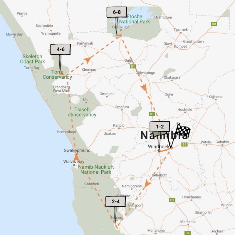
The quintessential Namibian self-drive adventure exploring the highlights from Sossusvlei and the Namib Desert to Damaraland’s wilderness and a safari in Etosha. A great mix of accommodation and excellent value.
Visiting Namib-Naukluft, Damaraland and 4 other areas
US$2,330 - US$3,940 per person
Pygmy Mouse Self-drive Safari
18 days • 10 locations • 3 country
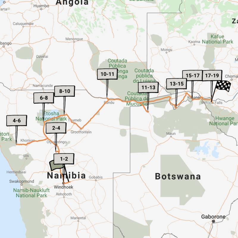
WINDHOEK AIRPORT TO VICTORIA FALLS AIRPORT
A truly epic southern African self-drive safari adventure from Namibia’s mountains and deserts, along the lush Caprivi Strip to Botswana and Victoria Falls in Zimbabwe, staying at luxury lodges throughout.
Visiting Etosha, Victoria Falls and 6 other areas
US$5,430 - US$8,770 per person
Bateleur Fly-in Safari
7 days • 4 locations • 1 country
WINDHOEK AIRPORT TO WINDHOEK AIRPORT
Classic fly-in Namibian safari staying at excellent camps. Explore Sossusvlei’s dunes and track Damaraland’s desert elephants before a safari in Etosha. Incredible scenery, good wildlife viewing and authentic cultural experiences.
Visiting Namib-Naukluft, Damaraland and 2 other areas
US$5,680 - US$8,970 per person
Cape Fox Guided Safari
13 days • 7 locations • 1 country
WINDHOEK AIRPORT TO WINDHOEK AIRPORT
A classic clockwise circuit around Namibia’s northern highlights with a private guide and vehicle. We can’t think of a better way to see more in this timeframe.
Visiting Windhoek, Namib-Naukluft and 4 other areas
US$8,190 - US$10,440 per person
Namaqua Chameleon Self-drive
12 days • 7 locations • 1 country
WINDHOEK AIRPORT TO WINDHOEK AIRPORT
A classic 12-night self-drive adventure around the highlights of eastern and northern Namibia taking in Sossusvlei, Swakopmund, Damaraland, Etosha and a final stop at Okonjima. Comfortable lodges and great value.
Visiting Okonjima, Etosha and 4 other areas
US$2,800 - US$4,470 per person

Our travellers’ wildlife sightings in Damaraland
This is their success for sightings in Damaraland.
Click on a species for more detail. How we work this out.

71% success

59% success

58% success

41% success

30% success

22% success

9% success

6% success

6% success

6% success

2% success

1% success
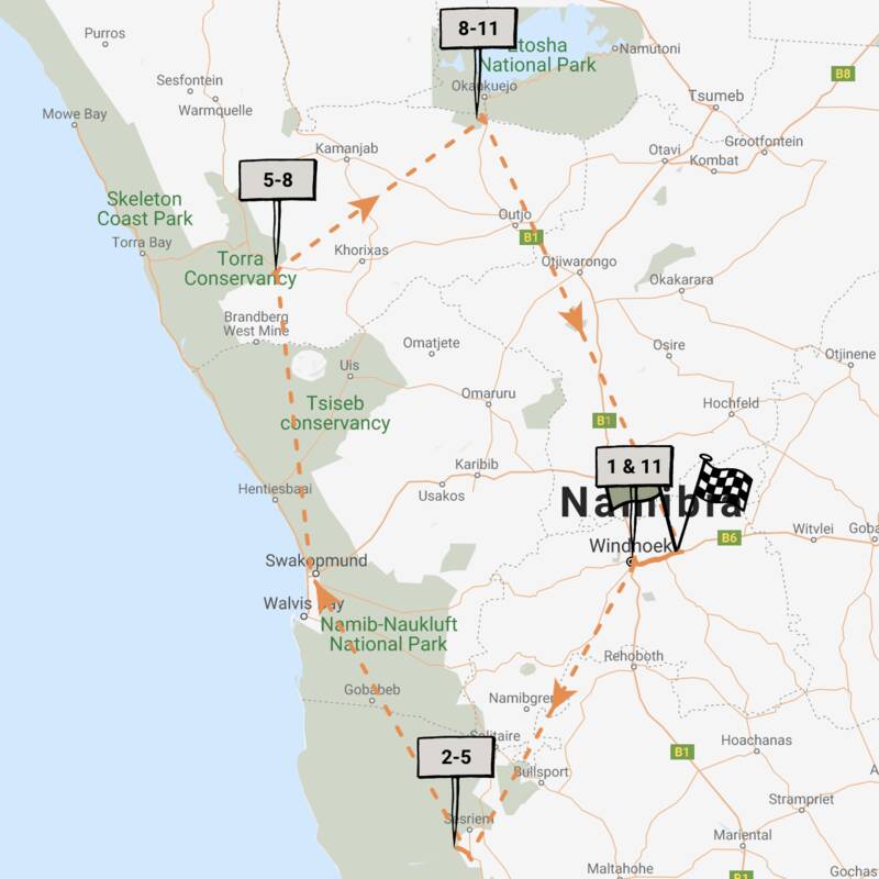
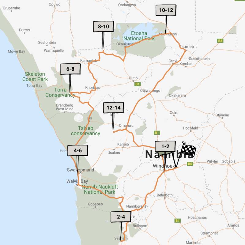
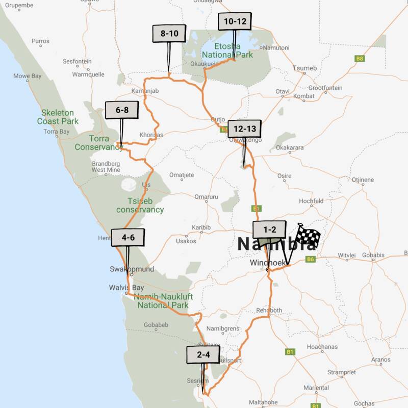
Map of Damaraland
Choices for where to stay in Damaraland

Most recent reviews of our safaris to Damaraland
Click below to browse all 1067 reviews from Damaraland. All from our travellers; all are in full & unedited.
When to go to Damaraland
Our month by month guide: What it's like to visit Damaraland in Namibia
Jan
Feb
Mar
Apr
May
Jun
Jul
Aug
Sep
Oct
Nov
Dec
Namibia in January
January is at the heart of Namibia’s rainy season. However, as you’d expect from a country dominated by desert and semi-desert environments, the rains are often (but not always) weak and usually quite localised. Some days will be clear, the strong sun raising temperatures to around 30ºC/86ºF; on others humidity and clouds build, sometimes culminating in spectacular thunderstorms. In extreme cases, these generate flash-floods which race down the beds of ephemeral rivers.
Across the country, the greening landscape makes a refreshing change, especially in desert areas. Many birds are in full breeding plumage and migrant species are here in force. In the north, where the rains are more reliable, the abundant water and food allows wildlife to disperse, making it trickier to spot.
- Variable weather: clear, hot & dry, or cloudy & humid with some rain
- Occasional, highly localised thunderstorms
- Many animals with young; birdlife at its most spectacular
- Wildlife dispersed & harder to see, especially in Etosha & the Caprivi
- Very few tourists (apart from the New Year) so rates mostly low
Our view
This is not a great time to visit
Weather in January
Namibia in February
February is the wettest month, but as Namibia is dominated by deserts, the rains are often weak and patchy. The variation in weather across Namibia is significant, too; the central highlands and Caprivi can see some heavy rain. More typically, some February days are clear with a hot, strong sun; others are cooler as cloudy skies build and, sometimes, culminate in short, spectacular thunderstorms. Occasionally these generate flash-floods, bringing ephemeral rivers to life and making travel more challenging.
Across the country, the landscape feels green and alive; insects and smaller animals are more easily seen, and many birds and animals are raising their young. However, small pools in the bush and thicker vegetation can make it hard to spot the wildlife.
- Variable weather: clear, hot & dry or cloudy & humid with some rain
- Occasional localised thunderstorms meander over the landscape
- The bush feels alive; birdlife is at its most spectacular
- Wildlife in Etosha & Caprivi is dispersed & harder to see
- Few tourists, so rates usually at their lowest
Our view
This is not a great time to visit
Weather in February
Namibia in March
March usually sees Namibia’s main rains tailing off, although actual precipitation varies hugely across the country and can be unpredictable from day to day. Many days will be clear, with a strong sun driving temperatures up. On others, clouds will build, and the late afternoon may see a short, spectacular thunderstorm. Such deluges reduce in both frequency and volume as the month progresses.
Across the country, landscapes are often vivid: a “green and pleasant land”. Many birds and animals are finishing raising their young, so smaller animals and insects are in evidence. In the north, where rains are generally heavier, pools in the bush and thicker vegetation can make it difficult to spot larger animals.
- Variable weather: clear, hot & dry or cloudy & humid with some rain
- Afternoon thunderstorms less common as March progresses
- Animals looking sleek and well-fed, after 3–4 months of plenty
- Wildlife in Etosha & Caprivi is dispersed & harder to see
- Few tourists visit during March, so rates often low
Our view
A good time to visit, with pros & cons
Weather in March
Namibia in April
Typically, April is dominated by dry weather; there’s an ever-decreasing chance of rain. Temperatures are now below their peak and continue to fall. Even so, days remain pleasant and warm, but there might be a slight chill in the air at night. The rains usually leave many parts of the country verdant and green, so animals are in fantastic condition – often with fast-growing young in attendance.
With the dust washed out of the atmosphere, photographers make the most of clear air, spectacular landscapes and healthy animals. Stargazers will have clearer night skies as the month progresses. In the game parks of Northern Namibia, water and food remain in plentiful supply, so finding big game can prove trickier than later in the year.
- Becoming drier &, especially at night, also cooler
- Few visitors, except around Easter, so rates remain low
- Wildlife in Etosha & Caprivi remains relatively hard to see
- Migrant birds have started to leave
- Fresh, clean air and often green, verdant landscapes
Our view
A good time to visit, with pros & cons
Weather in April
Namibia in May
By May, Namibia is usually drying out fast as the rains have ended. If they’ve been good, then the land remains green, but wildlife starts to congregate at more permanent water sources. Over much of the country the air quality and clarity can be amazing, making this an ideal month for photography.
Typical days are warm, with crisp, clear mornings and clear blue skies. Evenings are usually cool, and temperatures may dip below 10ºC (50ºF) overnight. Many lodges still charge “low season” prices, although with Namibia’s increasing popularity in recent years, some have started to introduce higher “shoulder season” rates.
May’s good-value rates, increasingly good wildlife sightings, beautiful landscapes and crystal-clear air combine to make this one of our favourite months in Namibia.
- Lovely weather: dry, warm days & cool nights
- The country is drying out although many landscapes remain green
- Fantastic air clarity – ideal for keen photographers
- Visitor numbers are often still low, mirrored by lodge rates
- Wildlife is starting to congregate more around remaining water
Our view
A very good time to visit
Weather in May
Namibia in June
Namibia is dry again. Skies are blue and usually largely cloudless. Days are lovely: warm and dry; nights are cold, sometimes below freezing in the desert. Most swimming pools in Namibia are always outdoors, making them too cold for all except the very dedicated.
Take a warm hat and gloves for game drives, where dawn and dusk will feel particularly chilly. In the north, especially Etosha, wildlife viewing is now into its dry-season pattern, focusing around the waterholes – though the park is still not busy.
Photographers come for superb air clarity, with minimal dust or smoke in the air. Historically, June rates have been low. However, with Namibia’s increasing popularity many lodges now count it amongst their “high-season” months, and request higher prices.
- Clear, bright days with blue skies; cold nights, mornings & evenings
- Great air quality, especially welcome for photographers
- “Shoulder season” for some lodges: lodge rates moderate
- Wildlife gravitates to waterholes, making game-viewing productive
- Some greenery in the landscape, depending on the last rains
Our view
A very good time to visit
Weather in June
Namibia in July
Reliably warm daytime temperatures (upwards of 20ºC/70ºF) and good wildlife sightings make this a popular month to visit Namibia. Rain would be very unusual indeed and clear skies make for great photographs. Once the sun sets, though, temperatures cool rapidly bringing cold nights that may dip below freezing in the desert. Be prepared: dress in layers and expect early-morning and late-afternoon drives, and anywhere coastal, to be cold.
As the land dries and vegetation shrivels, game congregates beside drinking water: Etosha’s waterholes are busy with animals. Across the country, lodges charge “high season” rates; many are fully booked a year or more in advance, especially during European school holidays (from the latter half of July to late August).
- Dry days, warm in the sun, with crisp, cold nights
- Cloudless skies: July is usually superb for stargazing
- The beginning of European school holidays so more families travelling
- Peak season: so high rates and many lodges fully booked far in advance
- A fantastic time of year for wildlife watching, particularly in Etosha
Our view
A very good time to visit
Weather in July
Namibia in August
August is the height of Namibia’s “winter”. Expect cloudless skies and plenty of warm sun in the day, but nights down to freezing in the desert. Dress in layers and bring warm clothes (including hats and gloves) for chilly starts and evenings. Only the hardiest even contemplate using outdoor pools.
It’s 3–4 months since any rain, so the land is dust-dry and much vegetation is golden brown. Many landscapes appear sparse and harsh. Wildlife congregates around available water sources, helping to guarantee good animal sightings.
Namibia is never really “busy” by the standards of Europe or the USA, but August is the most popular time to visit, especially for families. Book early (over a year in advance) if you want to stay at the best lodges.
- Dry days, warm in the sun; cold mornings, evenings & nights
- Cloudless skies in the day; spectacular stars at night
- Busy by Namibian standards: family rooms in particular demand
- Peak season: so high rates and many lodges fully booked far in advance
- A fantastic time of year for wildlife watching, particularly in Etosha
Our view
Fantastic: the very best time to visit
Weather in August
Namibia in September
September is a month of blue, cloudless skies and fantastic wildlife viewing. Rain is almost unheard of. As the month progresses, the days and nights get warmer. In some areas, daily maximums hit around the low 30s Celsius, although low humidity ensures this feels comfortable. The contrast makes the nights seem very cold. The air is becoming dustier, occasionally augmented by smoke from fires – so becoming hazy for photographic purists.
In the national parks, animals congregate around remaining water sources – making September one of the best months for game viewing. Hence it’s one of Namibia’s most popular months for visitors: a “high season” month that is often the time of choice for safari aficionados.
- One of the best months for wildlife viewing
- Warm days & cold nights, with temperatures rising during the month
- Many plants have faded from green to golden brown
- Air can be hazy – with dust & sometimes smoke
- High season rates; many lodges & camps are full 9 months in advance.
Our view
Fantastic: the very best time to visit
Weather in September
Namibia in October
Namibia is usually at its hottest and driest in October. Temperatures build as the month progresses; towards the end, daily highs may exceed 40ºC/100ºF, though with humidity close to zero, even this rarely feels oppressive.
In exceptional years, isolated rain showers may fall in late October. More usually, the end of the dry season sees wildlife watching at its best, particularly in Etosha. The place feels like a desert as spectacular herds of thirsty animals gather around the available water. October is popular amongst wildlife enthusiasts and commands peak-season prices, even if dust and smoke may make the air hazy, challenging photographers. Visitor numbers can fade towards the end of the month, allowing a window for last-minute bookings.
- Probably the most spectacular month for wildlife-viewing in Etosha
- Hot and dry: much of the country feels like a desert
- The air can be hazy with dust & smoke
- It’s peak time to visit, so expect high season rates
- Lodges & camps are full, especially early in October
Our view
A very good time to visit
Weather in October
Namibia in November
November is always a bit unpredictable: sometimes dry and hot; sometimes cloudier and cooler. Typically, mornings are hot and cloudless and clouds appear in the afternoon. Humidity builds and eventually breaks, resulting in spectacular thunderstorms that bring convection rainfall in late afternoons. Such storms are typically sparsely distributed and highly local – being completely absent from desert areas, for example. Places that do get good rain will flush green, with a tangible feeling of new life softening the landscapes. Many mammals give birth to their young.
Once any rains come, wildlife dissipates in search of food, and game viewing in Etosha becomes harder. Conversely, this is a great time for birdwatchers, with migrant species in breeding plumage.
- A very interesting, variable month, depending on the rains
- With rains come an amazing explosion of both vegetation & new life
- Wildlife viewing better in Damaraland than Etosha if it has rained
- Shoulder season: mid-range rates offer great value
- Away from the Namib, showers are more likely later in the month
Our view
A good time to visit, with pros & cons
Weather in November
Namibia in December
December is the first “proper” month of Namibia’s rainy season, and one of its hottest. Clear mornings give way to building clouds and, with luck, the occasional short, spectacular thunderstorm: refreshing and cleansing. These are often highly localised and generally warmly welcomed: most Namibians love rain!
Rains clear the air of dust. Even relatively short showers enable plant life to erupt, carpeting this thirstland in green and providing food for the young animals which abound. Animals disperse widely, which can make game viewing challenging. Many birds are breeding and so sporting their most colourful plumage.
Christmas and the New Year fall within local “summer holidays” – so places to stay can be surprisingly busy, especially in and around coastal towns, where temperatures are cooler.
- Hot and humid; sometimes refreshed by cooling showers
- Landscapes flushed green if/where there has been rain
- A tangible life and energy amidst this often green & pleasant land
- Very photogenic: blooming deserts amidst crystal-clear air
- Best time for birdwatchers; larger animals harder to spot
Our view
This is not a great time to visit
Weather in December
Namibia fact file
Useful information and advice to help you prepare for a trip including Damaraland.

Flights to Namibia
Advice on how to get to Namibia

LGBT travel in Namibia
Attitudes, the law & our experiences

Namibia general info
Essential travel info on Namibia

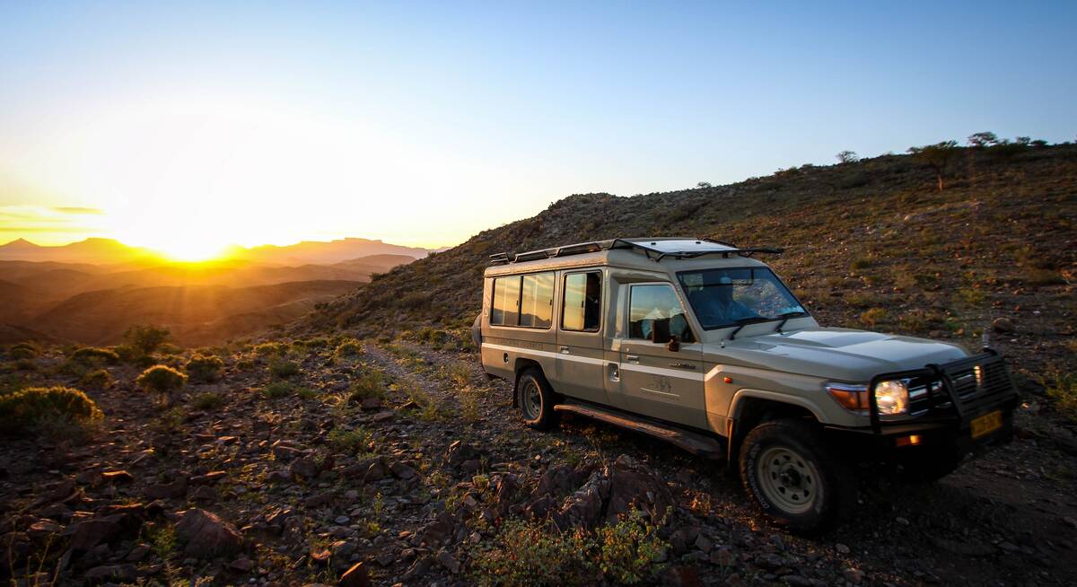
Self-drive - car types
Which car type to rent

Self-drive - driving tips
Tips to make driving in Namibia easier

Self-drive - hire groups
The different car hire group to rent

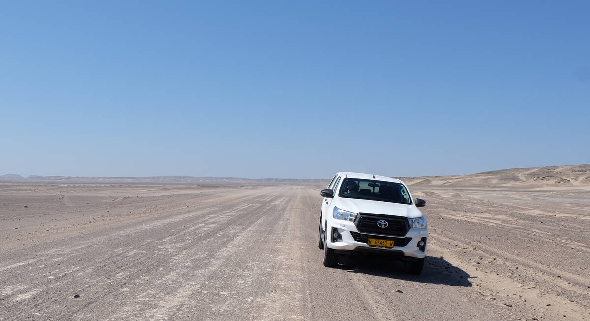
Self-drive - road types
Including pictures & descriptions of roads

Tipping in Namibia
Expectations & guidelines for tipping

Wildlife - cats & dogs
Including cheetah, lion, leopard, jackal & hyena

Wildlife - large antelope
Including sable, eland & blue wildebeest

Wildlife - large herbivores
Including elephant & black rhinos

Wildlife - smaller antelope
Including klipspringer & common duiker

Wildlife - primates
including Chacma baboon & Lesser bushbaby

Wildlife - small mammals
Including banded mongoose & pangolin

Weather & climate
The best time to visit Namibia