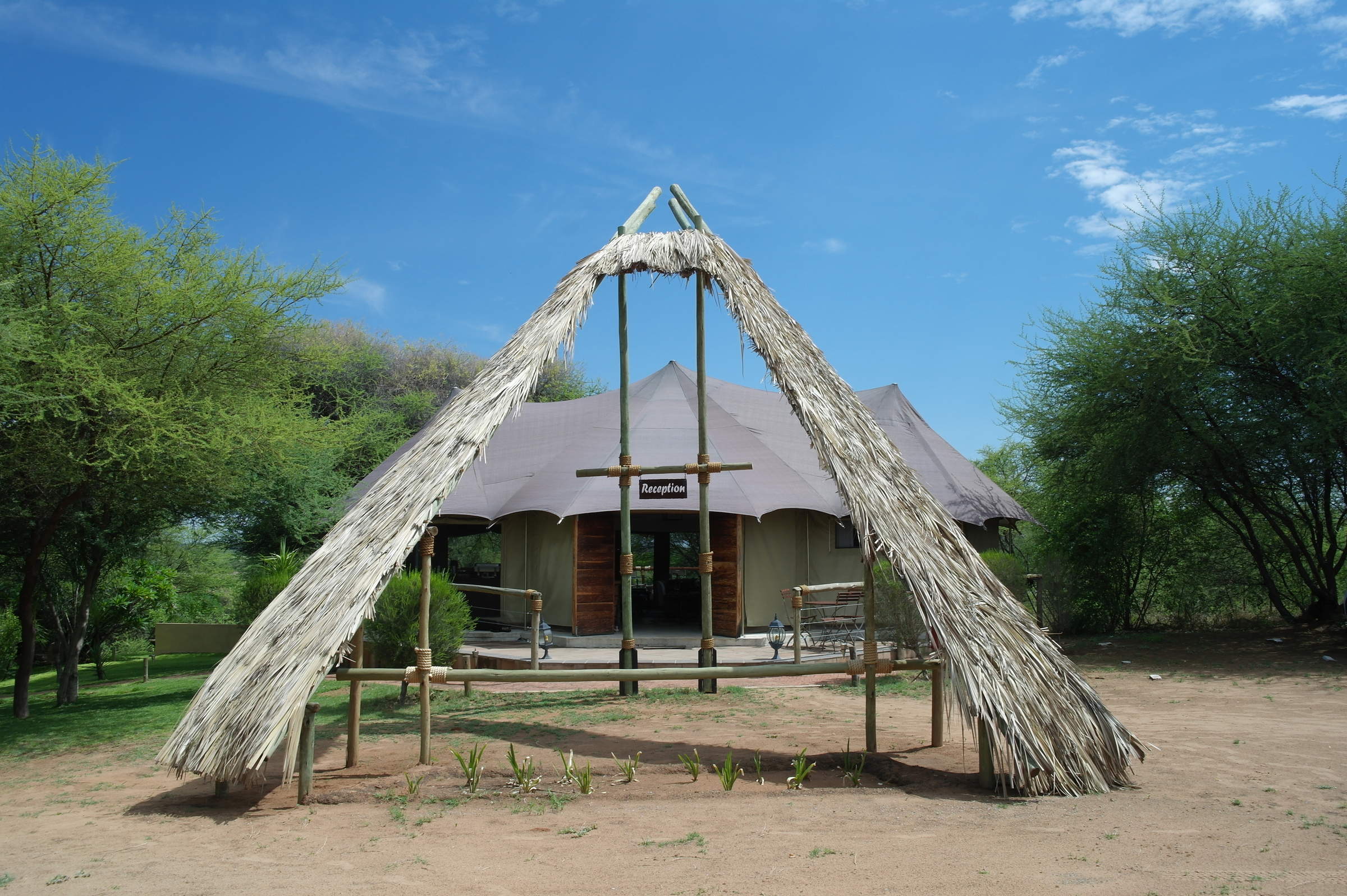
About Nkasa Lupala Tented Lodge
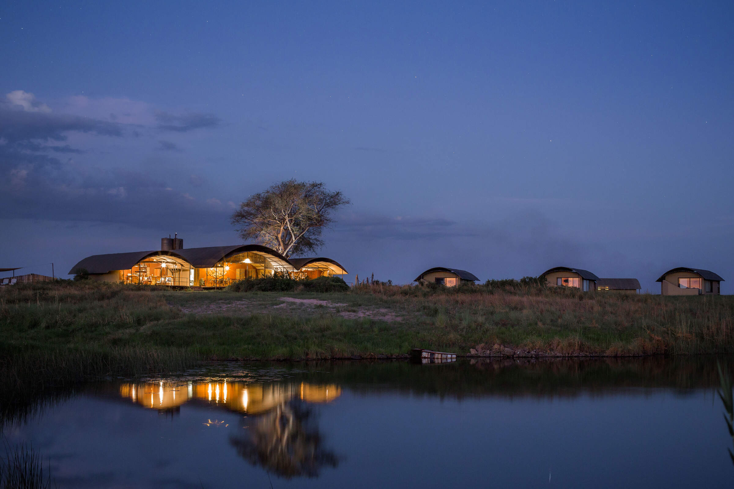
Surrounded by trees in the beautiful and peaceful Wuparo Conservancy, the small Nkasa Lupala Tented Lodge ...
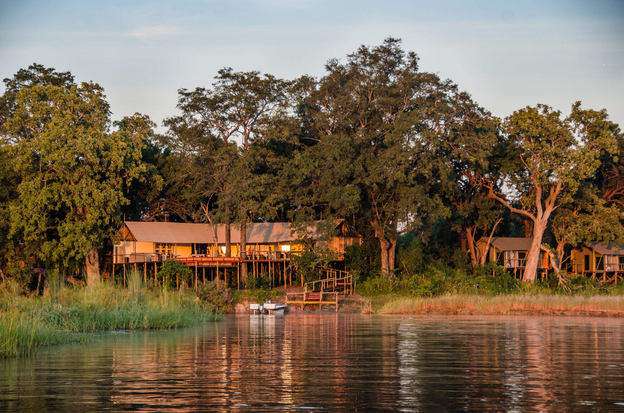
... was opened in 2011. The lodge is built on the banks of a channel of the Kwando–Linyanti river system, only a short drive from the Namibia’s Nkasa Rupara (formerly Mamili) National Park and is a perfect base from which to explore this little-visited corner of the Zambezi Region (widely known as the Caprivi Strip).
Remote Nkasa Lupala is a lovely choice for exploring Nkasa Rupara National Park, and its open location should attract those with a sense of adventure. Food, service and comfort are all of a high standard, and the remote location gives a real sense of being in the wilderness.
Our view
Remote Nkasa Lupala is a lovely choice for exploring Nkasa Rupara National Park, and its open location should attract those with a sense of adventure. Food, service and comfort are all of a high standard, and the remote location gives a real sense of being in the wilderness.
Namibia expert
Accommodation
10 tented rooms
Children
Best for aged 16+
Open
Jan & Mar - Dec
Activities

4WD Safari

Birdwatching

Boat trip

Cultural excursion

Fishing

Guided walking safari

Mokoro

Private activities

Self-guided walking
Traveller reviews of Nkasa Lupala Tented Lodge
38 real, un-edited reviews from Expert Africa's travellers.
Expert Africa's gallery
When we travel we take lots of photos ourselves to give you a real and un-edited view of the safaris. See our 31 pictures of Nkasa Lupala to get the candid view.
View gallerySafaris visiting Nkasa Lupala
Just ideas, we'll always tailor-make a trip for you
Sable Self-drive Safari
12 days • 7 locations • 3 country
WINDHOEK AIRPORT TO VICTORIA FALLS AIRPORT
A great-value southern African self-drive adventure from Namibia along the Caprivi Strip to Botswana and Zimbabwe, combining other-worldly landscapes, unforgettable wildlife spectacles and rarely visited places, and ending at Victoria Falls.
Visiting Etosha, Chobe and 4 other areas
US$8,530 - US$9,440 per person
Nkasa Lupala Tented Lodge: Our full report
Surrounded by trees in the beautiful and peaceful Wuparo Conservancy, the small Nkasa Lupala Tented Lodge ...
... was opened in 2011. The lodge is built on the banks of a channel of the Kwando–Linyanti river system, only a short drive from the Namibia’s Nkasa Rupara (formerly Mamili) National Park and is a perfect base from which to explore this little-visited corner of the Zambezi Region (widely known as the Caprivi Strip).
While not quite are remote as its sister property, Jackalberry Tented Camp, Nkasa Lupala is still well off the beaten track allowing travellers to experience the wild beauty of the Nkasa Rupara park and Wuparo Conservancy. The camp is unfenced, allowing game to wander freely through. On one of our stays here, a herd of more than 20 elephants came to visit, preventing anyone from returning to their rooms after breakfast until they had moved on!
As the first lodge in the area, Nkasa Lupala was in theory named to match the park when its name was changed from Mamili. Unfortunately, due to a quirk of the the local accent, the Italian Micheletti brothers called their lodge Nkasa Lupala, only to find that the park itself was to be Nkasa Rupara.
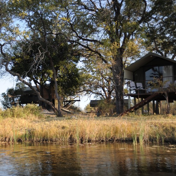
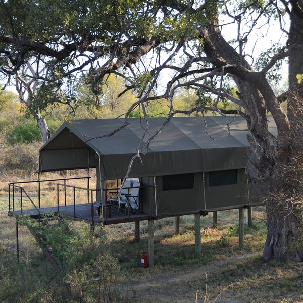
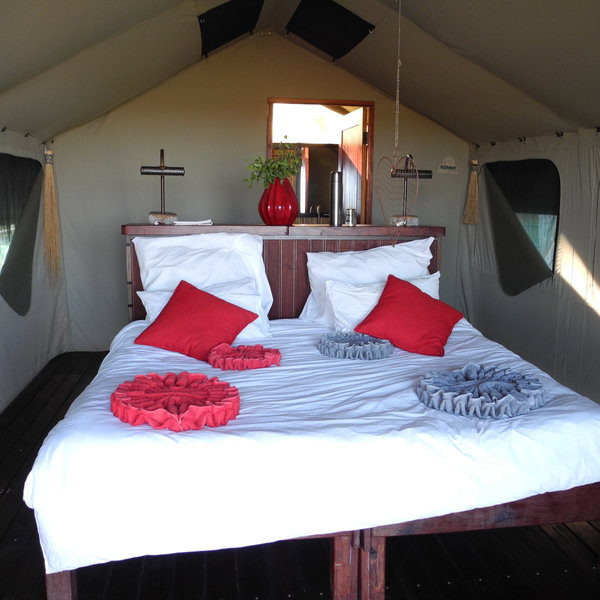
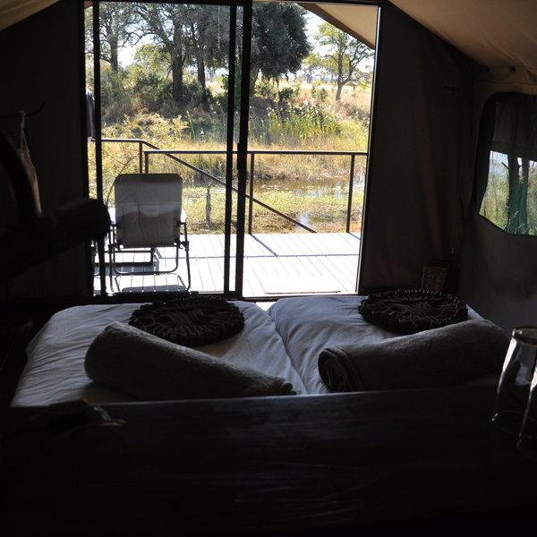
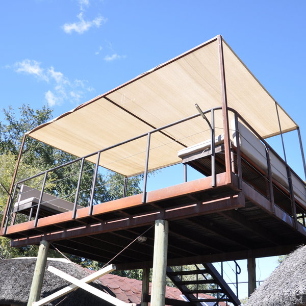
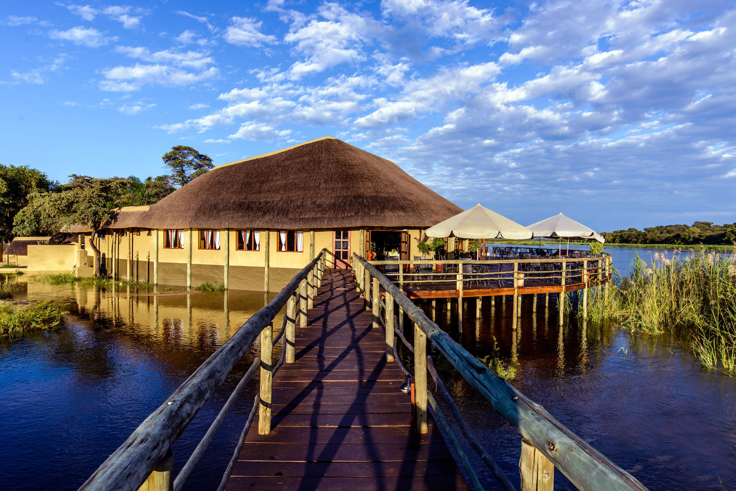
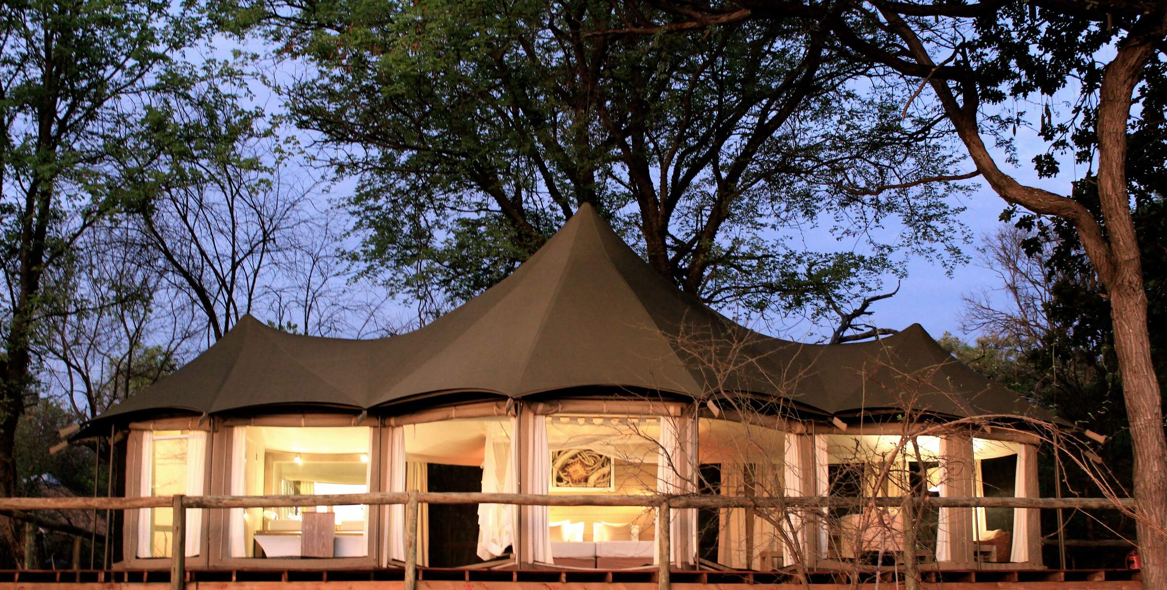
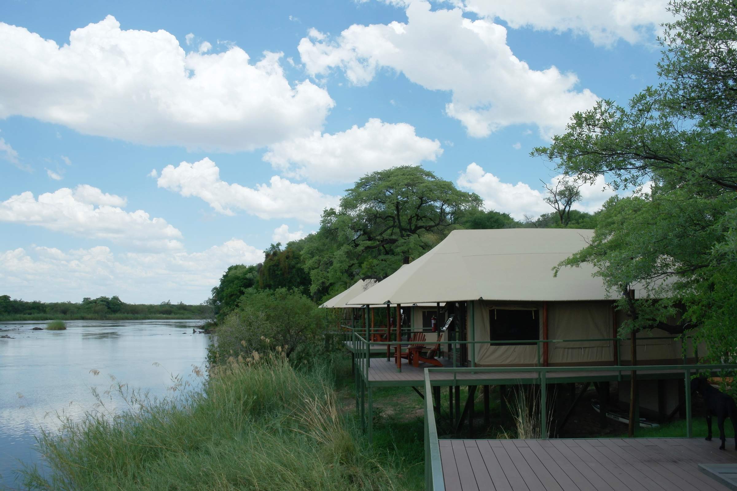
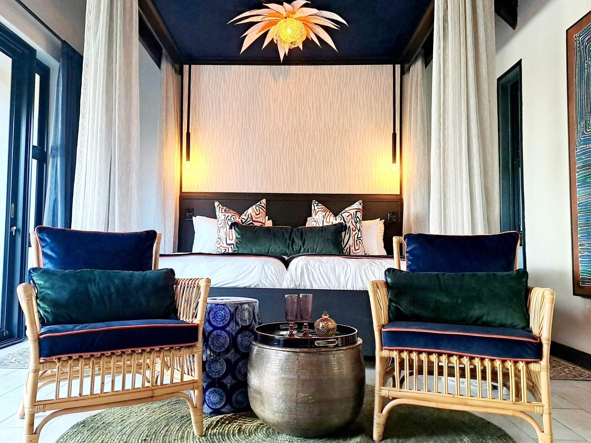
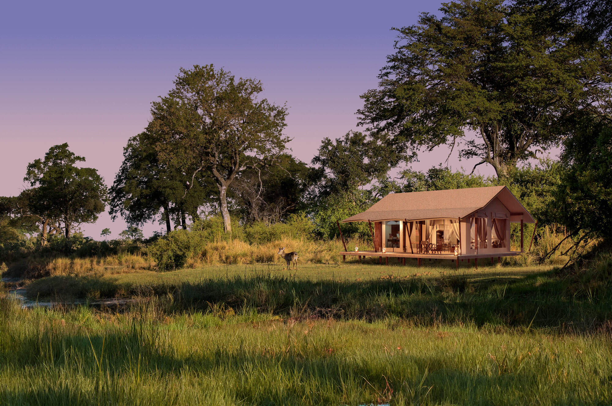
The lodge consists of 10 tented rooms, all raised up on stilts like treehouses, giving superb views of the surrounding area. The rooms are simple yet comfortable, with a double bed, wardrobe and luggage area. The style is quite modern, with smooth curves and artistic touches, such as the wire hearts that hang above each bed. Through glass sliding doors in front of the bed is a wooden veranda, with a couple of chairs and a lovely view.
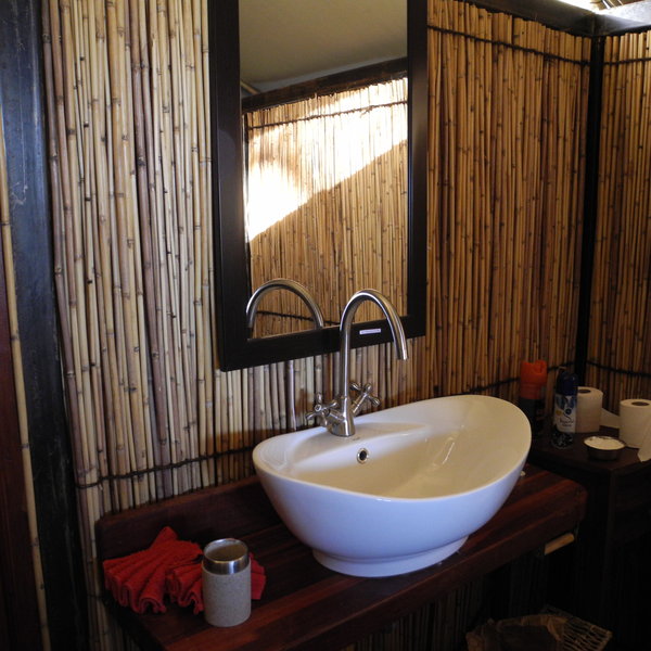
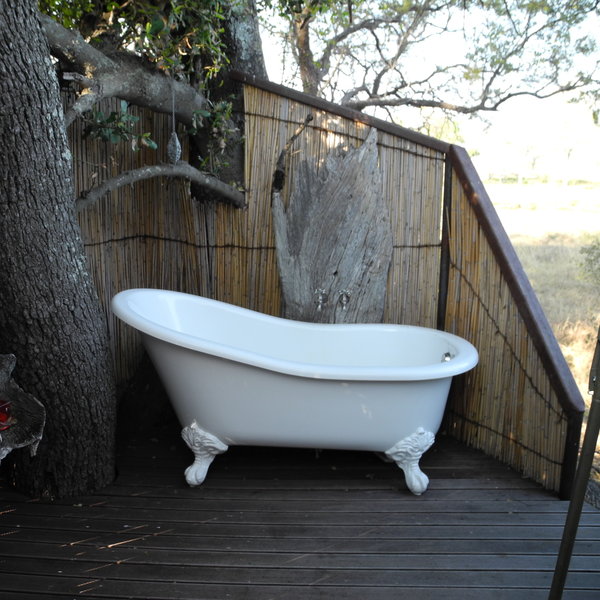
Behind the bed, the en-suite bathroom has a sink, flush toilet and a teardrop-shaped shower. One room, mostly used for honeymooners, has an outside bath and shower as well. Another has a small supplementary twin bedroom the other side of the bathroom, creating a family unit. When it’s not in use, however, you’d hardly know it was there.
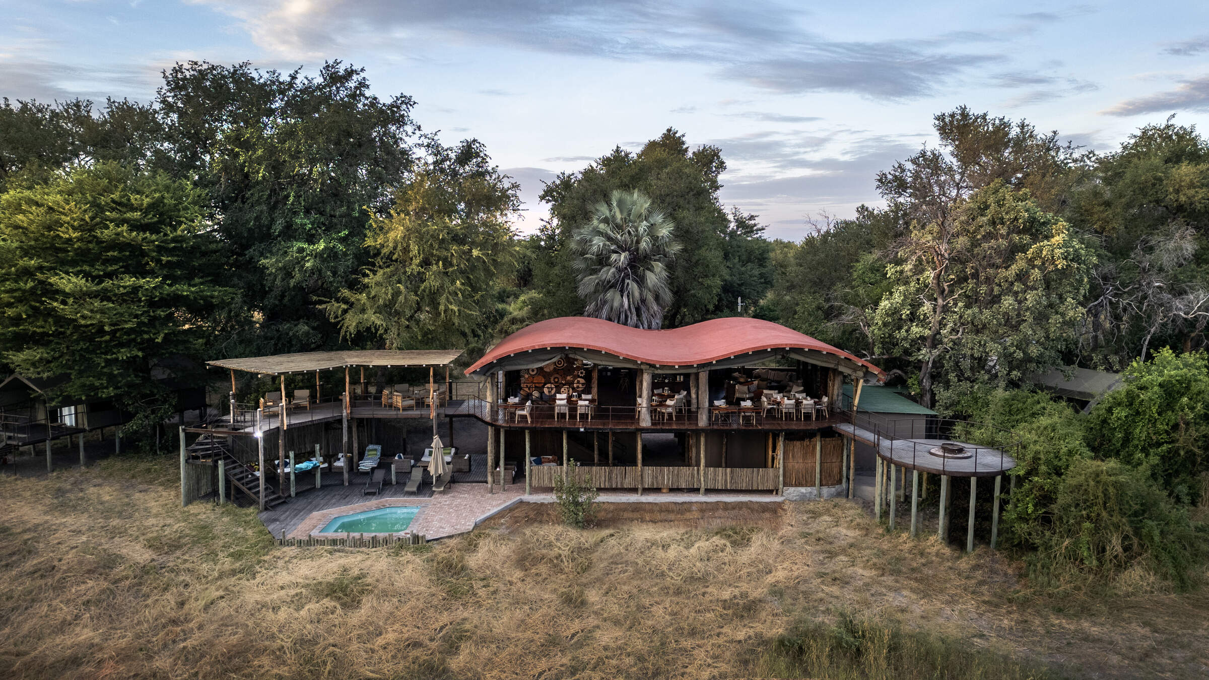
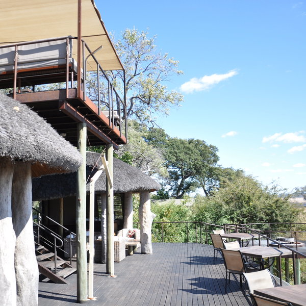
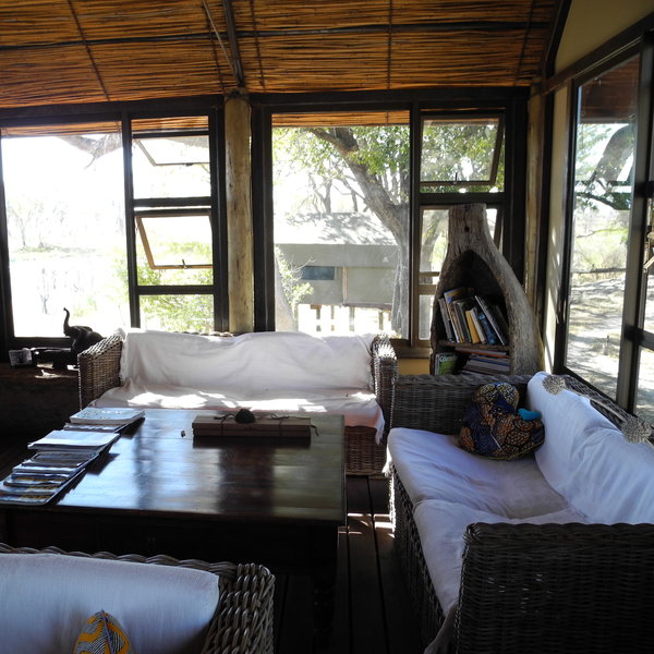
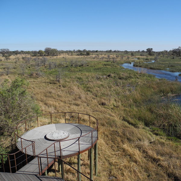
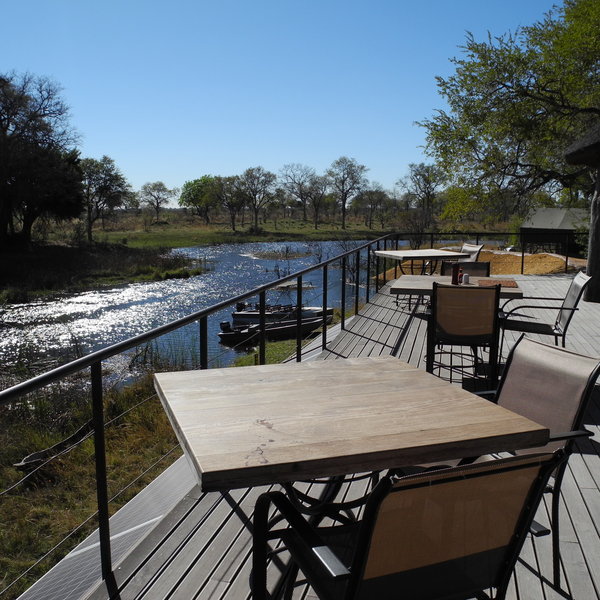
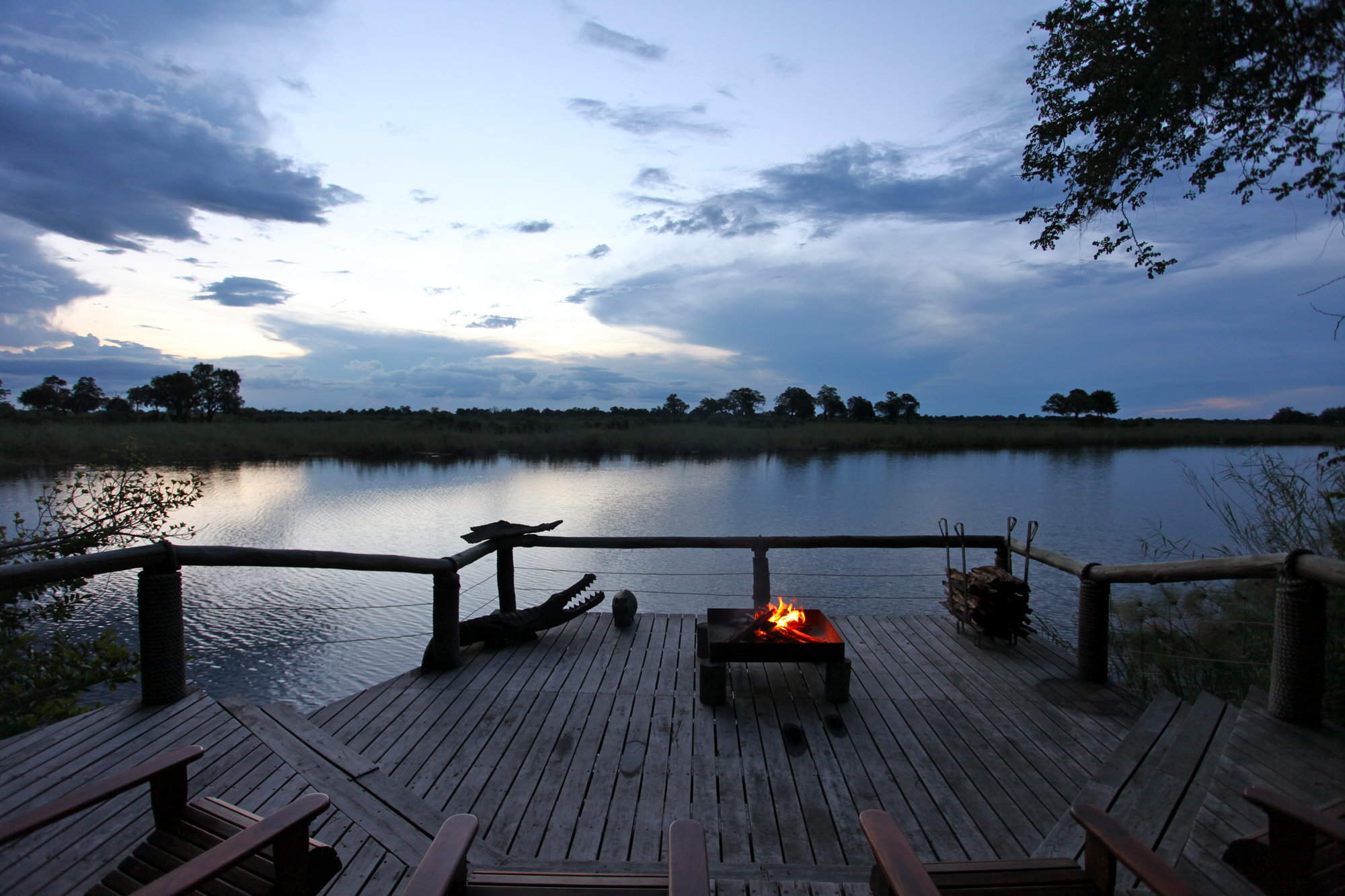
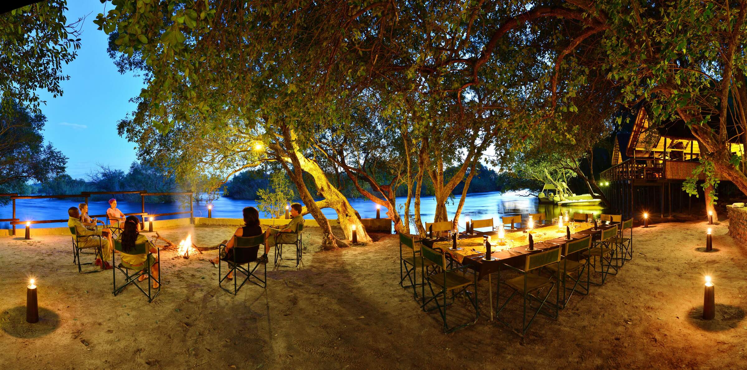
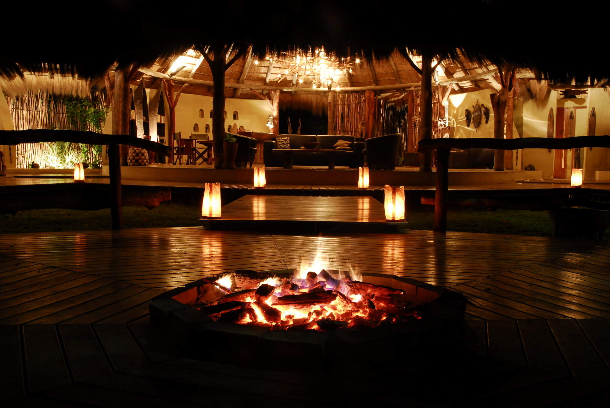
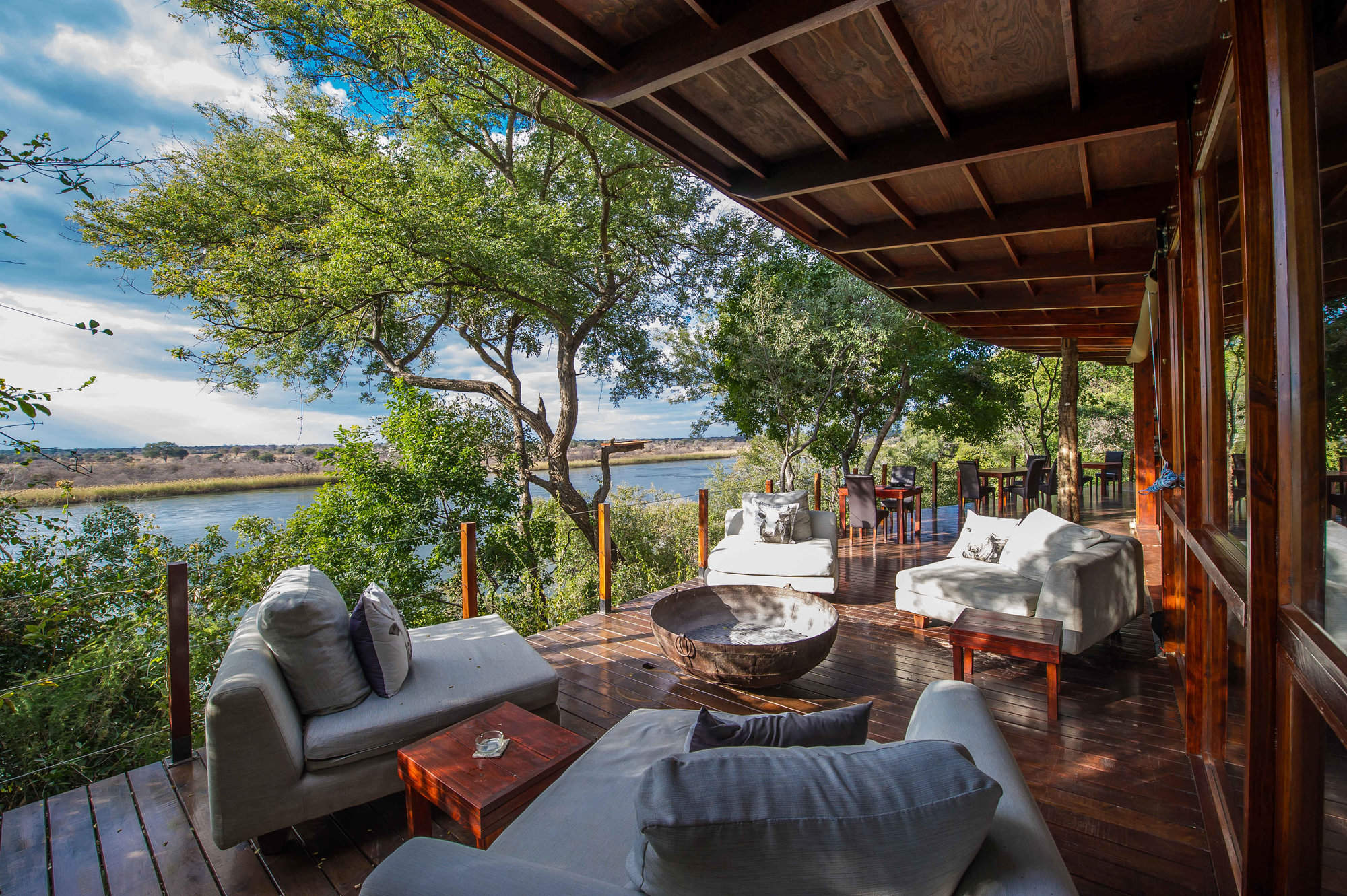
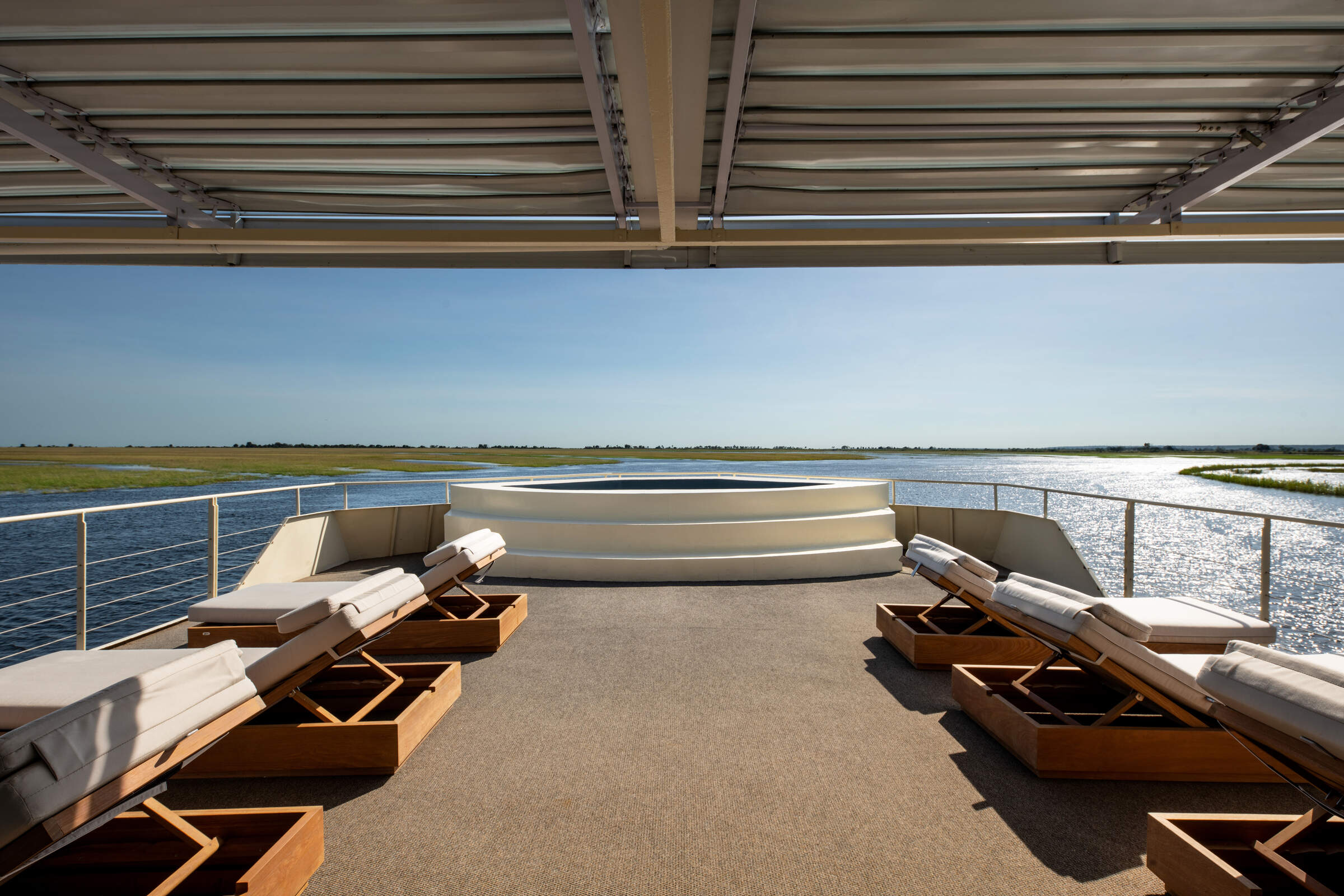
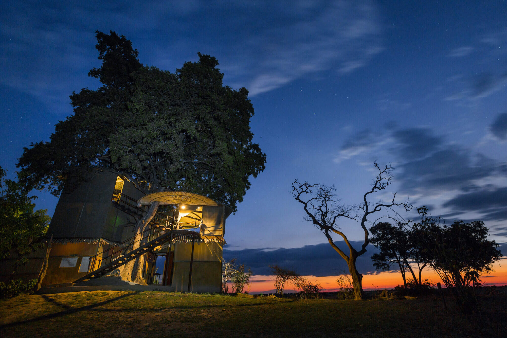
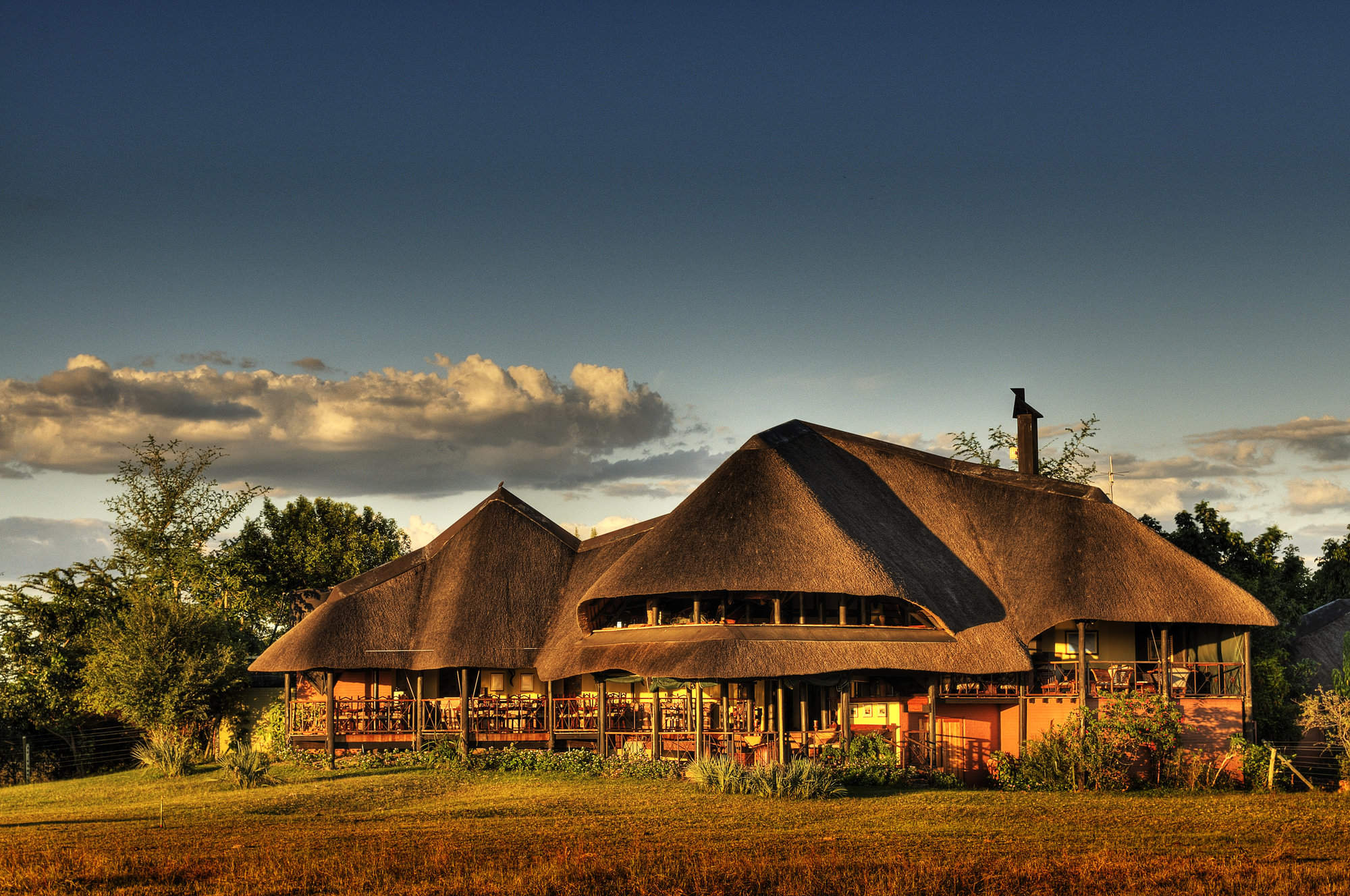
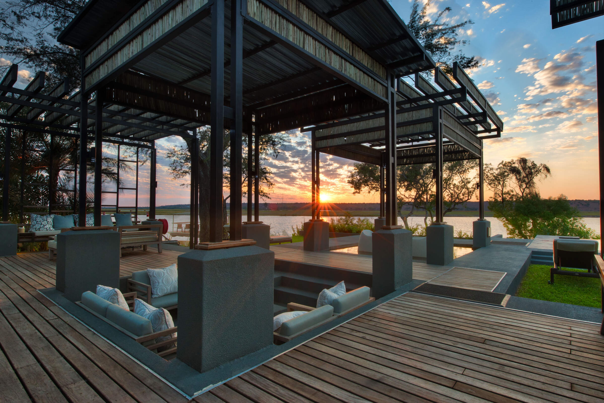
Linked to the rooms by a network of pathways is a three-storey communal area overlooking the river, where game is frequently spotted. Along with a bar, a partially undercover dining room, a comfortable lounge, and a viewpoint on the top floor, there’s even a campfire here, raised up over the river on the deck.
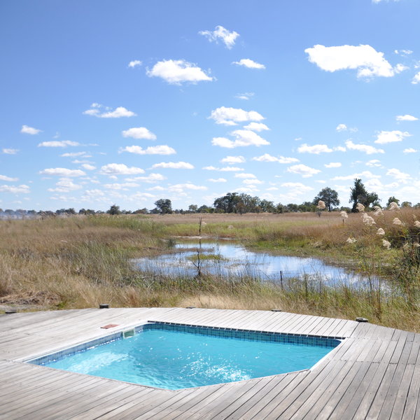
Close by is a plunge pool, whose covered seating area affords the perfect place to relax in the heat of the day with a drink and a book, or a pair of binoculars. There’s also a small curio shop.
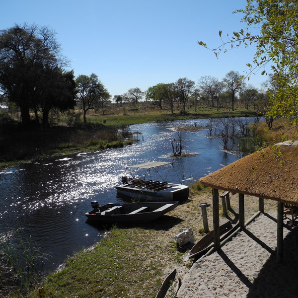
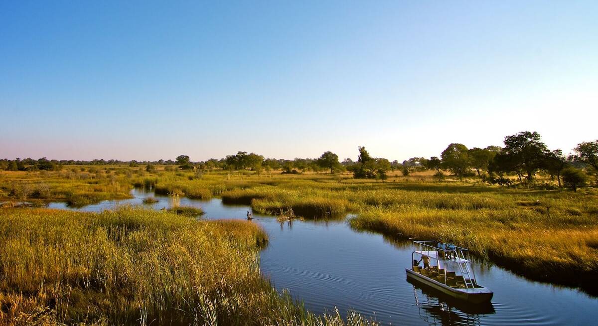
On our last visit, in July 2017 the channel that the lodge overlooks had a decent amount of water present, even allowing for mokoro activities. However on previous visits at the end of the dry season we have seen this channel dry up, restricting the activities on offer.
Nkasa Lupala has been designed to blend into its surroundings as much as possible. To complement this, it is designed to be eco-friendly, with solar power for electricity and solar geysers for hot water – supplemented by wood-burning boilers.
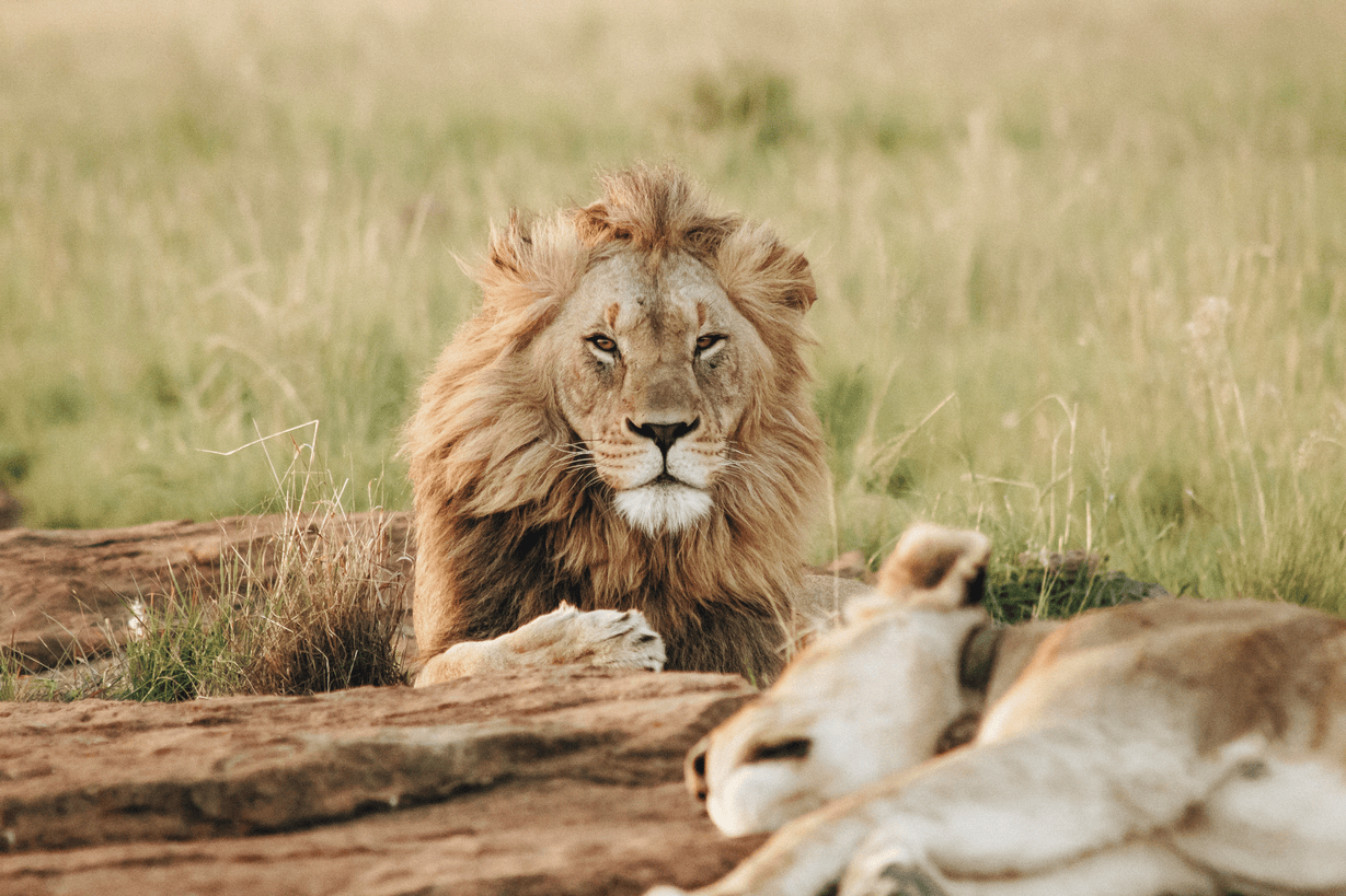
Activities at the lodge focus on game drives, day and night, into the Nkasa Rupara National Park, as well as within the Wuparo Conservancy. Possible sightings on these drives include elephant, buffalo, hippo, wildebeest and lion, as well as antelopes such as impala, kudu, roan and sable, and a wide variety of birds. Although those with 4WD vehicles can self-drive in the national park during daylight hours, it is not well signposted and the going can often be difficult, with poorly maintained roads that often flood. For this reason, Expert Africa would recommend leaving your own vehicle and exploring the park with a guide.
Guests at Nkasa Lupala may also take part in a boat trip (if water levels permit), visit a local village or go on a guided walk.
Activities
4WD Safari
Birdwatching
Boat trip
Cultural excursion
Fishing
Guided walking safari
Mokoro
Private activities
Self-guided walking
Families & children
- Attitude towards children
- Nkasa Lupala accepts children, but do not recommend that children under 16 stay here because the camp is unfenced and game frequently wanders through.
- Property’s age restrictions
- There are no age restrictions here.
- Special activities & services
- None
- Equipment
- None
- Generally recommended for children
- Due to the remote and unfenced nature of the camp, Expert Africa would not recommend Nkasa Lupala for young children.
- Notes
- Children must be under parental supervision at all times.
Food & drink
- Usual board basis
- Half Board
- Food quality
- The food here is Namibian with an Italian twist, thanks to its Italian owners. On our last visit we did not get a chance to try the food, however on a previous visit in December 2016, we found it to be well presented and very tasty.
A continental breakfast is served, with a hot option also available to order.
Lunches are light – perhaps a salad or sandwich.
For dinner on our last visit we enjoyed lentil soup, followed by roast chicken with vegetables, roast potatoes and tomato sauce, and rounded off by a delicious malva pudding.
On a previous trip the Italian influence was apparent on our sundowner boat cruise, where we tucked into mini pizzas with our gin and tonic. - Dining style
- Individual Tables
- Dining locations
- Indoor and Outdoor Dining
- Drinks included
- Drinks are not included with the exception of a flask of filtered drinking water in the rooms.
Our travellers’ wildlife sightings from Nkasa Lupala
Since mid-2018, many of our travellers who stayed at Nkasa Lupala Tented Lodge have kindly recorded their wildlife sightings and shared them with us. The results are below. Click an animal to see more, and here to see more on our methodology.

93% success

88% success

64% success

60% success

53% success

47% success

29% success

15% success

15% success

7% success

7% success

0% success

0% success

0% success

0% success

0% success

0% success
Getting there
- Location
- Caprivi Strip, Namibia
- Ideal length of stay
- 2-3 nights
- Directions
- Due to the remote location, Nkasa Lupala Lodge takes a bit of effort to reach. Self-drivers should park their car in Sangwali village, before a bumpy 4WD transfer to the lodge. However, don't let this put you off – the lack of accessibility and remoteness adds to the appeal of the lodge, which has a real wilderness feel to it. The journey is definitely worth it.
- Accessible by
- Self-drive
Special interests
- Birdwatching safaris
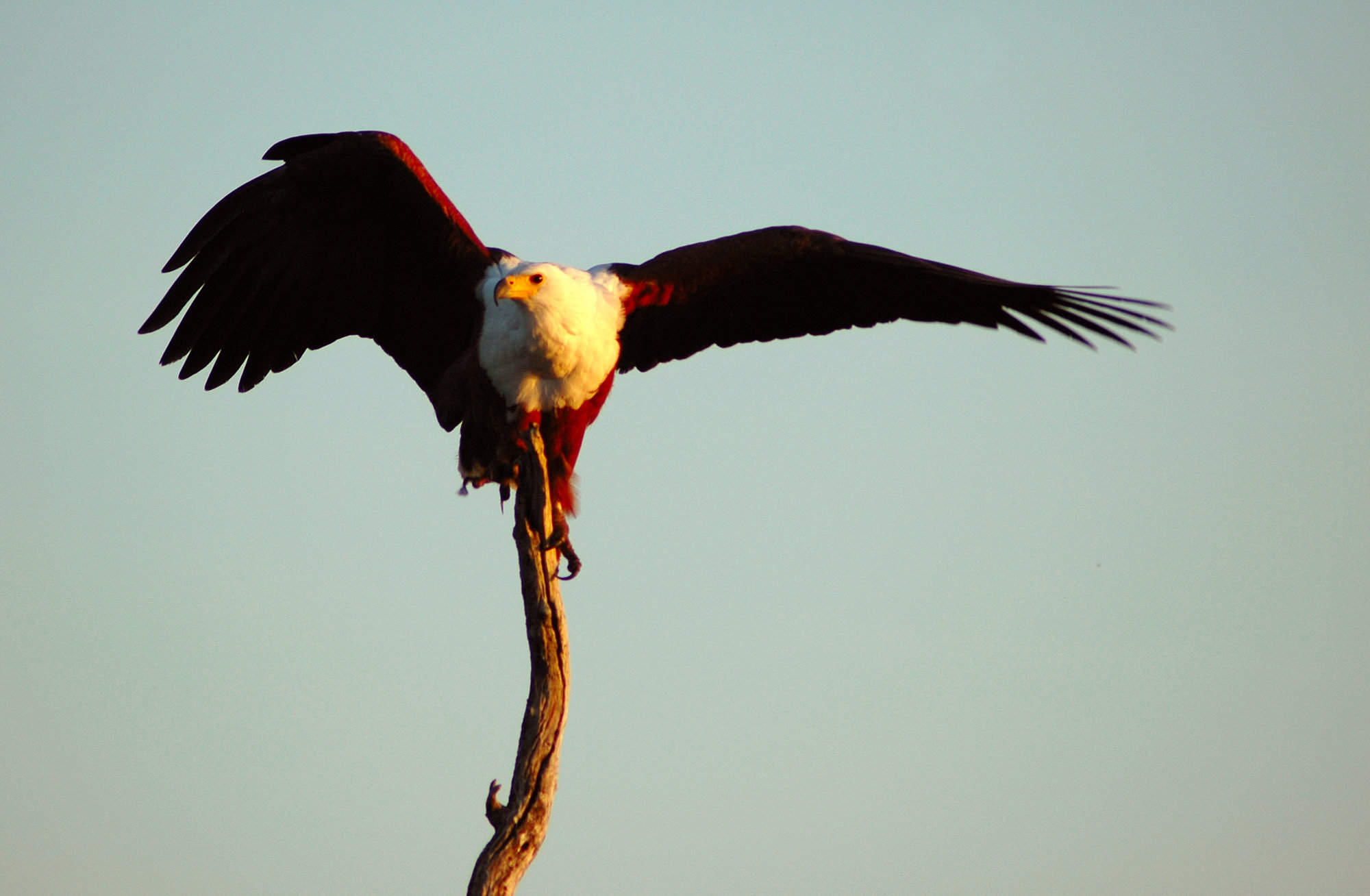
- Namibia's largest wetland area with conservation status, Nkasa Rupara National Park boasts more species of bird than anywhere else in the country. Nkasa Lupala is ideally located for birdwatching be it on foot, by vehicle or by boat.
- See ideas for Birdwatching safaris in Namibia
- Cultural Experiences
- Set within the Wupara Conservancy in Namibia’s Caprivi Strip, Nkasa Lupala Tented Lodge offers a cultural visit to the homestead region of the conservancy. This tour takes in a local school and – where possible – a traditional authority.
- See ideas for Cultural Experiences in Namibia
- Walking safaris
- Experience the lush environment of the Caprivi Strip on a walking safari from Nkasa Lupala. Led by a professional guide and an armed community ranger this is a great opportunity to experience the bush from a different perspective.
- See ideas for Walking safaris in Namibia
Sustainability
Better water management in a fragile ecosystem
Comprising of 10 With 10 luxury tents, Nikasa Lupala Tended Lodge is world-known for its eco-friendly management. Prizes such as the 2016 Responsible Tourism Award or the highest accreditation (5 desert flowers) from Eco Awards Namibia stand to confirm the lodge’s dedication for protecting the natural environment. As part of its sustainability practices, one of Nkasa’s main focuses is the responsible management of water.
Nkasa Lupala starts by educating both employees and staff about the importance of saving water, especially during the dry season, and strictly monitors watersheds and pipes to prevent any leakages. Moreover, the lodge has installed water saving devices, which represent another measure to ensure that using a small portion of the water from the close by channel brings no harm to the swamps or the neighboring National Park. Additionally, to prevent any wastewater from entering the channel surrounding Nkasa Lupala, the lodge uses exclusively biodegradable detergents and does not use treated wastewater for irrigating its gardens. Any wastewater obtained from the lodge’s daily operations is captured in underground septic tanks and filtered through drain fields before being reused.
Most importantly, Nkasa Lupa makes sure guests clearly understand their role in conserving the environment through orientations, written materials and guide explanations, as they are constantly educated about the different culture, the acceptable behaviors, and the challenges of operating in a fragile environment.
See more great sustainability projects in Namibia
Communications
- Power supply notes
- mains electricity
all the tents have electric sockets for charging devices. - Communications
- There is a cellphone signal here, and WiFi in the main area. The WiFi runs on the same schedule as the charging, 7.00am–7.00pm
- TV & radio
- None
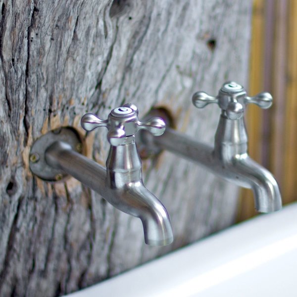
- Water supply
- Borehole
- Water supply notes
- The tap water is filtered and is fine for washing, but it is not fit for human consumption.
Health & safety
- Malarial protection recommended
- Yes
- Medical care
- There is a first-aid kit at the lodge and a clinic at nearby Sangwali village. The nearest hospital is in Katima Mulilo, approx 140km away.
- Dangerous animals
- High Risk
- Security measures
- For those leaving their car in the village, it is parked in the fenced and guarded area conservancy office. There are security on duty throughout the night. After dark guests are escorted to their rooms,
- Fire safety
- Fire extinguishers are located in every room.
Useful info
- Disabled access
- Not Possible
- Laundry facilities
- A laundry service is available for an extra charge.
- Money
- There are no safes in the rooms.
- Accepted payment on location
- Payment is accepted in most currencies and Visa and MasterCard are also accepted.
Plan and book your trip with Expert Africa
All of our trips are tailor-made, so we'll always adapt them to suit you. Talk to an Expert and let us plan and arrange your perfect trip.

Talk to an Expert
Call or email us now! We’ll match you with the Specialist in our team who is best suited to help you. Then together we can start planning your trip.

Set up your itinerary
Based on our experience and your ideas, your specialist will create a detailed, costed itinerary. We’ll refine it together, until we have a trip that you’re perfectly happy with.

Prepare for your trip
The same Specialist will make the seamless arrangements for your trip, send you detailed travel documents, and be available to answer any questions before you depart.

Travel with peace of mind
After you set off, you’ll be cared for by our partners in Africa, most of whom have worked with Expert Africa for decades. And if you ever need us urgently, we’re available 24/7.

When you return
We love to learn about your trip, and so will always be grateful if you’ve the time to give feedback to your Specialist when you return.
Nkasa Lupala Tented Lodge's location
Look closer at the environment and surroundings of Nkasa Lupala.
Other lodges in Caprivi Strip
Alternative places to stay in this same area.

Ndhovu Safari Lodge
Ndhovu is a simple riverside lodge, with tents that are reminiscent of safaris a decade or two ago.
Hakusembe Lodge
Hakusembe River Lodge is a substantial lodge with a superb location on the Kavango River.
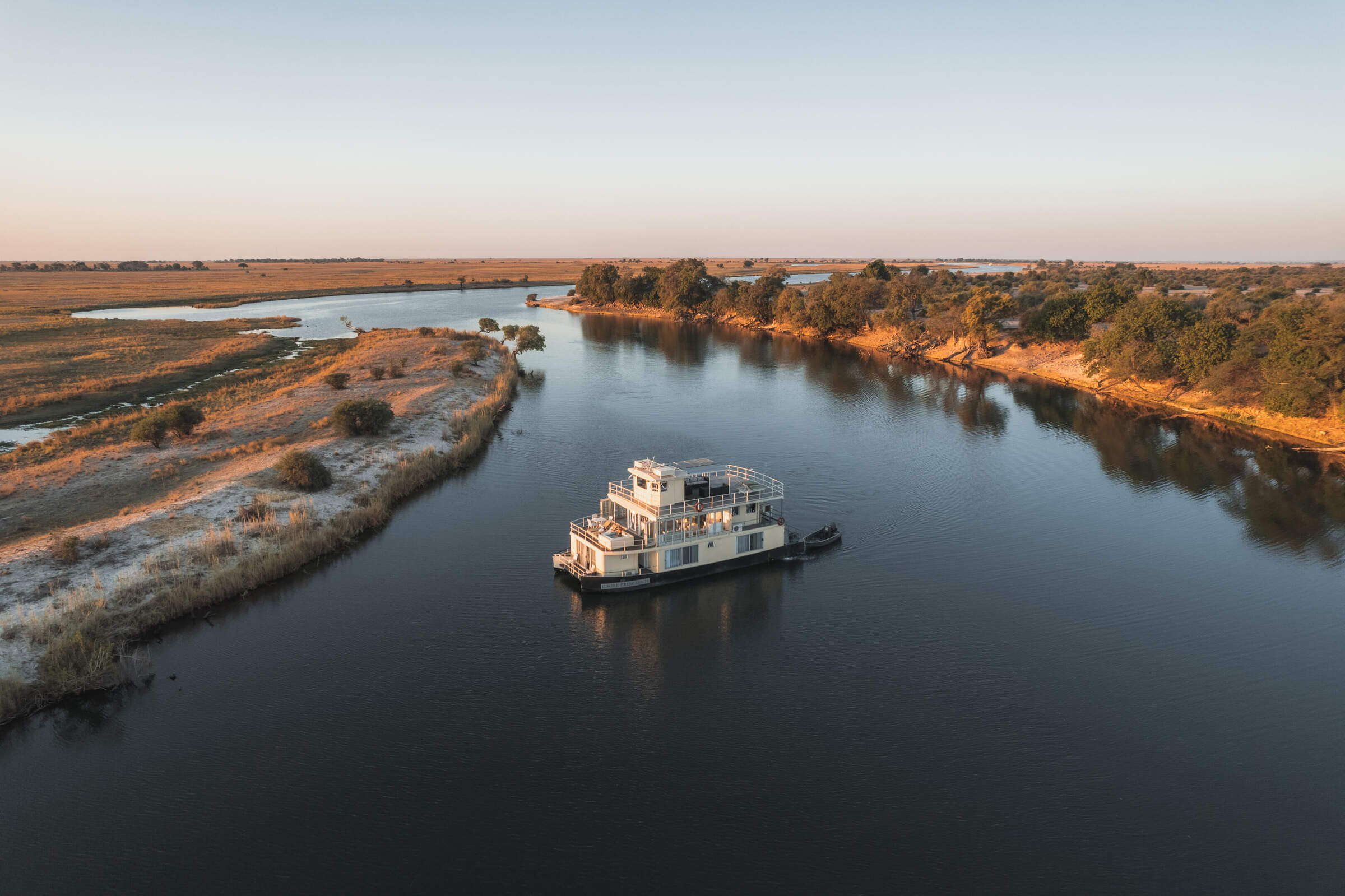
Chobe Princesses
The Chobe Princess houseboats offer a memorable way to explore the Chobe and Zambezi Rivers in Namibia's Caprivi. Perfect for a couple or for a group of family or friends.
Lianshulu Lodge
Beside the Kwando River, within Mudumu National Park, Lianshulu is a small safari lodge offering 4WD safaris and river trips – with particularly good birdlife.
Nunda River Lodge
NNunda River Lodge overlooks a pretty part of the Kavango River near Popa Falls and the productive Mahango National Park.
Ichingo Chobe Lodge
Safari holiday in Namibia's Caprivi Strip, staying at Ichingo Chobe River Lodge on Impalila Island.
Camp Kwando
Near to Mudumu National Park, Camp Kwando is a comfortable and unfussy option with opportunities for game drives, boat safaris and fishing.
Nambwa Tented Lodge
A beautiful safari lodge In the remote Bwabwata National Park, Nambwa Tented Lodge brings serious comfort to a relaxing safari.
River Dance
Build on stilts on the banks of the Kavango River, River Dance Lodge has great views, a relaxed ambience and excellent birdlife.
Zambezi Queen
The Zambezi Queen offers luxurious two- and three-night cruises along the game-rich Chobe River, including game viewing by small boat and 4WD as well as catch-and-release fishing.
Taranga Lodge
Situated on the banks of the Kavango, Taranga Safari Lodge works as a convenient stopover before going onto explore the Caprivi.
Divava Lodge & Spa
The substantial Divava Okavango Lodge & Spa offers plenty of pampering opportunities in an unspoilt riverside setting
Cascade Island Lodge
Cascade Island Lodge, near Kasane in the Caprivi Strip is a very luxurious, high end option for those seeking peace and privacy on the Zambezi River.
Shametu Lodge
Shametu River Lodge has the best views of the Popa Rapids of any private lodge in the Divundu area.
Jackalberry Camp
Jackalberry Camp is uniquely situated in the Nkasa Rupara National Park affording unrivalled access to this little-visited corner of Namibia.
Namushasha Lodge
One of the larger lodges in the Bwabwata National Park, Namushasha is an economic option with an attractive river-side location.
Kazile Island Lodge
On an island in the Kwando River within Bwabwata National Park, the remote Kazile lsland Lodge offers games drives, bush walks and boat cruises.
Serondela
Accessible only by river, Serondela combines the remoteness of Namibia’s Caprivi Strip with access to Botswana’s flagship Chobe National Park.
Chobe Savanna Lodge
Chobe Savanna Lodge stands opposite Chobe National Park, Botswana. Click here to learn more about the area and your options for a safari there.
Chobe Water Villas
Chobe Water Villas is a beautiful and thoughtfully designed lodge, in a great location on the Namibian banks of the Chobe River.
Nkasa Linyanti
On a private island within the remote Nkasa Rupara National Park, Nkasa Linyanti will combine tented comfort with an impressive range of safari activities.
When to go to Caprivi Strip
Our month by month guide: What it's like to visit Nkasa Lupala in Caprivi Strip
Jan
Feb
Mar
Apr
May
Jun
Jul
Aug
Sep
Oct
Nov
Dec
Caprivi Strip in January
January marks the heart of the rainy season in the Caprivi Strip. The Zambezi and Kwando rivers swell, nourishing the lush landscapes of Bwabwata and Mudumu National Parks. Rainfall can be heavy but localised, with temperatures around 30°C/86°F.
The verdant environment makes a refreshing change, especially in typically drier areas. Birdlife is abundant, with many species in full breeding plumage and migratory birds present in force. In Nkasa Rupara National Park, the abundant water allows wildlife to disperse, making it more challenging to spot. However, boat cruises along the major rivers offer excellent opportunities for wildlife viewing and birdwatching.
- Variable weather: hot and dry or humid with rain
- Occasional localised thunderstorms in the region
- Abundant birdlife, especially migratory species
- Wildlife dispersed, harder to spot in Bwabwata
- Few tourists, low rates at lodges and camps
Our view
This is not a great time to visit
Weather in January
Caprivi Strip in February
February is the wettest month in the Caprivi Strip, with the Zambezi Region experiencing some of the heaviest rainfall. The Kavango and Zambezi rivers reach their peak levels, creating a lush, green paradise.
Days alternate between clear, hot and humid, and cooler with building clouds culminating in spectacular thunderstorms. These storms can cause flash floods, bringing ephemeral rivers to life and making travel more challenging, especially in remote areas like Khaudum National Park. The landscape feels vibrant and alive; insects and smaller animals are more easily seen in Bwabwata and Mudumu National Parks. Many birds and animals are raising their young. However, the abundance of water and thicker vegetation can make it harder to spot larger wildlife. Boat safaris along the Chobe River offer excellent game viewing opportunities.
- Weather alternates between hot/dry and humid/rainy
- Thunderstorms meander over the lush landscape
- Vibrant birdlife in wetlands and floodplains
- Wildlife scattered across Bwabwata National Park
- Low tourist numbers, great deals on accommodation
Our view
This is not a great time to visit
Weather in February
Caprivi Strip in March
March usually sees the main rains in the Caprivi Strip tailing off, though precipitation varies across the region. Many days are clear with strong sun, while others may end with short, spectacular thunderstorms. As the month progresses, these rains reduce in frequency and volume. The landscape remains vivid and green, particularly in Bwabwata and Mudumu National Parks.
Wildlife viewing can be challenging as animals disperse, but patient observers may spot young animals and a variety of bird species in breeding plumage. The Kwando and Zambezi rivers remain high, offering excellent opportunities for boat safaris and fishing. Impalila Island becomes more accessible as water levels start to recede.
- Weather varies: clear and hot or cloudy and humid
- Thunderstorms decrease as the month progresses
- Animals well-fed after months of plentiful food
- Wildlife viewing challenging in Bwabwata Park
- Few visitors, low rates at lodges and camps
Our view
A good time to visit, with pros & cons
Weather in March
Caprivi Strip in April
April in the Caprivi Strip is characterised by increasingly dry weather, with temperatures starting to fall. Days remain pleasantly warm, and humidity is still high, but nights start to have a slight chill. The recent rains leave the region lush and green, particularly in Bwabwata and Nkasa Rupara National Parks.
Animals are in excellent condition, often with fast-growing young. As the atmosphere clears, photographers can capture spectacular landscapes and healthy wildlife. Stargazing becomes more rewarding as night skies clear.
In the northern parks like Mudumu and Bwabwata, water and food remain plentiful, so big game can be more dispersed. However, boat safaris along the Zambezi and Chobe rivers continue to offer excellent wildlife viewing opportunities. April is an ideal time for birdwatching, with many migratory species still present.
- Nights become cooler and drier in the region
- Easter sees a slight increase in visitor numbers
- Wildlife still dispersed in Bwabwata National Park
- Migratory birds begin their northward journey
- Lush green landscapes and crisp, clean air
Our view
A good time to visit, with pros & cons
Weather in April
Caprivi Strip in May
By May, the Caprivi Strip is drying out, but if rains have been good the land remains green. Wildlife in Bwabwata and Mudumu National Parks starts to congregate around permanent water sources. The air quality and clarity can be amazing, making this an ideal month for photography.
Typical days are warm with crisp, clear mornings and blue skies. Evenings are cool, with temperatures possibly dipping below 10°C/50°F overnight. Many lodges still charge low season prices, offering good value. The combination of increasingly good wildlife sightings, beautiful landscapes, and crystal-clear air makes May one of the best months to visit the Caprivi Strip. River activities along the Zambezi, Chobe, and Kwando rivers are particularly enjoyable, with pleasant temperatures and good wildlife viewing opportunities.
- Pleasant weather: warm days and cool nights
- Landscapes remain green as the region dries out
- Excellent visibility for wildlife photography
- Low visitor numbers and moderate lodge rates
- Wildlife starts to congregate near water sources
Our view
A very good time to visit
Weather in May
Caprivi Strip in June
June sees the Caprivi Strip fully dry, with blue, cloudless skies. Days are warm and dry, while nights can be cold, sometimes near freezing in more exposed areas. Warm clothing is essential for early morning game drives in Bwabwata and Mudumu National Parks.
Wildlife viewing enters its dry-season pattern, focusing around waterholes and rivers. The Kwando and Zambezi rivers offer excellent boat safari opportunities, with animals frequently coming to drink. Photographers benefit from superb air clarity, with minimal dust or smoke. Fishing, particularly for tigerfish, becomes increasingly popular as water levels stabilise.
Historically, June accommodation prices have been low, but the region's increasing popularity means some lodges now charge higher prices.
- Clear days, cold nights
- Great conditions for landscape photography
- Moderate lodge rates in this shoulder season
- Wildlife gathers at waterholes for easier viewing
- Some greenery persists in the lush landscape
Our view
A very good time to visit
Weather in June
Caprivi Strip in July
July in the Caprivi Strip offers reliably warm daytime temperatures above 20°C/68°F and excellent wildlife sightings. Rain is extremely rare, and clear skies make for great photographs, especially in Bwabwata and Nkasa Rupara National Parks. Nights can be very cold, potentially below freezing in exposed areas. Visitors should dress in layers and be prepared for chilly morning and evening game drives.
As vegetation dries out, game concentrates around water sources., and the Kwando and Zambezi rivers become wildlife hotspots, offering excellent boat safari opportunities. Lodges charge high season rates, and many are fully booked well in advance, especially during European school holidays.
- Dry days, cold nights ideal for stargazing
- European holidays bring more family travellers
- Peak season with higher rates and busy lodges
- Excellent wildlife viewing in Bwabwata Park
- Boat safaris popular on the region's rivers
Our view
A very good time to visit
Weather in July
Caprivi Strip in August
August is the height of winter in the Caprivi Strip. Expect cloudless skies and warm sun during the day, but nights can drop to freezing in exposed areas. Warm clothes are essential for early morning and evening activities.
The landscape is dry, with much vegetation turned golden brown, creating stark and beautiful scenery in Bwabwata and Mudumu National Parks. Wildlife congregates around available water sources, guaranteeing excellent animal sightings, especially along the Kwando and Zambezi rivers. Boat safaris and fishing expeditions are highly rewarding, with animals frequently seen coming to the water's edge to drink.
August is the most popular time to visit, particularly for families. Advance booking is crucial for the best lodges.
- Dry days and cold nights continue in Caprivi
- Cloudless skies offer spectacular stargazing
- Busier season, especially for family accommodation options
- Peak rates and advance bookings necessary
- Prime time for game drives and river safaris
Our view
Fantastic: the very best time to visit
Weather in August
Caprivi Strip in September
September in the Caprivi Strip brings blue, cloudless skies and fantastic wildlife viewing. Rain is almost unheard of, and temperatures gradually increase. Daily maximums can reach the low 30s Celsius / 80s Fahrenheit, though low humidity keeps it comfortable. Nights remain cool.
The air becomes dustier, creating atmospheric scenes for photography. In Bwabwata, Mudumu, and Nkasa Rupara National Parks, animals cluster around remaining water sources, making September one of the best months for game viewing. It's a popular time for visitors, with high season rates in effect. Safari enthusiasts often choose this month for its reliable wildlife sightings. Boat safaris along the Zambezi and Chobe rivers offer excellent opportunities to see elephants and other wildlife coming to drink.
- Excellent month for wildlife viewing in Caprivi
- Warming temperatures as the month progresses
- Landscape transitions from green to golden brown
- High season rates at lodges and camps continue
- Advance bookings essential for accommodation
Our view
Fantastic: the very best time to visit
Weather in September
Caprivi Strip in October
October is typically the hottest and driest month in the Caprivi Strip. Temperatures build throughout the month, with daily highs potentially exceeding 40°C/104°F, though the low humidity makes it bearable. In rare years, isolated showers may occur late in the month.
Wildlife viewing in Bwabwata and Mudumu National Parks is at its peak, with animals congregating around dwindling water sources. The Zambezi and Kwando rivers become crucial lifelines for wildlife. October is popular among wildlife enthusiasts and commands peak-season prices. Dust and occasional smoke can create hazy conditions, challenging for photographers but creating dramatic scenes. Boat safaris offer respite from the heat and excellent game viewing.
- Peak wildlife-viewing in Bwabwata National Park
- Hot and dry conditions throughout the region
- Hazy air due to dust and occasional bush fires
- High season rates at lodges and camps persist
- Early October sees many facilities fully booked
Our view
A very good time to visit
Weather in October
Caprivi Strip in November
November in the Caprivi Strip can be unpredictable, alternating between hot, dry periods and cooler, cloudier days. Typically, mornings start clear and hot, with clouds building in the afternoon. Humidity increases, often culminating in spectacular late-afternoon thunderstorms. These storms are usually localised, bringing relief to some areas while others remain dry. Places receiving rain quickly flush green, softening the landscape in Bwabwata and Nkasa Rupara National Parks.
Many mammals give birth as the first rains arrive. Once rains begin, wildlife in the parks becomes more dispersed, making game viewing more challenging. However, this is an excellent time for birdwatchers, with migrant species arriving in breeding plumage. Boat safaris along the major rivers continue to offer good wildlife viewing opportunities.
- Variable conditions depending on the rains
- New life emerges with the onset of rains
- Wildlife viewing shifts to wetter areas
- Shoulder season offers value for money
- Increased chance of showers later in the month
Our view
A good time to visit, with pros & cons
Weather in November
Caprivi Strip in December
December marks the first proper month of the Caprivi Strip's rainy season and is one of the hottest. Mornings are often clear, giving way to building clouds and occasional short, spectacular thunderstorms. These rains are generally welcomed, clearing the air of dust and prompting plant life to erupt across Bwabwata and Mudumu National Parks.
Young animals abound, and many bird species are in breeding plumage. Wildlife disperses widely with the increased water availability, making game viewing more challenging but rewarding for patient observers. The Zambezi and Kwando rivers offer cooler temperatures and continued opportunities for boat safaris and fishing. Christmas and New Year fall within local summer holidays, so accommodation options can be surprisingly busy, especially around Katima Mulilo and other major towns.
- Hot and humid, occasional cooling showers
- Landscape turns green where rain has fallen
- Renewed energy in the lush Caprivi environment
- Clear air enhances photography opportunities
- Excellent for birdwatching, challenging for mammals
Our view
This is not a great time to visit
Weather in December

Looking for inspiration on where to travel next?
Visit our trip chooser to explore your options and find inspiration for your perfect African adventure
Inspire me