About DumaTau Camp
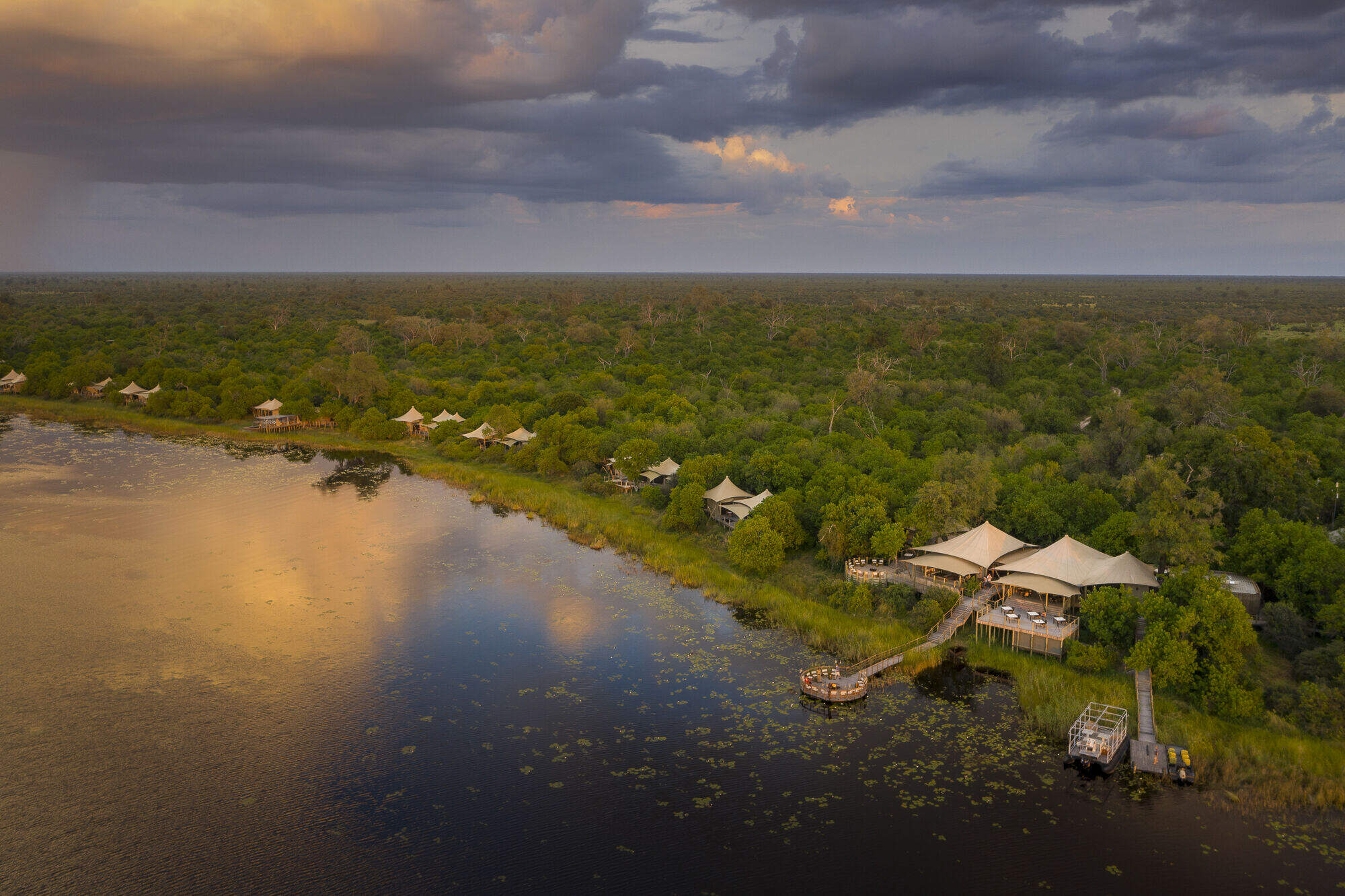
Originally opened in 2000, Botswana's tented DumaTau Camp has been rebuilt and reinvested a number of times ...
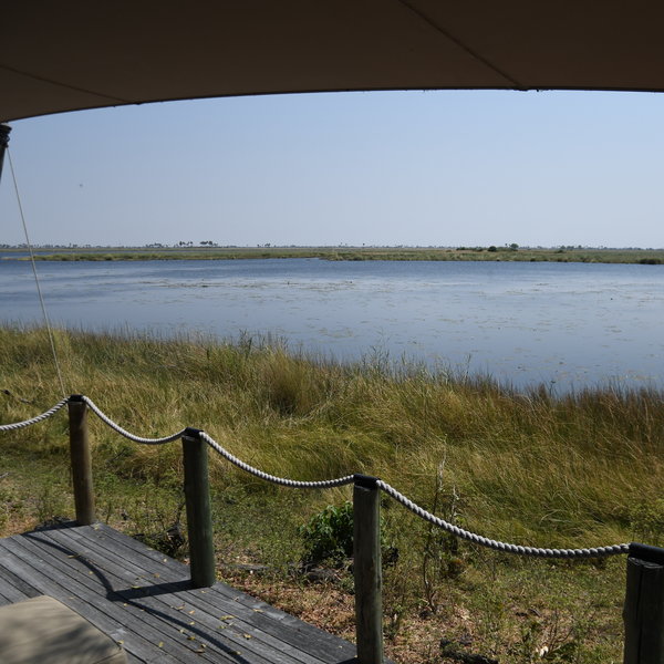
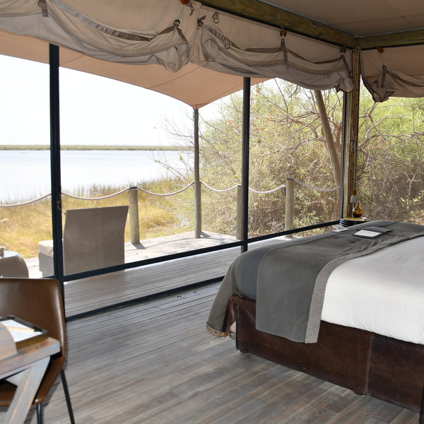
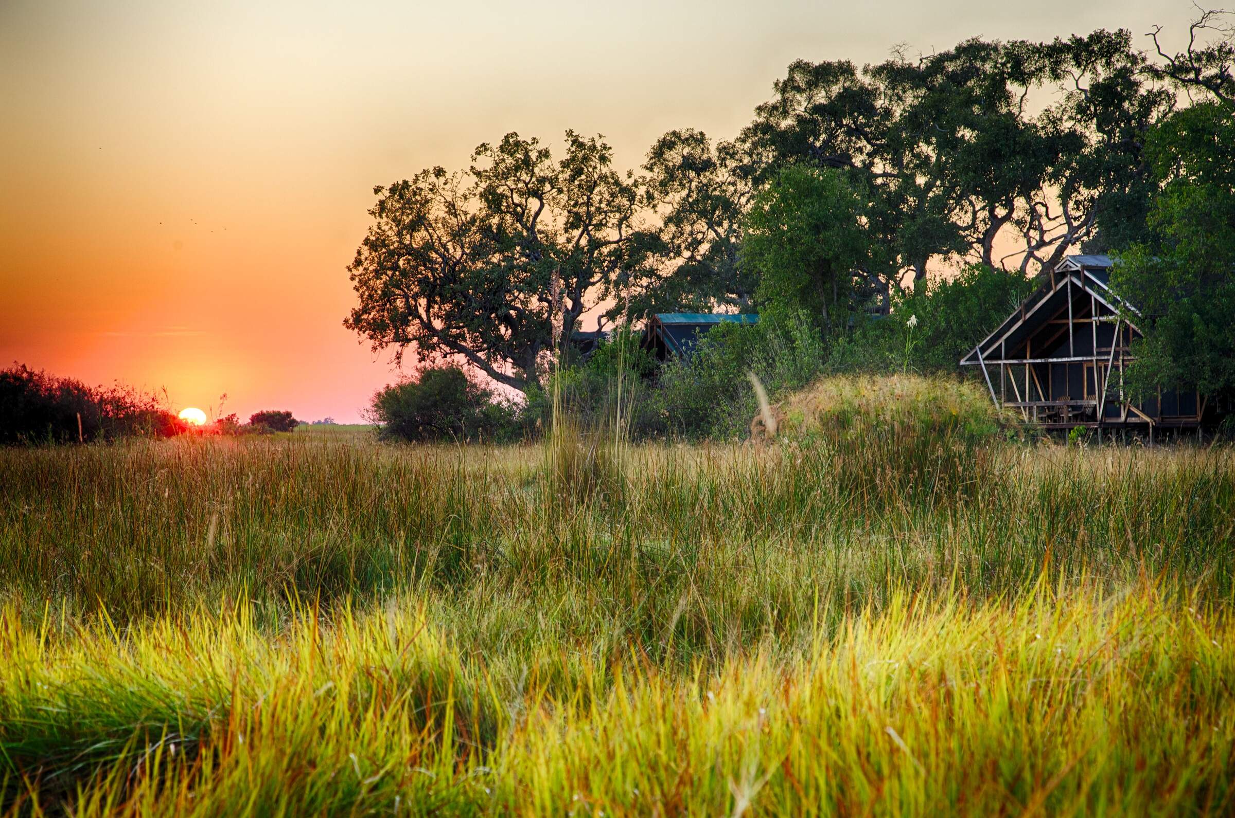
... and is now a premier luxury camp sitting beside the Linyanti River, not far from the original camp. It overlooks a lagoon and expansive swamps within the extensive, private Linyanti Reserve, where wildlife safaris are possible year round.
We are in the process of updating this lodge page to reflect Duma Tau's latest upgrade.
DumaTau is a stylish camp with excellent service and a very friendly team including some super guides. We recommend a safari here between about June and October when game viewing is at its best. There's a good population of predators in the area, plus plenty of elephants, buffalo and other game. If you visit towards the end of this peak season or outside of it, you can expect a stunning environment, but you'll have to work harder for good game sightings, as the density of animals in the camp's immediate vicinity will be lower.
Our view
DumaTau is a stylish camp with excellent service and a very friendly team including some super guides. We recommend a safari here between about June and October when game viewing is at its best. There's a good population of predators in the area, plus plenty of elephants, buffalo and other game. If you visit towards the end of this peak season or outside of it, you can expect a stunning environment, but you'll have to work harder for good game sightings, as the density of animals in the camp's immediate vicinity will be lower.
Country manager: Botswana
Accommodation
8 tented rooms
Children
Best for aged 12+
Open
All year
Activities

4WD Safari

Birdwatching

Boat trip

Fishing

Guided walking safari

Helicopter

Mokoro

Night drive

Private activities
Traveller reviews of DumaTau Camp
53 real, un-edited reviews from Expert Africa's travellers.


Expert Africa's gallery
When we travel we take lots of photos ourselves to give you a real and un-edited view of the safaris. See our 26 pictures of DumaTau to get the candid view.
View gallerySafaris visiting DumaTau
Just ideas, we'll always tailor-make a trip for you

Bushbuck Safari
8 days • 3 locations • 1 country
MAUN AIRPORT TO MAUN AIRPORT
Discover three of Botswana’s best game-viewing regions with stays in the private Linyanti, Chitabe and Vumbura reserves. Intimate, smart camps offer a range of activities by which to discover these stunningly varied habitats.
Visiting Okavango Delta, Kwando-Linyanti
US$18,020 - US$31,740 per person
DumaTau Camp: Our full report
Originally opened in 2000, Botswana's tented DumaTau Camp has been rebuilt and reinvested a number of times ...
... and is now a premier luxury camp sitting beside the Linyanti River, not far from the original camp. It overlooks a lagoon and expansive swamps within the extensive, private Linyanti Reserve, where wildlife safaris are possible year round.
We are in the process of updating this lodge page to reflect Duma Tau's latest upgrade.
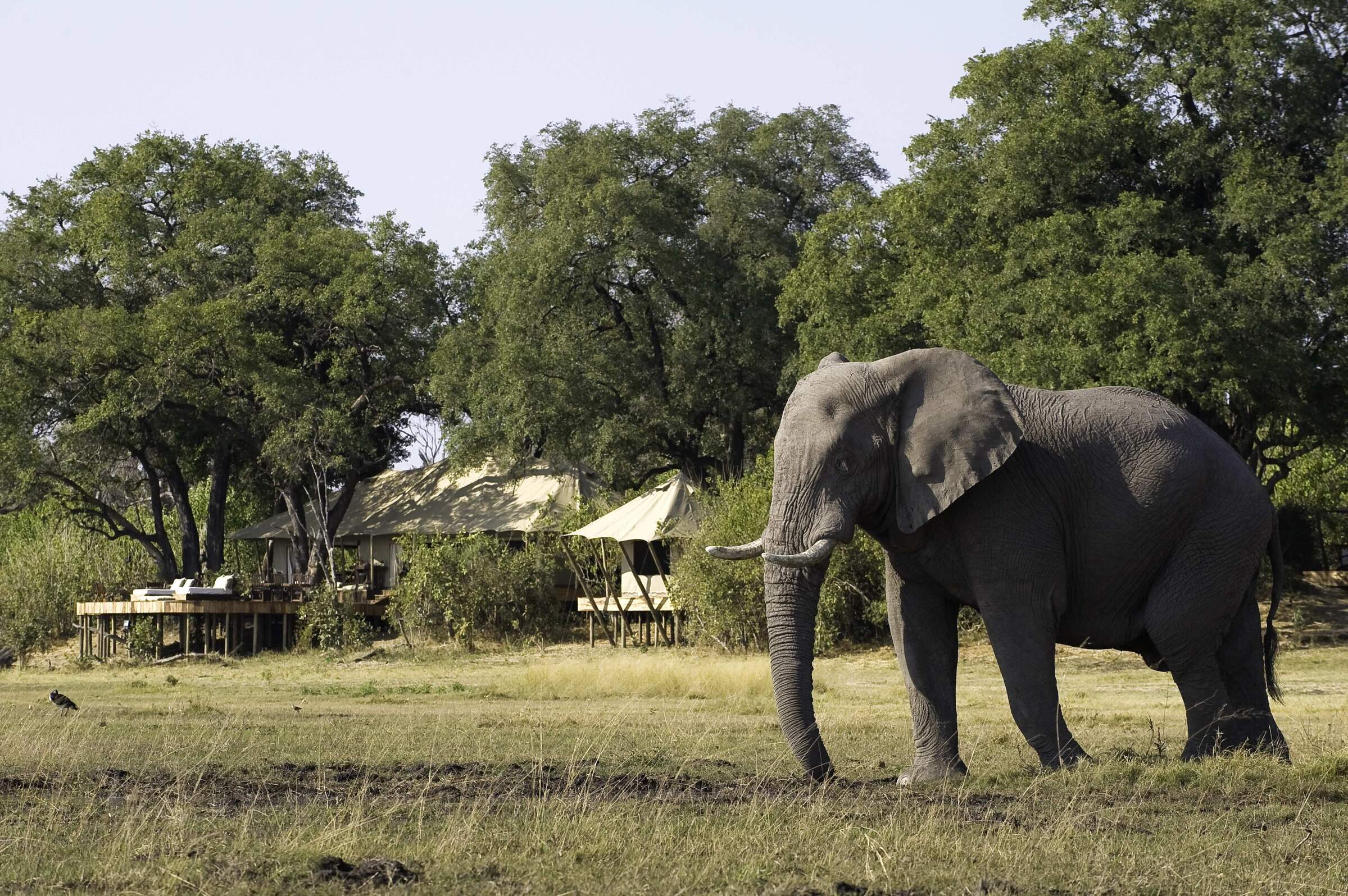
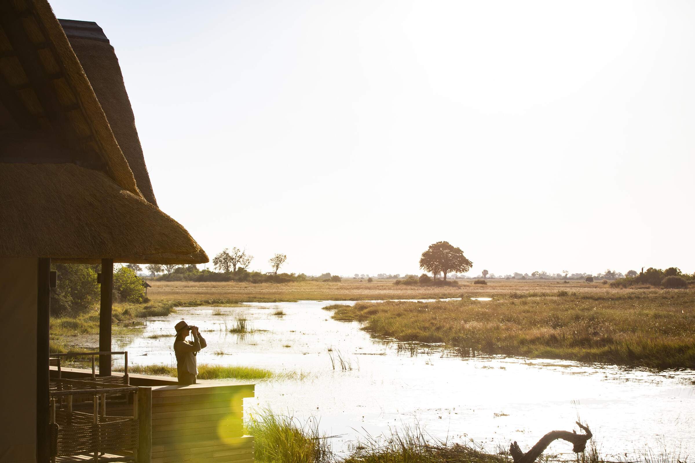
In topography, this area of northern Botswana is similar to the northern riverfront of Chobe National Park. The permanent waterways are fringed by riparian forest, and dense woodland (mostly mopane) stretches away to the south. DumaTau itself lies close to the Zibadianja Lagoon (the source of the Savuti Channel), under towering jackalberry (African ebony), sausage and mangosteen trees.
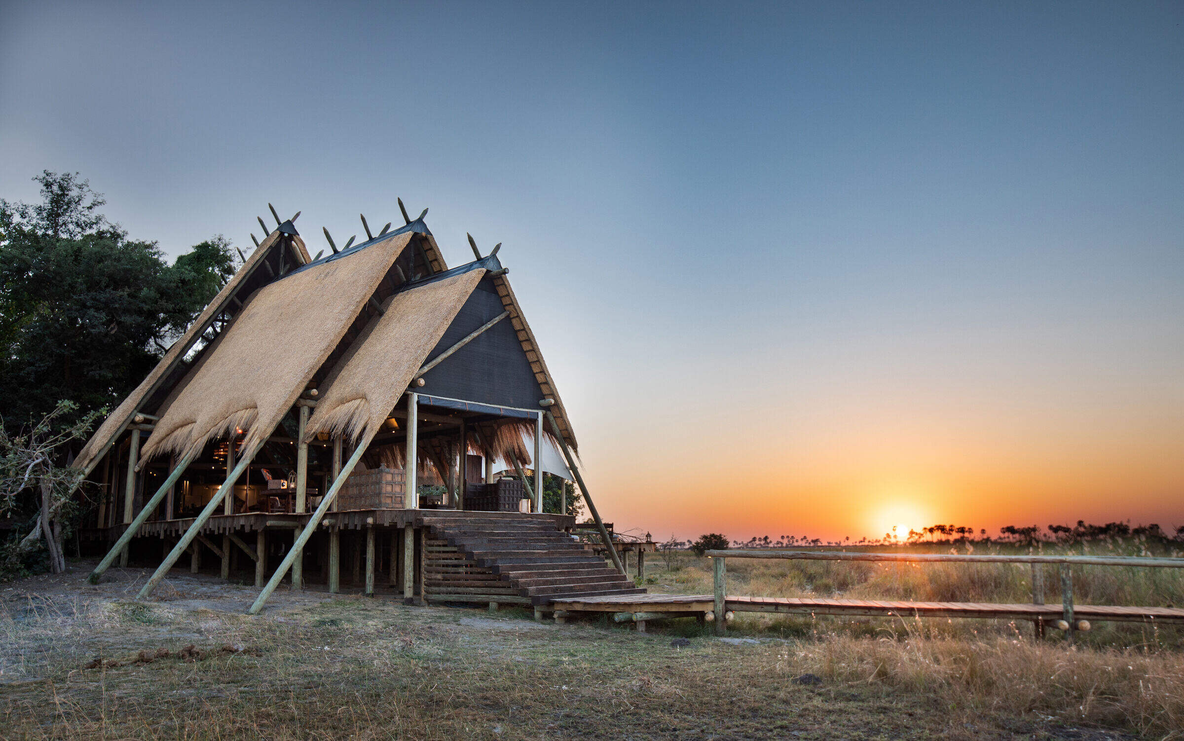
The décor at DumaTau is contemporary and light, almost Scandinavian in feel. The raised main area is split across two wooden-framed tents, divided by a central walkway. During our last stay in August 2018 the canvas walls were rolled up, but can easily be closed for wet or windy weather.
The large dining area is both decorative and functional, with a self-service coffee and tea station. Silver platters hold water glasses and mugs; and during mealtimes food platters sit atop wooden logs on the table. Cheeky hornbills often keep camp guests entertained with the occasional opportunistic fly past – especially at brunch.
Dining is usually communal at DumaTau, while private meals can be organised on request. During the winter months, gas patio heaters help ward off the chill of the early mornings and late evenings.
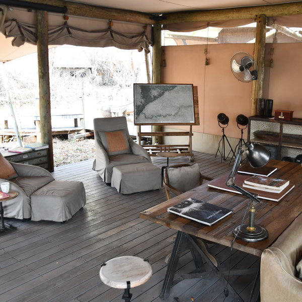
The light wood and natural coloured furnishings of the lounge at Duma Tau Camp make a nice change from the more traditional safari décor. Along with an array of sofas and armchairs, a large desk, old tin and wooden cabinets, old trunks and vintage lamps, are a good selection of photography books. To the front is a cleverly designed bar which allows uninterrupted views over the river.
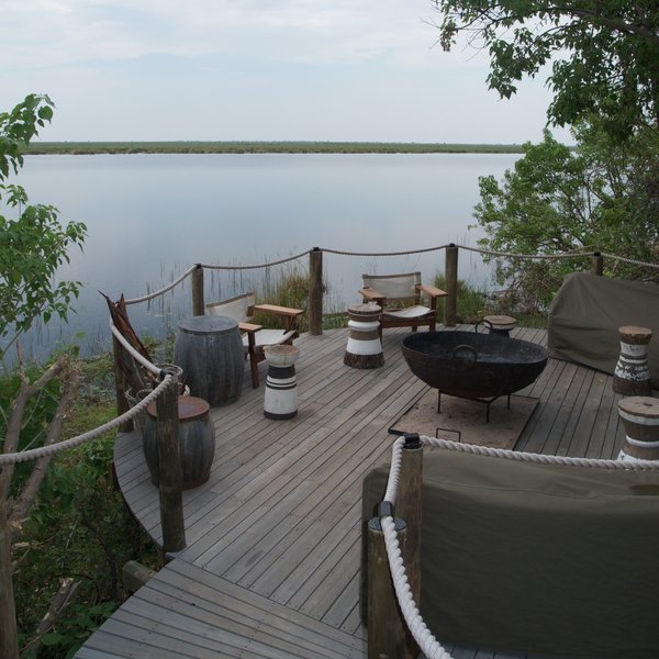
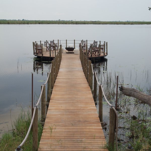
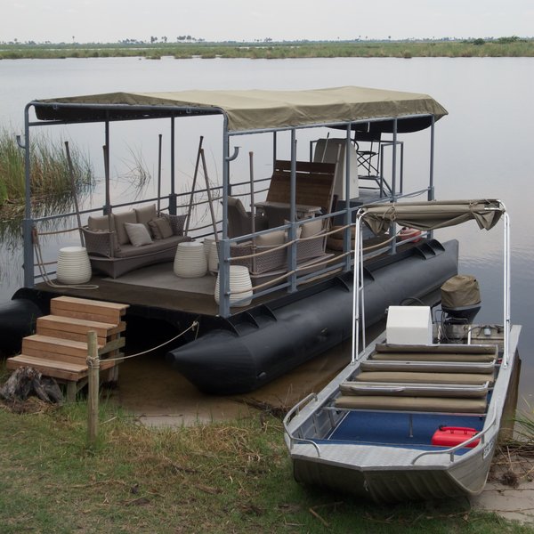
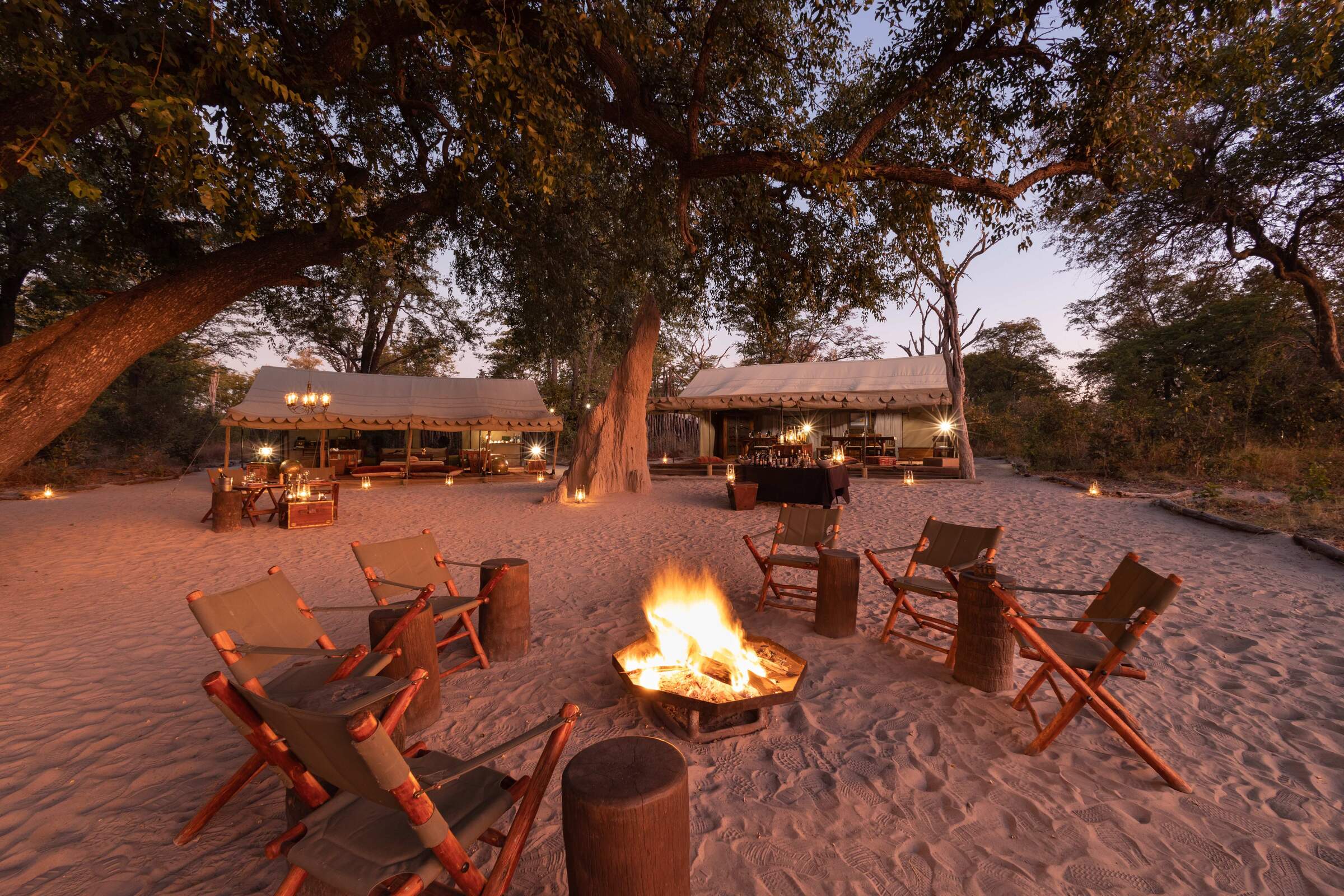
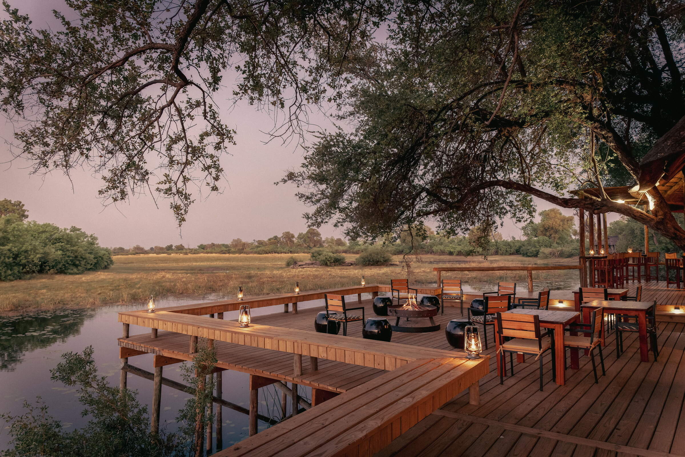
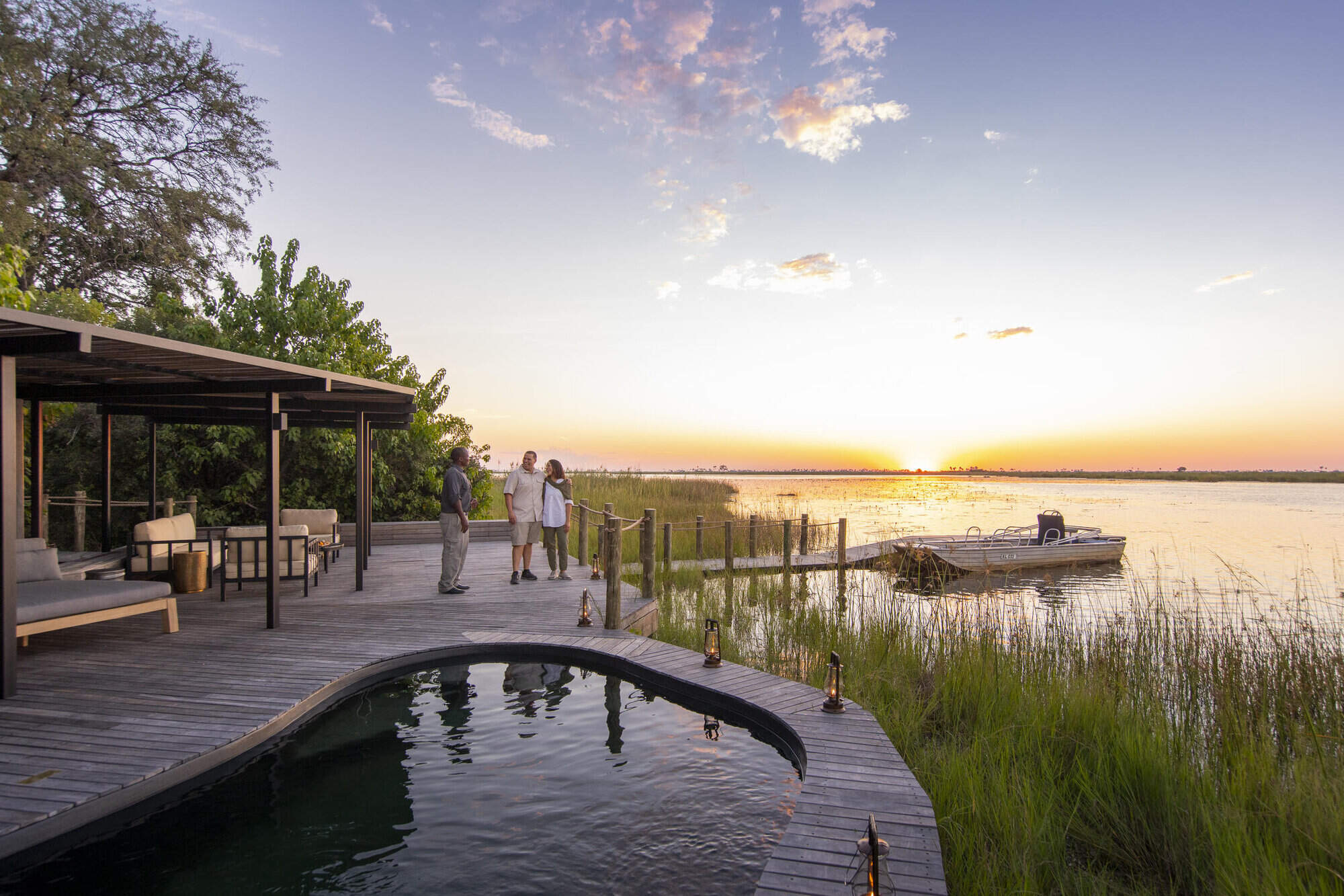
Steps lead down to a wooden floating jetty, which opens up to a circular area with a boma and deckchairs, while moored alongside is a very comfortable floating barge, set out with sofas. There is also a well-stocked curio shop to one side of the main area.
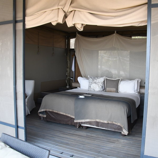
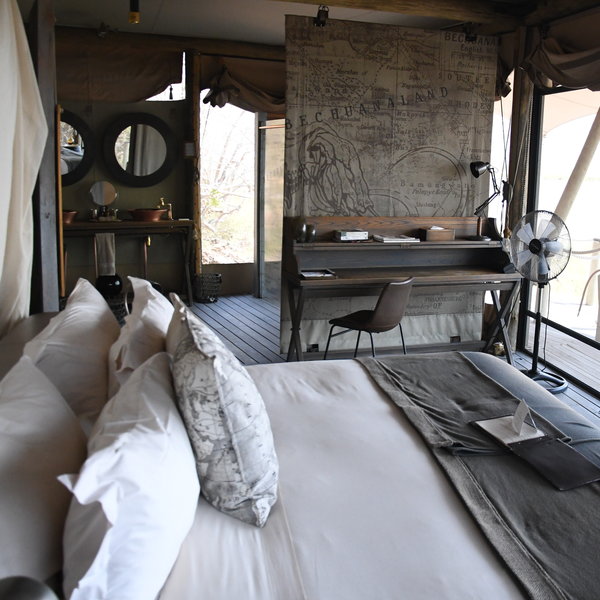
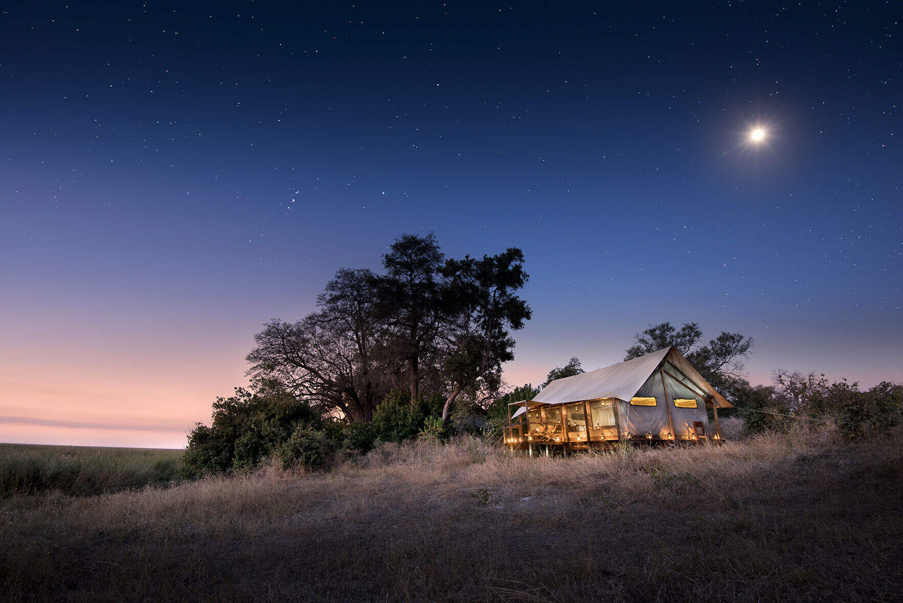
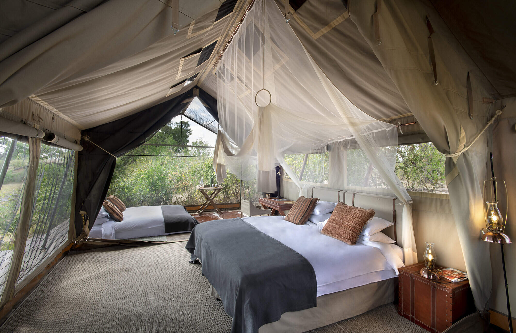
Raised wooden walkways lead through the bush to DumaTau's ten tented rooms, which are spread out along the river on each side of the main area. To the front, overlooking the water's edge, each has a large raised veranda with comfortable rattan chairs. The tents are substantial, constructed on wooden decks beneath a canvas roof, with mesh walls that allow guests to enjoy the surrounding landscape. At night, the room attendants roll down the canvas tent flaps for privacy and to keep out any chilly breezes. Two of the rooms are designed for families, but as they consist of two separate tents joined by an open deck, children under 12 must share a room with an adult.
Each tented room at Duma Tau is entered through a wooden door secured with a latch, to reveal large double or twin beds surrounded by a mosquito net, and with a fan overhead. On either side are reading lights set on square leather-trimmed luggage trunks. The rooms follow a similar soft colour palette to the main area, with whitewashed wooden floors, brown striped floor rugs, and natural-coloured furnishings. In one corner is a desk with an assortment of stationery, power plugs and reference books, as well as a floor-standing fan; in another, an ottoman chair takes pride of place beside a small table. Tea- and coffee-making facilities and filtered drinking water are also provided.
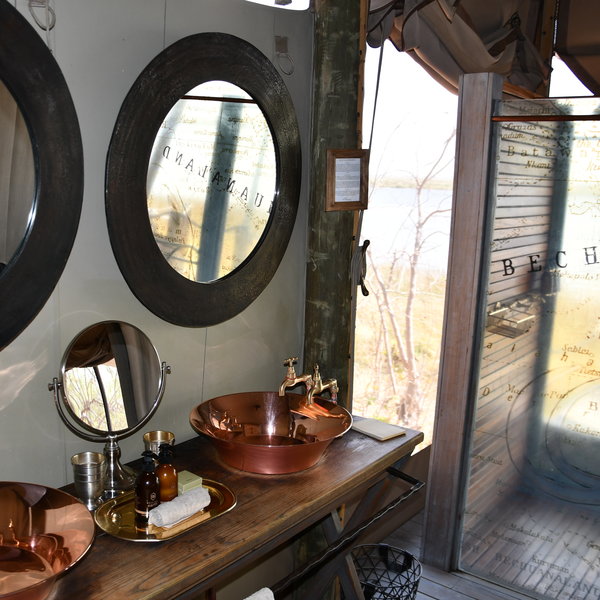
Behind the bed is a luggage rack, a long mirror and a wardrobe that houses a digital safe, emergency radio, blankets, bug spray and two cotton dressing gowns. A curtain divider separates the bedroom from the en-suite bathroom, where his-and-hers copper basins are set on a wooden washstand overlooking the river. Both the flush toilet and rain-head shower are enclosed in separate cubicles.
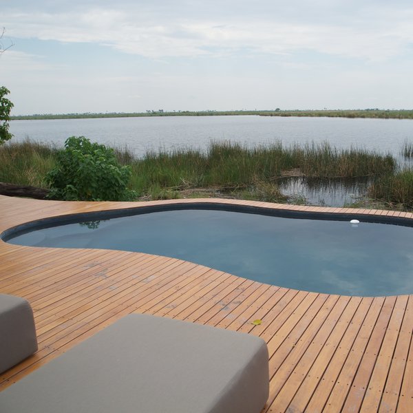
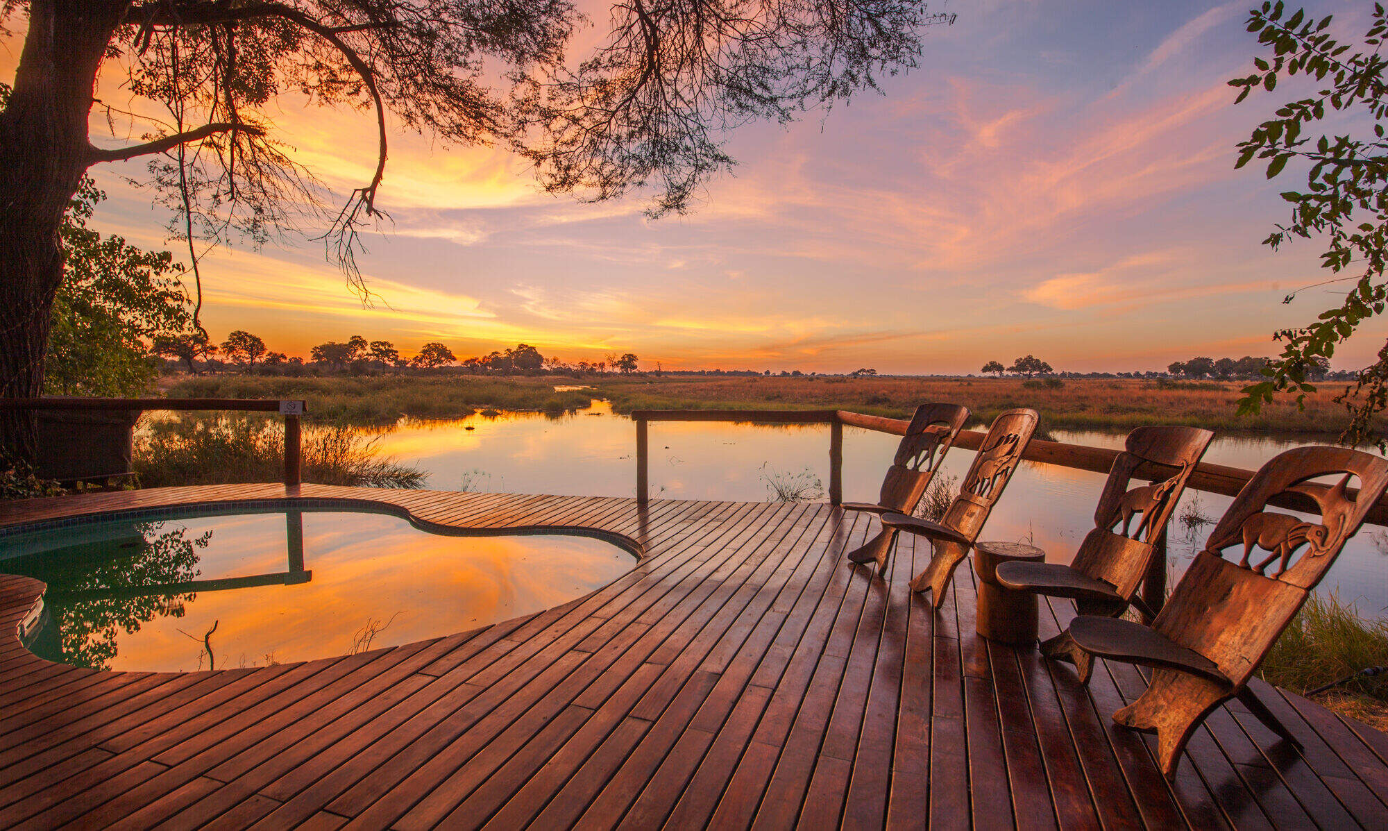
DumaTau Camp is spread out along an extensive stretch of the river, with a swimming pool at one end, just beyond tent number 10. If you are in tent 1, it is a decent ten-minute walk to the pool. For some this will be a welcome walk after sitting sedentary in a vehicle. It's an inviting spot, surrounded by decking, and dotted with very comfortable sunloungers and umbrellas. There is also a changing area and loo so there is no need to take the long walk back to your tent. Hidden in the reeds on the other side of the pool, a small jetty with a floating hide and a comfortable sofa is a secluded place to watch birds or just read a book.
The focus of activities at DumaTau is on 4WD day and night game drives. This safari camp also offers boat trips (often taken as a sunset cruise in the afternoon), occasional short walks, and fishing (except in the closed season, in January and February). The camp is backed by forest, with open floodplains to the west and the Savuti Channel to the south – allowing guests to explore a variety of habitats.
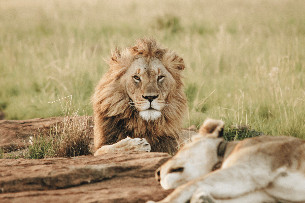
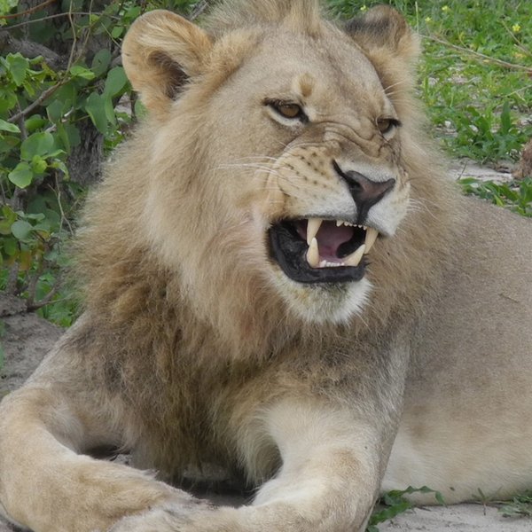
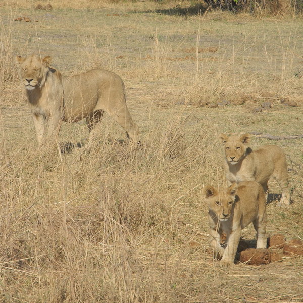
DumaTau means 'roar of the lion' in Setswana, and there are good opportunities to see these magnificent cats here. Indeed, on a previous visit, we had a spectacular encounter with the large DumaTau pride whom we found amidst a whirlwind of dust, snarling and flying fur as they fought off two rival lions who were intent on taking over the pride! This pride is spotted regularly, although more recently their territory has shifted towards the neighbouring Selinda Reserve, so there are times when the guides aren't able to locate them.
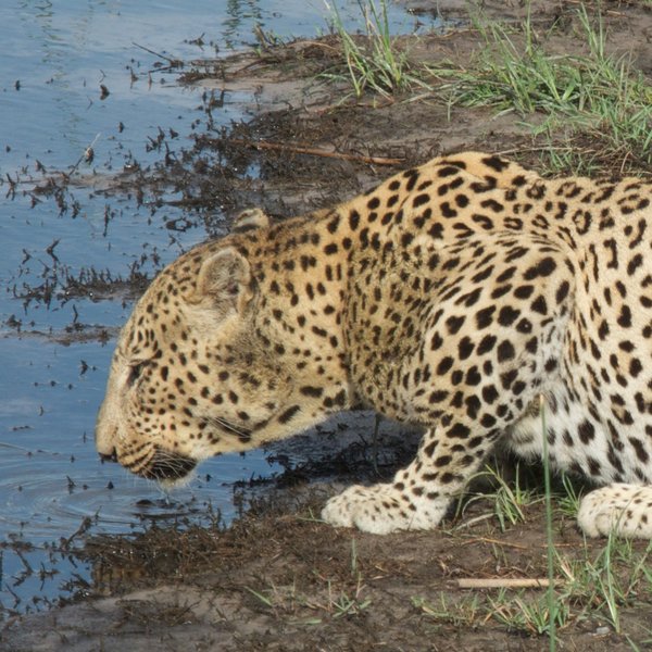
On our most recent trip we spent the morning with a large male leopard which had taken the kill from a smaller female which are frequently seen in the DumaTau area. There is an abundance of game and birdlife to be found along the water edge and also into the woodland. Our guide, Mocks, was particularly knowledgeable, accommodating and experienced when it came to positioning the vehicle for photography.
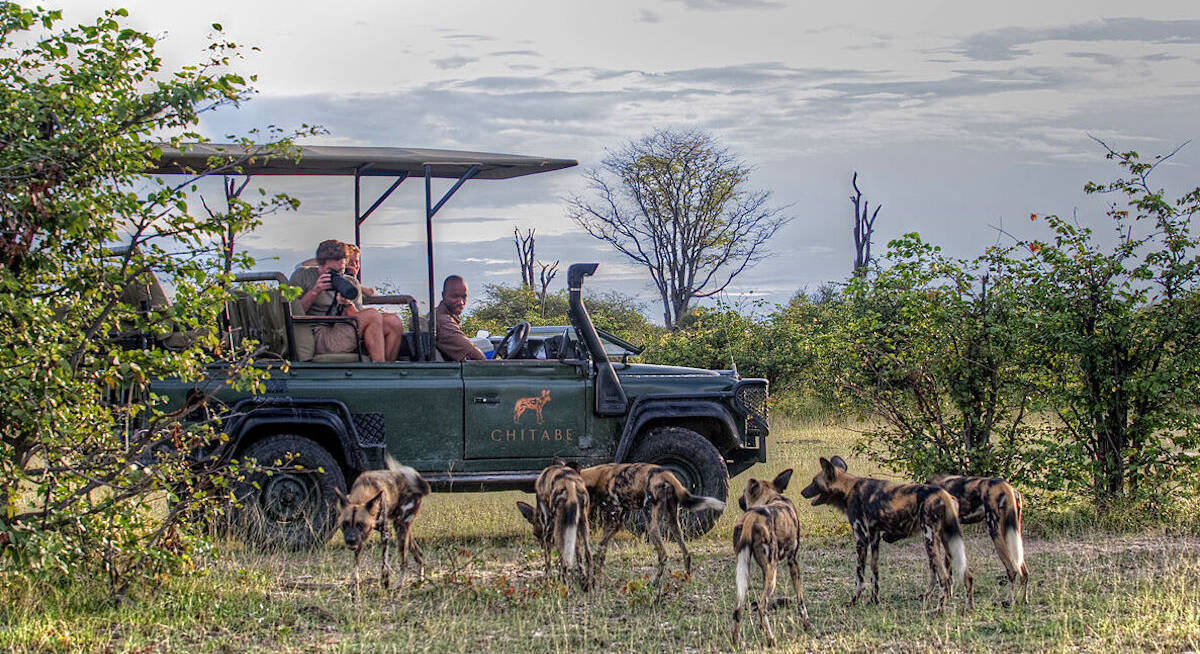
Other predators that are commonly seen here include wild dog and spotted hyena. And, on our most recent trip, we were exceptionally lucky to see both a young male leopard and a hyena together, however, the wild dog frequently cross over into the neighboring Selidna reserve.
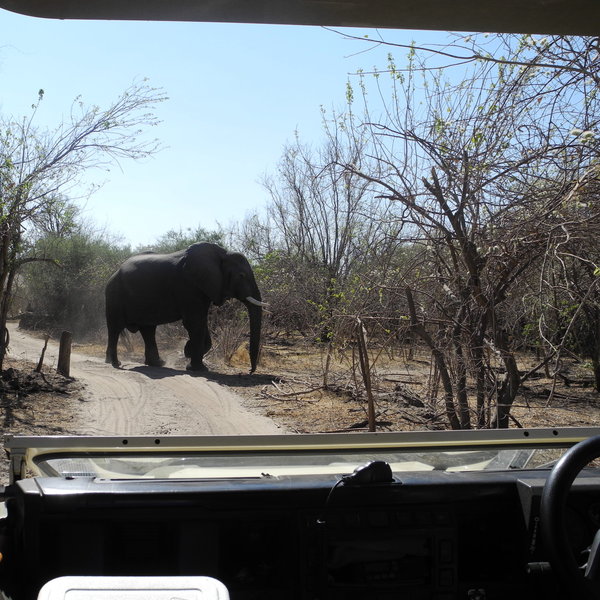
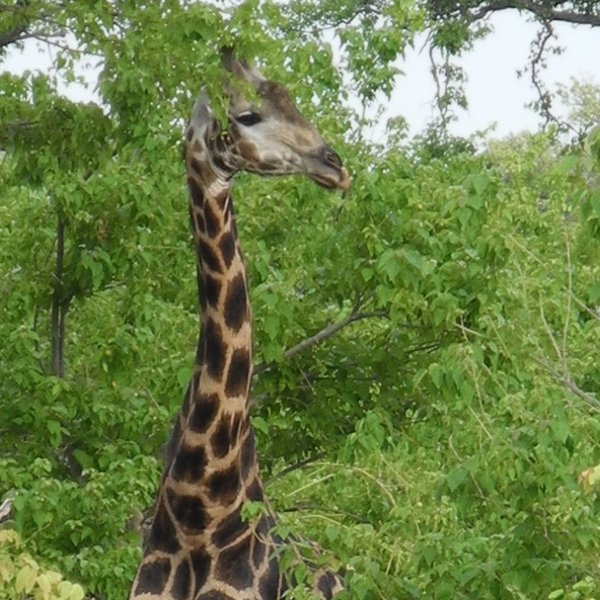
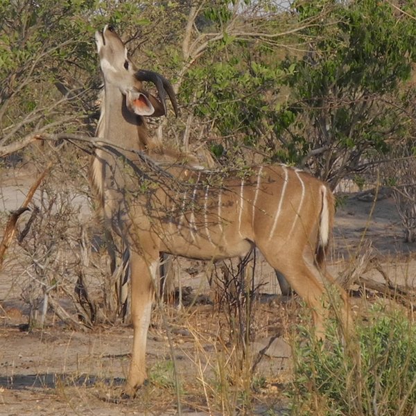
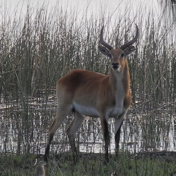
Although DumaTau is one of Botswana's better areas for seeing wildlife year round, safaris here are traditionally best in the dry season – from June to October – as wildlife movements in the Linyanti region are quite seasonal. When the rain stops and the standing pools dry up, animals increasingly migrate to permanent waters like this. This is especially true for elephants and buffalo, but also for many species of antelope and plains game.
It's worth noting that DumaTau is one of four safari camps that operate within the Linyanti Concession, and often share sightings. In order to minimise the stress on the animals, and to maintain a good clear view for guests, Wilderness Safaris operate a strict policy of a maximum of three vehicles per sighting. Guides keep in close contact with each other via radio and operate a standby system whereby vehicles take turns at any given sighting. This can be frustrating, particularly when you have to pull away to let another vehicle in, but it does mean that sightings retain a degree of exclusivity.
Activities
4WD Safari
Birdwatching
Boat trip
Fishing
Guided walking safari
Helicopter
Mokoro
Night drive
Private activities
Families & children
- Attitude towards children
- Children aged six and over are welcome at DumaTau, but families with children aged 6–12 must book a private vehicle (at significant extra cost). The exceptions to this are families of six people who will fill a vehicle anyway, or where the whole camp has been booked for exclusive use by one party!
- Special activities & services
- Child-friendly activities such as bush arts and craft can be arranged.
- Generally recommended for children
- We would recommend DumaTau for children aged 12 or older, with an interest in the natural world.
- Notes
- It is worth noting that because the family rooms are separated by an unenclosed deck, children under 12 must share a room with an adult. DumaTau is not fenced and potentially dangerous animals wander through the camp. Parents must keep their children under constant, close supervision.
Food & drink
- Usual board basis
- Full Board & Activities
- Food quality
- The meals on our last visit in August 2018 were very good and well presented.
Before setting off on our morning activity, a light breakfast included cereals, fruits, yoghurts, juice, toast, muffins, cold meats, cheese platter, pancakes and porridge, served with tea and coffee. We also loved the coffee to go cups for that extra cup of caffeine first thing in the morning!
Brunch, included pork schnitzel with a spinach lasagna sundried tomato salad, butternut and feta salad and couscous. A cheese platter with freshly made bread and crackers was also available for desert. A cooked breakfast of eggs, bacon and sausages was also available.
For afternoon tea we were offered a mini vegetable samosas, chicken wings and melon balls. To drink there was iced tea, coffee and juice.
A three-course dinner was taken in the dining area. For starters we had a Hungarian mushroom soup served with fresh bread. Our main course was a choice of either Venison stew or lemon and herb chicken accompanied by couscous, broccoli and parsnips. Desert was a soufflé. - Dining style
- Mixture of group dining and individual tables
- Dining locations
- Indoor and Outdoor Dining
- Drinks included
- Soft drinks, bottled water, local beers and spirits, plus a limited selection of (usually) South African red and white wines are included. Champagne, imported wines and spirits will cost extra and must be requested well in advance.
Our travellers’ wildlife sightings from DumaTau
Since mid-2018, many of our travellers who stayed at DumaTau Camp have kindly recorded their wildlife sightings and shared them with us. The results are below. Click an animal to see more, and here to see more on our methodology.

100% success

100% success

100% success

100% success

83% success

67% success

67% success

50% success

33% success

17% success

0% success

0% success

0% success

0% success

0% success

0% success
Getting there
- Location
- Kwando-Linyanti area, Botswana
- Ideal length of stay
- You'll need a minimum of two nights at DumaTau, but three nights would be better to experience the area properly – and four would be fine if you’re aiming for a fairly leisurely safari.
- Directions
- DumaTau is 50 minutes by light aircraft from Maun (or 45 minutes from Kasane) followed by roughly 30 minutes drive from the airstrip, depending on game spotted along the way.
- Accessible by
- Fly-and-Transfer
Special interests
- Family safaris
- Duma Tau has two family units; each consisting of two en-suite rooms separated by an open deck. It would best suit families on safari in Botswana with children aged over 12; those with younger children have to book a private vehicle.
- See ideas for Family safaris in Botswana
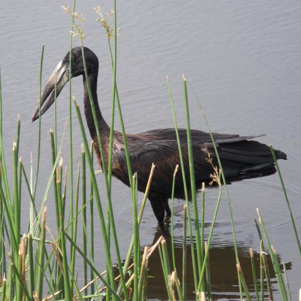
- Birdwatching safaris
- Birding is outstanding at Duma Tau. There is a diversity of habitats which in turn attracts a variety of species ranging from waterbirds to the drier mopane woodland species. The Savute Channel has a high concentration of eagles and raptors.
- See ideas for Birdwatching safaris in Botswana
- Photography safaris
- The safari vehicles used by DumaTau are open-sided, which is handy for wildlife photography. With a maximum of six guests per vehicle, all guests have a 'window' seat for a clearer view and the guides are usually adept at positioning the vehicle.
- See ideas for Photography safaris in Botswana
- Luxury safaris
- Designed with privacy and luxury in mind, the rooms at DumaTau are spacious and airy. The stylish décor, large private verandas and cosy nooks with river views create a real sense of exclusivity, making this the perfect place to relax during your safari holiday.
- See ideas for Luxury safaris in Botswana
Communications
- Power supply notes
- DumaTau uses solar power as the main source of power but has a generator for back up. Each room has a number of plug sockets for charging batteries with a variety of the more common adaptors.
- Communications
- For most purposes, consider yourself out of contact here. There is no cellphone reception, no direct fax or phone and no email. In an emergency, there is radio contact with Maun.
- Water supply notes
- All the tented rooms have plumbed hot and cold running water for showers as well as flush toilets. Guests are usually given a water bottle on arrival with filtered water, which they are encouraged to top up from the filtered supply in the camp’s main area. Each room is also provided with glasses and a flask of filtered drinking water. We don’t recommend that travellers drink from the tap.
Health & safety
- Malarial protection recommended
- Yes
- Medical care
- Camp managers and safari guides are first-aid trained and a comprehensive first-aid kit is kept at camp. A nurse is on call, in Maun, to give advice if a guest falls ill. In an emergency the camp will arrange for guests to be flown out for medical treatment. Please note that it is only possible to fly out of camp during daylight hours as the bush airstrips do not have any lighting at night.
- Dangerous animals
- High Risk
- Security measures
- Due to the presence of potentially dangerous wildlife around this unfenced camp, guests are escorted to their rooms after dark. Each room has an air horn to attract attention in case of emergency.
- Fire safety
- Fire extinguishers are located in main areas and on the room balconies.
Useful info
- Disabled access
- On Request
- Laundry facilities
- A full laundry service is included.
- Money
- No foreign exchange facilities are offered. There are digital safes in the rooms. The office also has a central safe where you can put larger valuables in a coded bag.
- Accepted payment on location
- MasterCard and Visa credit cards are accepted; Diners and Amex are not. No commission is charged on credit-card transactions. Cash payments may be made in South African rand, British pounds, US dollars, euros and Botswana pula.
Plan and book your trip with Expert Africa
All of our trips are tailor-made, so we'll always adapt them to suit you. Talk to an Expert and let us plan and arrange your perfect trip.

Talk to an Expert
Call or email us now! We’ll match you with the Specialist in our team who is best suited to help you. Then together we can start planning your trip.

Set up your itinerary
Based on our experience and your ideas, your specialist will create a detailed, costed itinerary. We’ll refine it together, until we have a trip that you’re perfectly happy with.

Prepare for your trip
The same Specialist will make the seamless arrangements for your trip, send you detailed travel documents, and be available to answer any questions before you depart.

Travel with peace of mind
After you set off, you’ll be cared for by our partners in Africa, most of whom have worked with Expert Africa for decades. And if you ever need us urgently, we’re available 24/7.

When you return
We love to learn about your trip, and so will always be grateful if you’ve the time to give feedback to your Specialist when you return.
DumaTau Camp's location
Look closer at the environment and surroundings of DumaTau.
Excursions from DumaTau
Optional extra day-trips and excursions possible whilst you're staying at DumaTau. Talk to us: these are usually best arranged before you go.
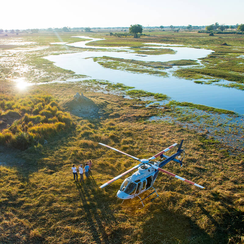
Helicopter Flight - Botswana
Various: from 30 minutes to half a day.
Low-flying, agile and offering superb views, helicopters are an ideal way to move around the Okavango Delta.You can use them instead of fixed-wing inter-lodge transfers or as an addition to other wildlife watching activities, and of course, helicopters can hover to allow that perfect pic, whereas fixed-wings can’t.
More about Helicopter FlightOther lodges in Kwando-Linyanti area
Alternative places to stay in this same area.
Lagoon Camp
Within the vast Kwando Reserve, renowned for its wild dogs, Lagoon Camp offers excellent game viewing that focuses on predators.
Lebala Camp
With enthusiastic guides and trackers, Lebala – in a vast private reserve – is particularly well-placed for seeking wild dogs.
Selinda Camp
In an attractive area that is particularly rich in game between June and November, the luxurious Selinda Camp caters particularly well for photographers.
Linyanti Bush Camp
Linyanti Bush Camp blends relative simplicity with numerous activities and very good guiding.
Selinda Explorers Camp
The luxurious, traditional tented Selinda Explorers Camp offers a mix of walking, canoeing and game drives led by really top notch guides in a game-rich area.
Savuti Camp
Set above the Savuti Channel, the refurbished seven-room Savuti Camp offers the potential for viewing large herds of elephant and significant lion encounters.
Zarafa Camp
Zarafa is an exclusive camp overlooking the scenic Zibadianja Lagoon within the Selinda Reserve, a particularly game-rich area between June and early November.
Kings Pool
King’s Pool is a top-end luxury safari camp with a price tag to match; the game viewing can be very good during the dry season.
Linyanti Expeditions
Tip-top guiding. In tune with the habitat. Down-to-earth, authentic camp comfort. A place of wilderness safari harmony.
Little DumaTau
Small and sophisticated, Little DumaTau lies adjacent to its larger sibling in the private Linyanti Reserve, overlooking a beautiful lagoon.
When to go to Kwando-Linyanti area
Our month by month guide: What it's like to visit DumaTau in Kwando-Linyanti area
Jan
Feb
Mar
Apr
May
Jun
Jul
Aug
Sep
Oct
Nov
Dec
Kwando-Linyanti area in January
January marks the peak of the rainy season in the Kwando, Linyanti, and Selinda Reserves. Evening thunderstorms bring short but intense rains, cooling the air while temperatures remain warm. Wildlife disperses across the lush landscape due to the abundant water, making game viewing more challenging, though the southern and western parts of the Selinda Reserve still offer rewarding sightings.
The Kwando River and Linyanti floodplains attract water-loving species such as red lechwe, sitatunga, and waterbuck. Migratory birds thrive during this time, offering incredible birdwatching opportunities. The vibrant greenery creates stunning photography backdrops, and lower rates make January a great choice for budget-conscious travellers seeking a quieter, greener safari.
- Warm temperatures with occasional thunderstorms
- Spectacular birdlife, including migratory species
- Wildlife dispersed across lush floodplains
- Zebra and wildebeest migration in full swing
- Good availability at lodges and camps
Our view
A good time to visit, with pros & cons
Weather in January
Kwando-Linyanti area in February
February continues the rainy season with heavy rains and a humid atmosphere. The landscape is vibrant and teeming with life. Insects and smaller animals become more visible, while many species are raising their young, making for fascinating wildlife encounters. The Selinda Spillway and Zibadianja Lagoon are magnets for diverse wildlife during this time.
Thick vegetation and tall grasses can make it harder to spot larger animals, but water-based activities like boat cruises along the Kwando and Linyanti rivers offer superb birdwatching. The reserves’ papyrus reed-beds are home to elusive species like sitatunga, while buffalo and elephants frequent the floodplains. With fewer visitors, February is perfect for those looking for a more intimate safari experience.
- Warm with occasional thunderstorms
- Young animals abundant across the reserves
- Dispersed wildlife across the lush terrain
- Birds thriving, many in breeding plumage
- Excellent camp availability and low visitor numbers
Our view
This is not a great time to visit
Weather in February
Kwando-Linyanti area in March
March marks the tail end of the rainy season, with sunny days becoming more frequent and occasional afternoon thunderstorms still sweeping through. The landscape remains lush, with many animals finishing raising their young. Predators like lions and wild dogs are more active, taking advantage of plentiful prey.
Birdwatching is still rewarding, although some migratory species start to leave as the season progresses. The Kwando River and its channels provide excellent fishing and wildlife viewing opportunities. As the rains taper off, game drives become more productive, particularly in open areas of the reserves.
- Variable weather with clearer skies and rains decreasing
- Wildlife well-fed and thriving in lush surroundings
- Birdlife remains spectacular, though migrants begin to leave
- Lower rates and fewer visitors at camps
Our view
A good time to visit, with pros & cons
Weather in March
Kwando-Linyanti area in April
April is a transitional month in the Kwando, Linyanti, and Selinda Reserves, marking the shift from the wet to dry season. Rainfall becomes less frequent, giving way to clear skies and a verdant landscape. Night temperatures start to drop, especially in areas further from water.
As vegetation begins to thin, wildlife viewing improves, with increased predator-prey activity around water sources. The Selinda Spillway becomes a focal point for diverse wildlife, including elephants, buffalo, and various antelope species. Predator activity starts to become more visible, particularly around permanent water sources. Walking safaris and boat cruises offer unique ways to explore the ecosystem. With the shoulder season starting, April provides good value and a mix of lush scenery and growing wildlife activity.
- Cooler evenings with occasional light rain
- Selinda Spillway ideal for diverse wildlife sightings
- Good predator-prey interactions observable
- Excellent conditions for walking safaris and boat trips
- Shoulder season rates make this a popular month
Our view
A good time to visit, with pros & cons
Weather in April
Kwando-Linyanti area in May
May is one of the best months to visit the Kwando, Linyanti, and Selinda Reserves. With almost no rain, temperatures cool further in the mornings and evenings, increasing predator activity. Wildlife begins to concentrate around permanent water sources like the Linyanti and Kwando rivers, providing superb game viewing opportunities, especially of elephants and buffalo.
The Selinda Reserve’s diverse landscapes attract a variety of species, and walking safaris in the Kwando Reserve provide close-up wildlife encounters. Crisp, clear air enhances photography, capturing the vibrant wildlife and scenic beauty. May offers a balance of fantastic wildlife sightings, pleasant weather, and the final stretch of shoulder-season rates.
- Cool mornings and evenings, minimal rain
- Excellent predator activity and game viewing
- Crisp air perfect for photography
- Shoulder season rates - availability limited
Our view
A very good time to visit
Weather in May
Kwando-Linyanti area in June
June signals the start of the dry season, with cool mornings and evenings and warm, sunny days. The clear skies and thinning vegetation make this an excellent month for photography and wildlife viewing. As surface water dries up, animals gravitate to permanent water sources like the Kwando and Linyanti rivers, where predators are often seen stalking prey.
Game viewing excels in the Kwando-Linyanti areas, with improved visibility as vegetation thins, and the Selinda Spillway becomes a wildlife hotspot, attracting elephants, buffalo, and other species. Boat cruises provide a peaceful way to observe water-dependent wildlife, while night drives offer glimpses of nocturnal predators and other species. June’s popularity means high demand for camps, so early bookings are essential.
- Warm days, cold nights—ideal safari conditions
- Excellent conditions for wildlife photography
- Animals congregating around water sources
- Vegetation thinning, improving visibility
- Peak season begins with higher rates
Our view
Fantastic: the very best time to visit
Weather in June
Kwando-Linyanti area in July
July offers excellent game viewing conditions. Cool mornings and evenings are ideal for wildlife activity. The landscape is drier, concentrating animals around remaining water sources. The Kwando and Linyanti rivers become crucial for wildlife, attracting large herds of elephants and buffalo. Predator sightings increase, especially around waterholes. The Selinda Reserve's diverse habitats support a wide range of species, from big cats to rare antelopes.
It's one of the best months for walking safaris - cool and fresh in the mornings, with thinning vegetation enhancing visibility. Boat cruises provide serene views of the rivers and their surrounding wildlife. Night drives reveal fascinating nocturnal species, though temperatures can be chilly, so warm clothing is essential. July's popularity means camps are often fully booked, so early reservations are essential.
- Comfortable days, cold mornings and nights
- Excellent game viewing around waterholes and rivers
- Walking safaris and boat cruises highly recommended
- Peak season with camps often fully booked
Our view
Fantastic: the very best time to visit
Weather in July
Kwando-Linyanti area in August
August is a peak safari month, with warm days and cool nights offering comfortable conditions. Wildlife is highly concentrated around water sources, providing exceptional game viewing. The Selinda Spillway becomes a focal point for predators and prey, with frequent sightings of elephants, buffalo, and big cats.
Boat cruises along the Kwando and Linyanti rivers offer a unique perspective on the reserves’ wildlife, while clear skies make for incredible stargazing at night – but it’s cold so bring warm clothes, hats and gloves. August's popularity for northern hemisphere travellers means limited availability and higher rates at most camps.
- Dry, warm days with cool nights
- Wildlife activity peaks around water sources
- Okavango floods usually reach Selinda Spillway
- Super stargazing on clear nights
- High rates and limited availability in camps
Our view
Fantastic: the very best time to visit
Weather in August
Kwando-Linyanti area in September
September is a favourite for wildlife enthusiasts, with probably the best wildlife viewing of the year. Daytime temperatures are warming, but nights remain cool. The dry landscape concentrates wildlife around permanent water sources like the Kwando and Linyanti rivers, and along the Selinda Spillway. Large herds of elephants and buffalo are common on the floodplains, and predator sightings increase, with higher chances of witnessing dramatic hunting interactions.
The return of migratory birds like carmine bee-eaters adds a splash of colour to the reserves, enhancing birdwatching. The dry, hazy conditions create dramatic sunsets, while boat cruises and game drives offer rewarding, laid-back wildlife encounters. September’s popularity means high rates and limited availability at most camps, with early booking is essential.
- Warm days, cool nights—prime safari weather
- Exceptional wildlife viewing and predator activity
- Stunning sunsets and excellent birdwatching
- High season continues with limited availability
Our view
Fantastic: the very best time to visit
Weather in September
Kwando-Linyanti area in October
October is the hottest and driest month in these reserves, creating some of the most concentrated and dramatic wildlife sightings of the year. Animals gather around dwindling water sources, leading to intense predator-prey interactions. The Selinda Spillway becomes a lifeline for both herbivores and carnivores.
Boat cruises offer relief from the heat and a chance to observe water-dependent species. Migratory birds continue to arrive, adding vibrancy to the parched landscape. The clear, hazy conditions create spectacular photographic opportunities, particularly at sunset. Night drives are not nearly so cold and can reveal fascinating nocturnal activities. Despite the daytime heat, October remains a favourite for game viewing.
- Hot days, with chances of rain late in the month
- Outstanding big game sightings around limited water sources
- Excellent birdwatching with arriving migrants
- Water activities limited as floods recede
- Final month of peak season - high demand at camps
Our view
Fantastic: the very best time to visit
Weather in October
Kwando-Linyanti area in November
Sometime in November usually marks the start of the green season as temperatures and humidity rise, leading to the first dramatic thunderstorms. The landscape begins to transform, with fresh greenery spreading across the reserves. Wildlife starts to disperse as waterholes refill, but predator sightings remain good near permanent water sources. The Kwando and Linyanti rivers remain important for the large herds of elephants, and the Selinda Spillway continues to attract wildlife.
This is a fantastic time for birdwatching, with migratory species arriving in abundance. Where available, boat cruises highlight the changing environment, while game drives still offer rewarding wildlife encounters. Early November sees lower rates, making it a good choice for travellers seeking great game viewing at lower rates.
- Hot days with increasing humidity and dramatic thunderstorms
- Green season begins transforming landscape
- Wildlife viewing less predictable but rewarding near rivers
- Migratory birds arrive, enhancing birdwatching
- Shoulder season offers lower rates and good availability
Our view
A good time to visit, with pros & cons
Weather in November
Kwando-Linyanti area in December
December marks the height of the rainy season, bringing welcome relief from the high temperatures. While wildlife viewing becomes more challenging due to the dispersal of animals, skilled guides can still uncover remarkable sightings. The Kwando and Linyanti rivers remain vital habitats, and areas such as the Selinda Reserve offer rewarding game viewing, especially around Zibadianja Lagoon.
The landscape undergoes a dramatic transformation as fresh growth attracts herbivores. Migratory birds are plentiful, making this an excellent time for birdwatching. Although predator sightings are less frequent, they are often spectacular against the vibrant, lush scenery. Luxurious camps offer comfortable retreats during occasional rain showers, and lower-season rates make December an appealing choice for value-conscious travellers seeking a green-season safari.
- Warm with frequent rain storms
- Wildlife more dispersed across the reserves
- Green season in full effect, lush landscapes
- Low season rates make it a value-friendly option
Our view
A good time to visit, with pros & cons
Weather in December

Looking for inspiration on where to travel next?
Visit our trip chooser to explore your options and find inspiration for your perfect African adventure
Inspire me