About The Hide
Independent and owner-run, The Hide sits in a small private concession in a north-eastern annexe of Hwange, ...
... Zimbabwe’s flagship National Park. Expert Africa has been sending travellers here since the mid-1990s, and recent investments have ensured that this old favourite remains one of the top accommodation choices in Hwange, thanks also to its popular waterhole and high densities of wildlife.
Zimbabwe has been through some tough times in recent years, but The Hide is now in fantastic shape, with substantial upgrades completed and continuous small improvements. Caring owners, friendly staff and knowledgeable guides add to an overall experience that's usually excellent – helped by the camp's outstanding location and surrounding private concession. The Hide has fairly consistently been one of Zimbabwe's best safari camps since we started using it; far from resting on its laurels, it's clearly working hard to remain on top; we're impressed.
Our view
Zimbabwe has been through some tough times in recent years, but The Hide is now in fantastic shape, with substantial upgrades completed and continuous small improvements. Caring owners, friendly staff and knowledgeable guides add to an overall experience that's usually excellent – helped by the camp's outstanding location and surrounding private concession. The Hide has fairly consistently been one of Zimbabwe's best safari camps since we started using it; far from resting on its laurels, it's clearly working hard to remain on top; we're impressed.
Zimbabwe expert
Accommodation
10 tents & 2 camps
Children
Fine for all ages
Open
All year
Activities

4WD Safari

Birdwatching

Guided walking safari

Night drive

Private activities

Sleeping under the stars
Traveller reviews of The Hide
39 real, un-edited reviews from Expert Africa's travellers.

Expert Africa's gallery
When we travel we take lots of photos ourselves to give you a real and un-edited view of the safaris. See our 32 pictures and 1 videos of The Hide to get the candid view.
View galleryThe Hide: Our full report
Independent and owner-run, The Hide sits in a small private concession in a north-eastern annexe of Hwange, ...
... Zimbabwe’s flagship National Park. Expert Africa has been sending travellers here since the mid-1990s, and recent investments have ensured that this old favourite remains one of the top accommodation choices in Hwange, thanks also to its popular waterhole and high densities of wildlife.
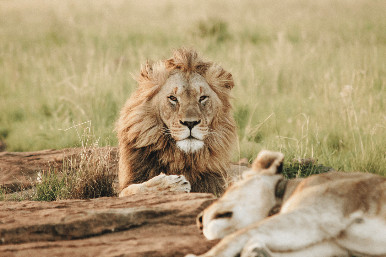
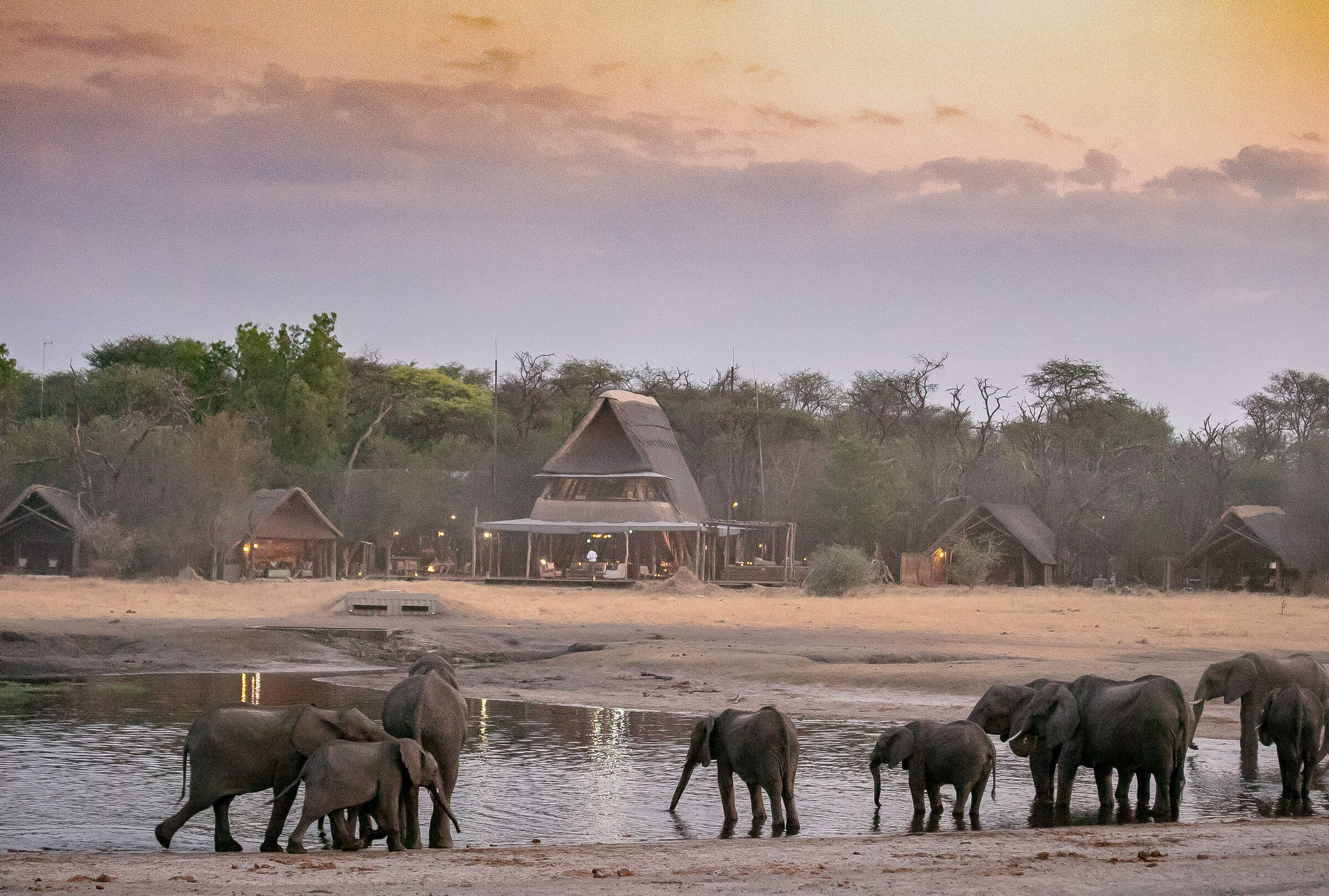
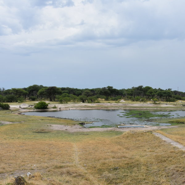
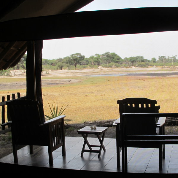
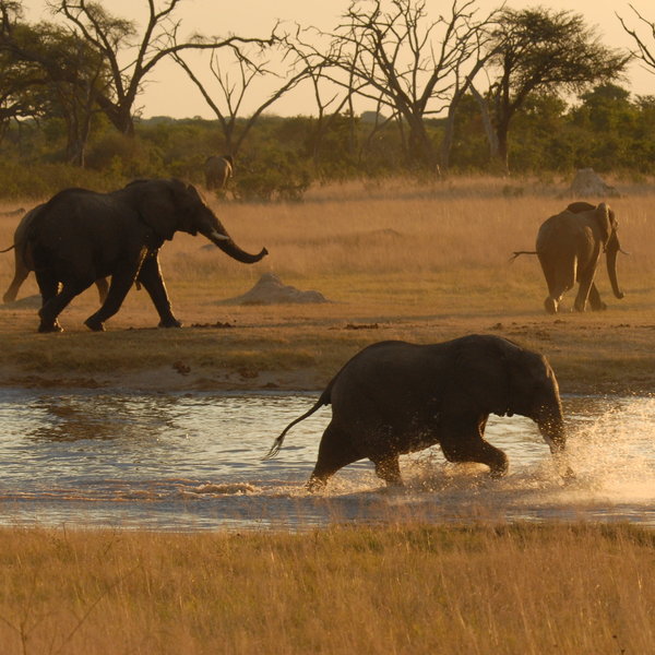
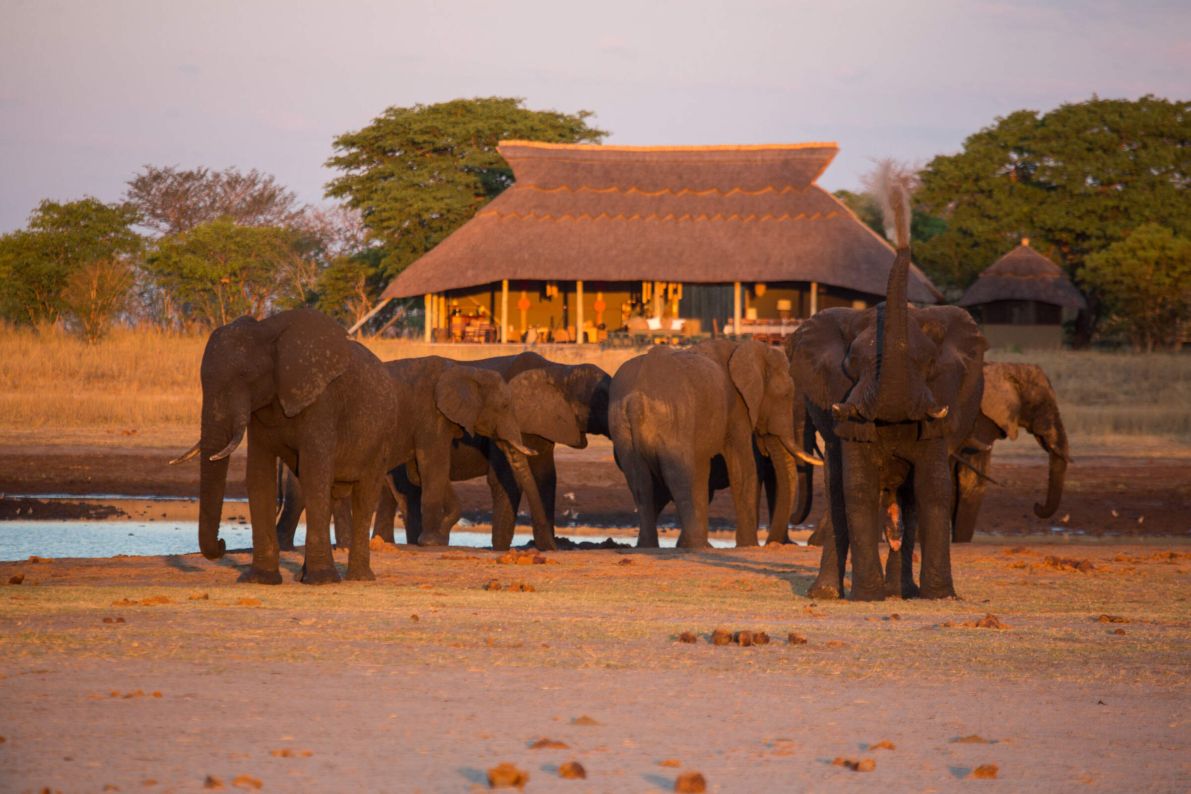
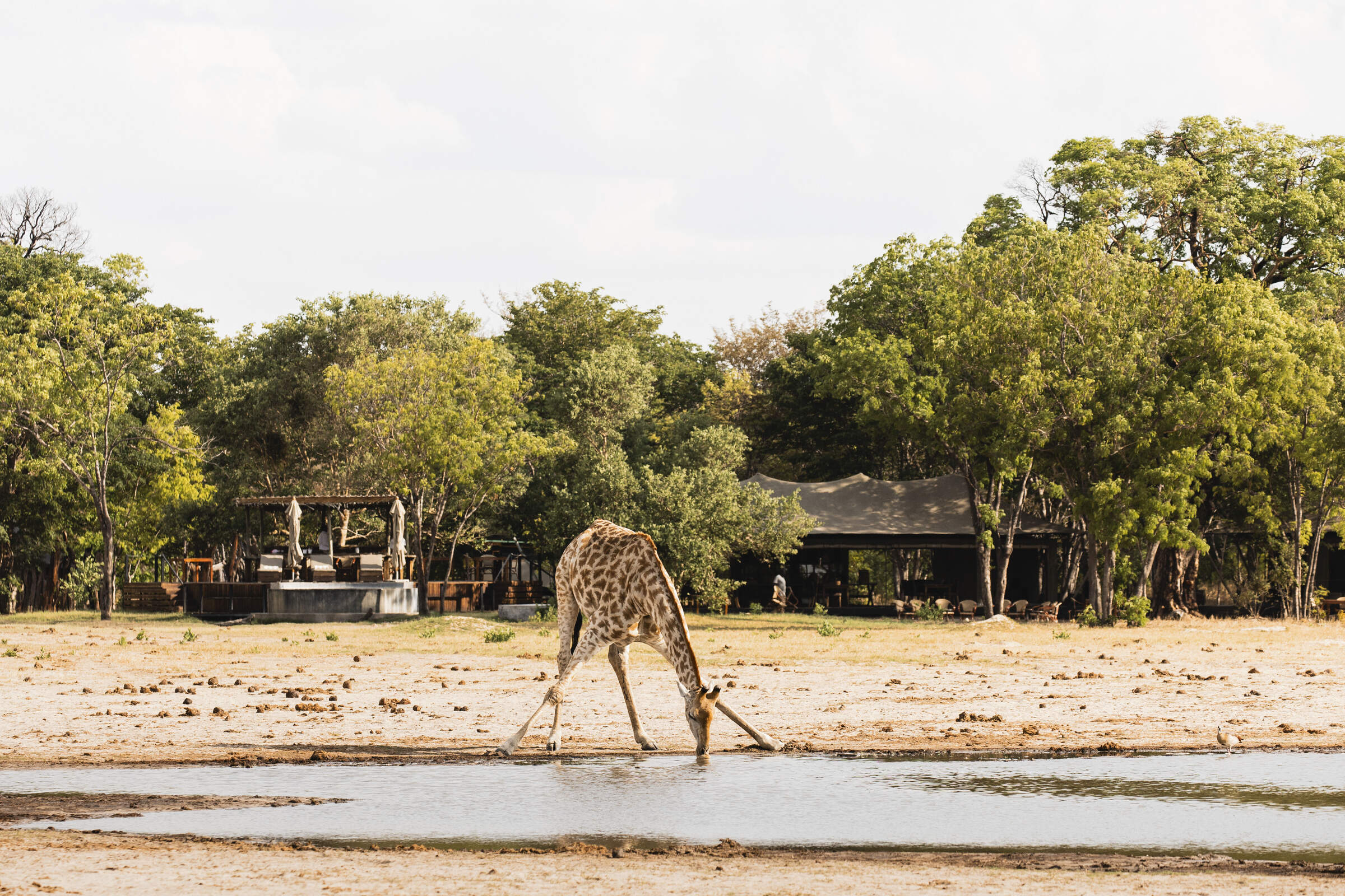
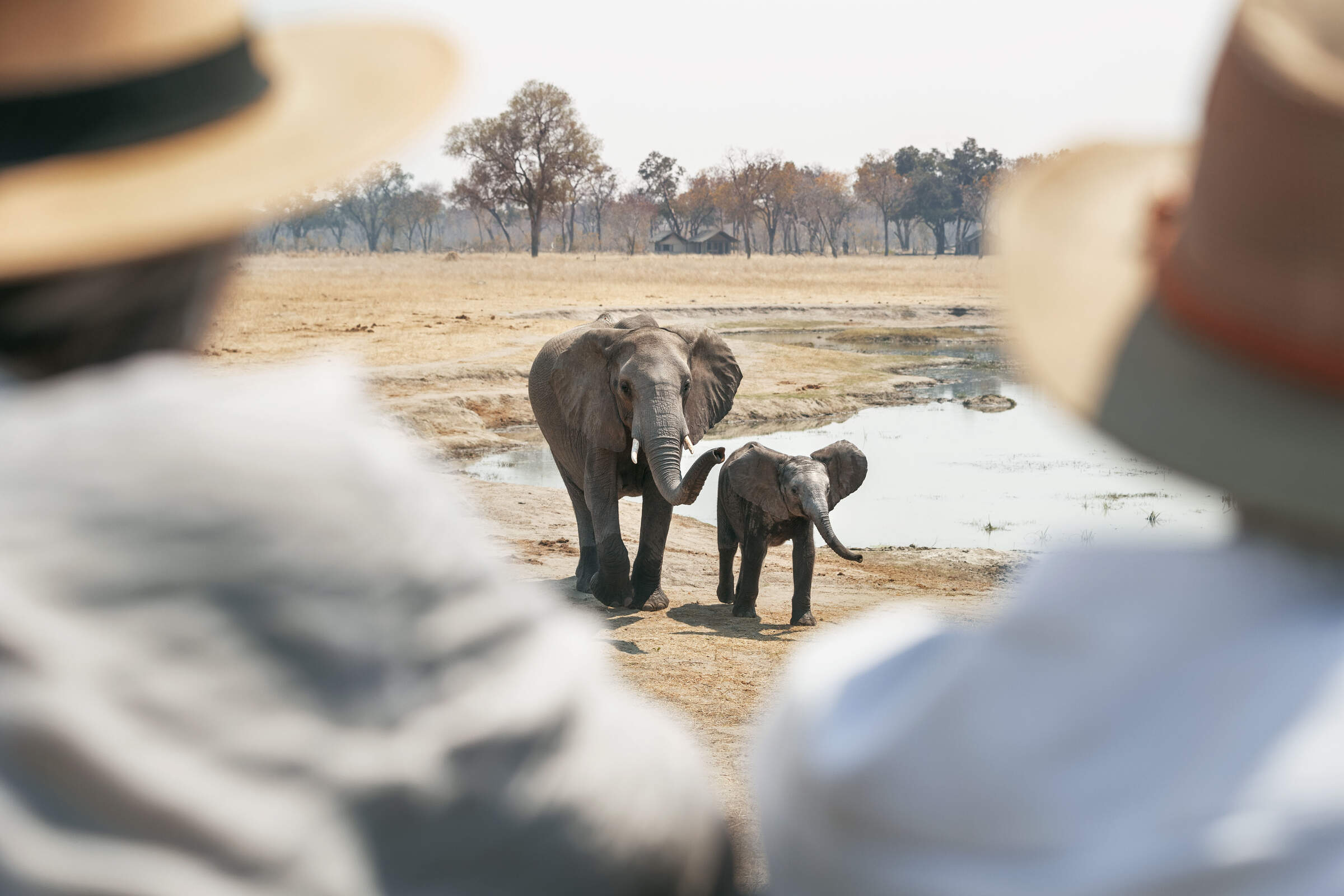
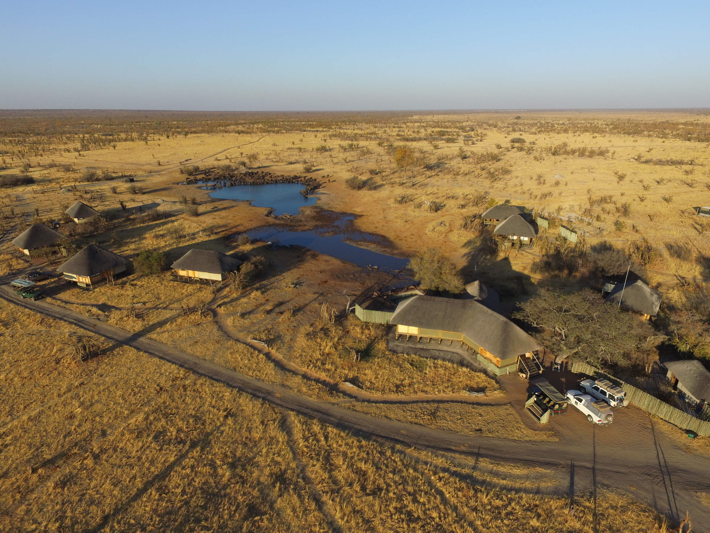
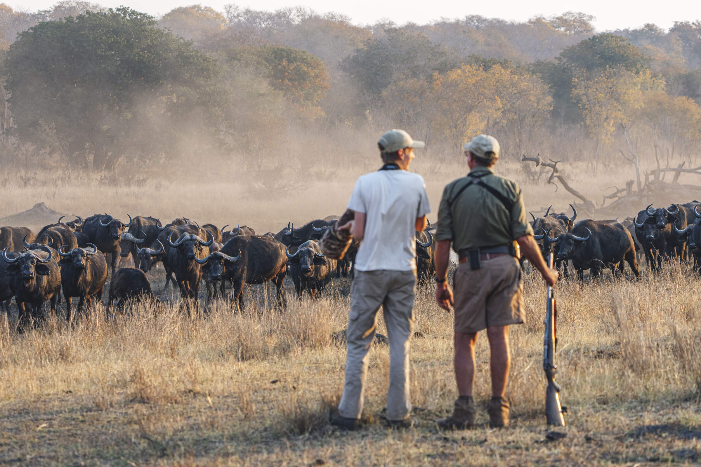
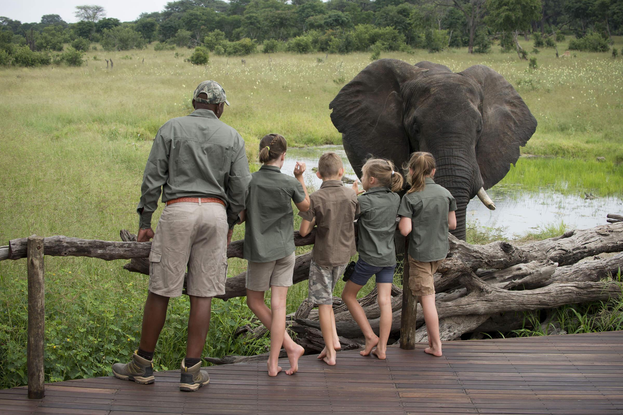
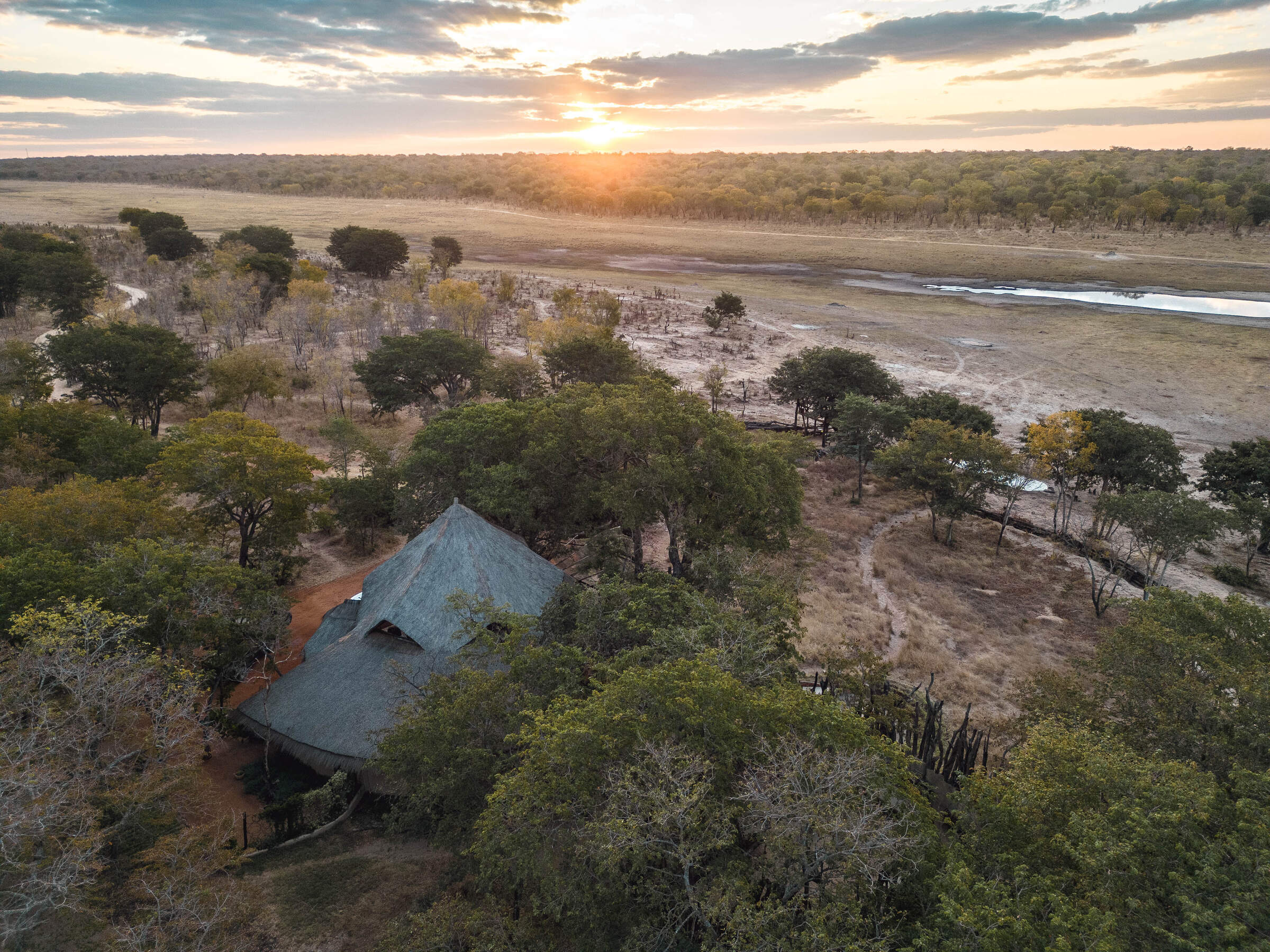
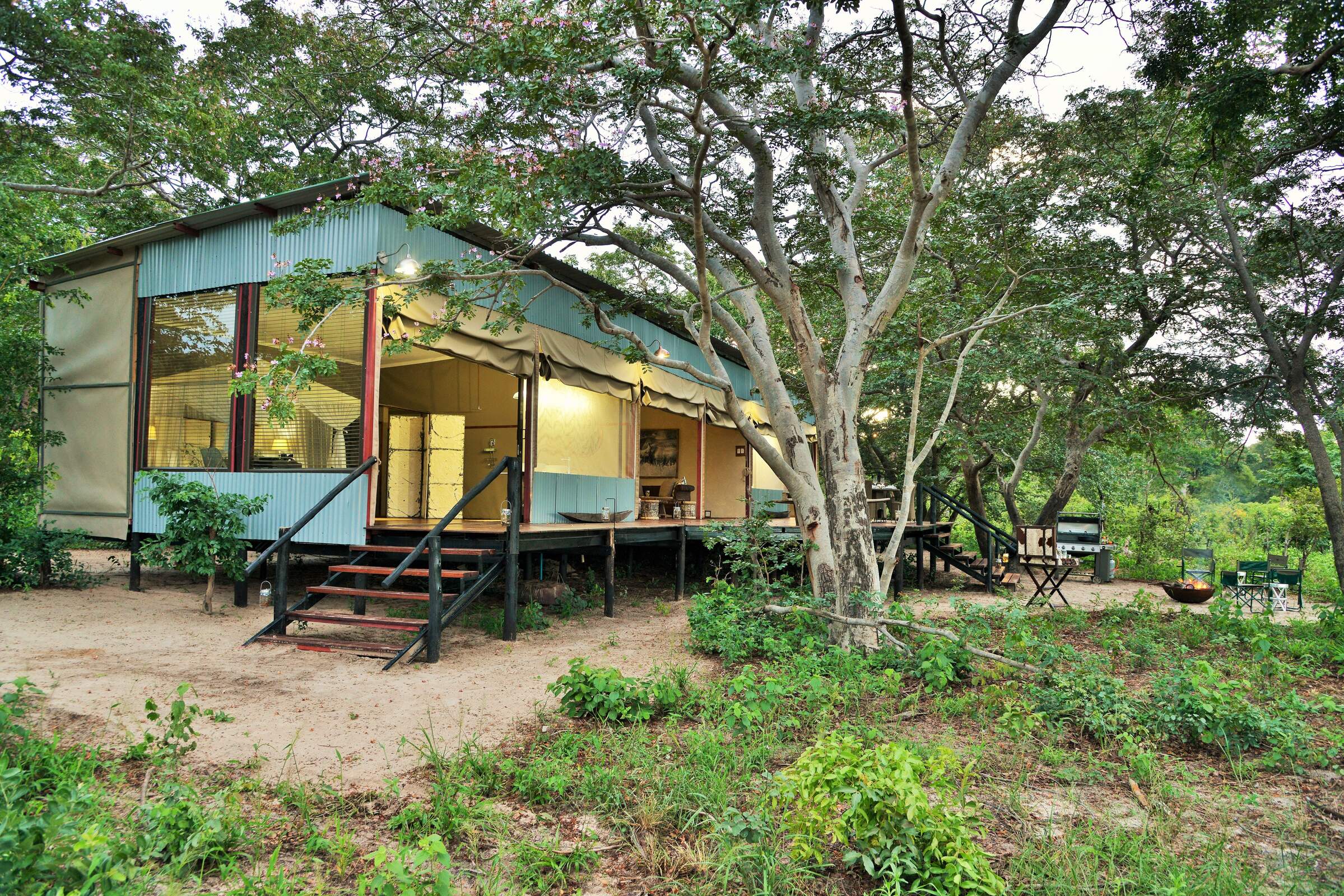
Set in the shade of acacia woodland, the mid-size camp overlooks a permanent (pumped) waterhole that supports various animals such as elephant, buffalo and giraffe. An ancient vlei (dried-up riverbed) “flows” across the front of camp, creating a linear clearing where animals can be viewed from anywhere in the camp. Interestingly, the soft sands around The Hide make it very difficult for hyena to den here. In their absence, the lion density is slightly higher in this area than in some other parts of Hwange National Park.
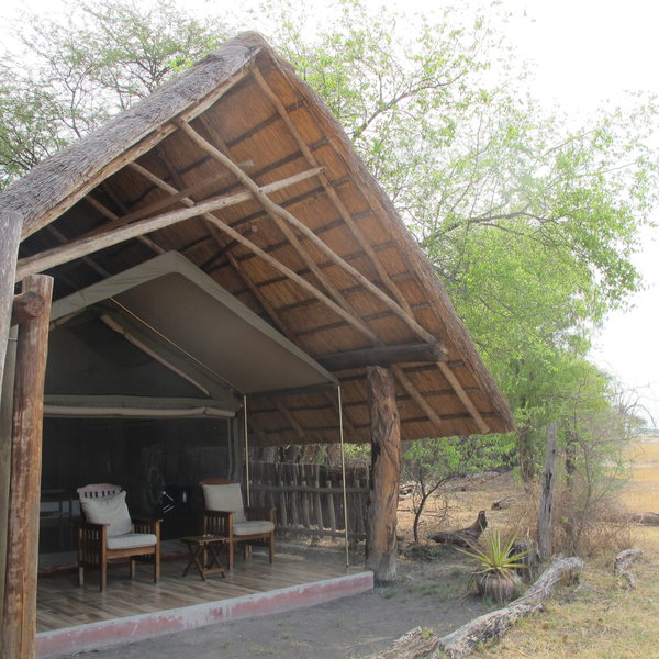
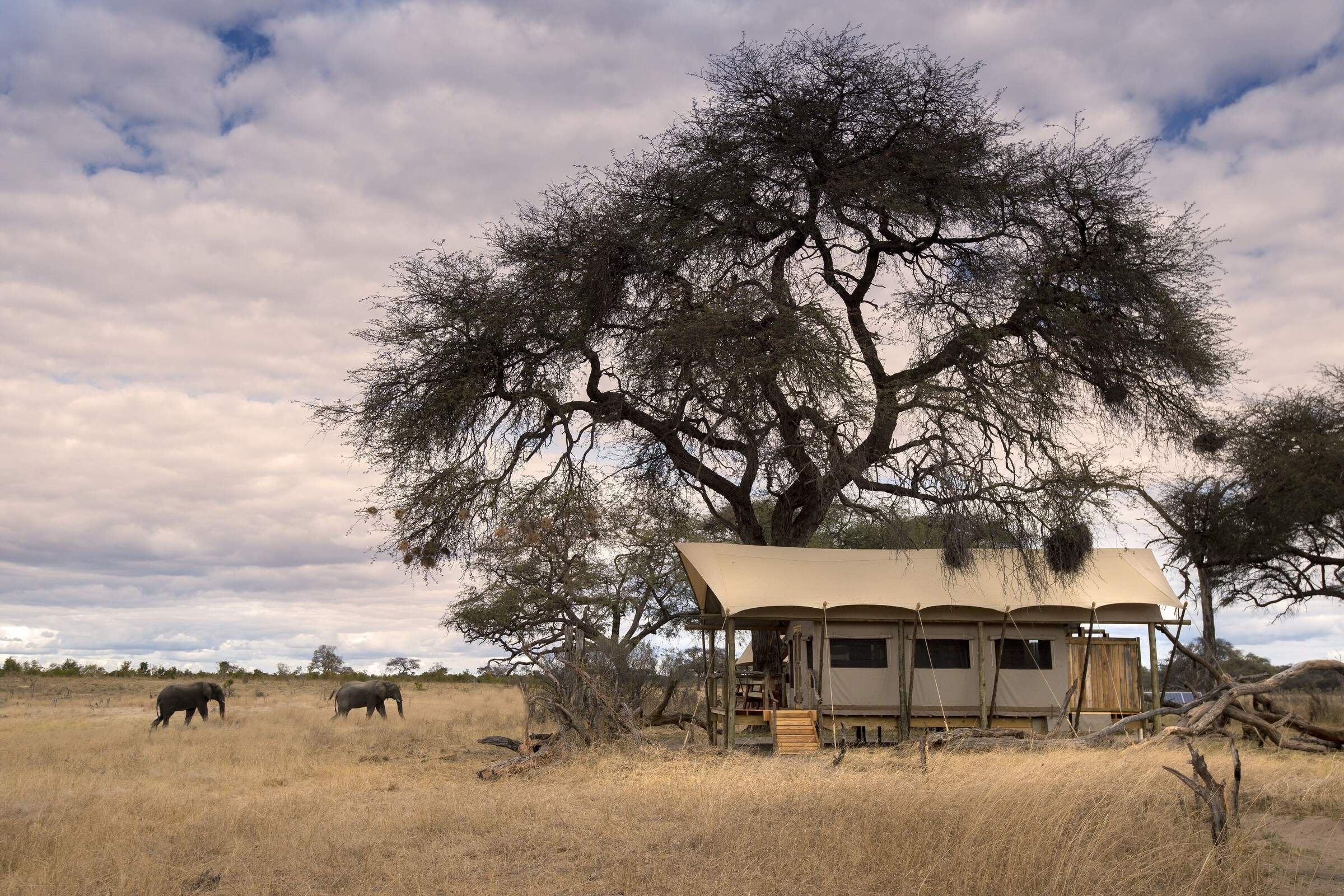
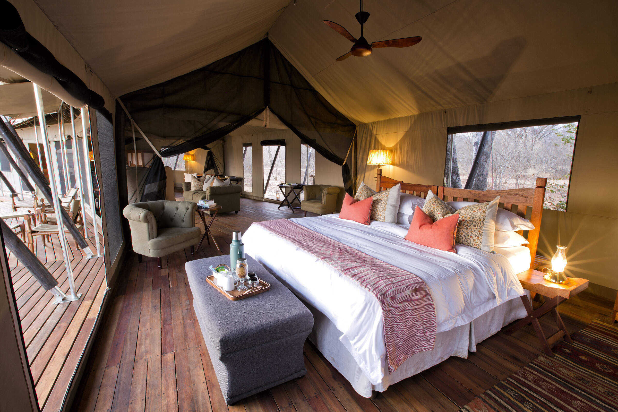
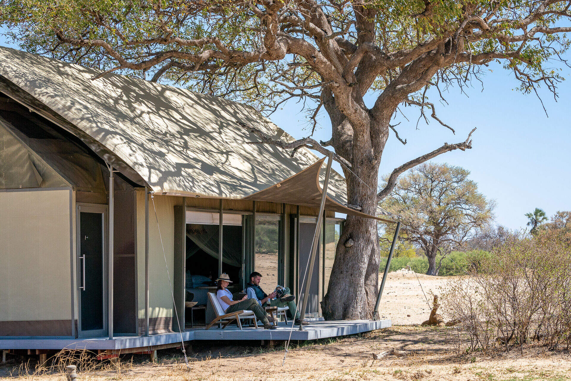
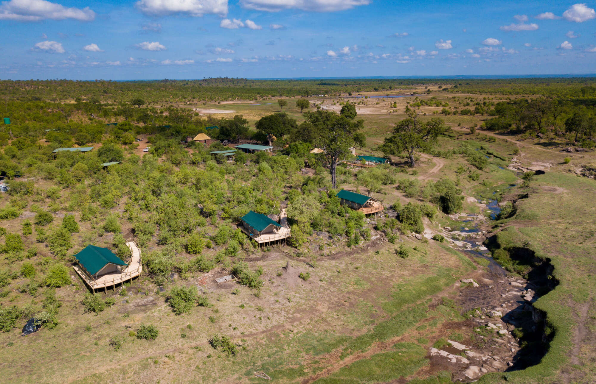
The Hide feels as though it has evolved in a very unstructured fashion. Its accommodation is largely focused on ten tented chalets: six “deluxe” chalets, two family chalets (which can also be converted into extra-spacious double chalets), and two honeymoon chalets. The camp also offers a couple of options for families or groups of friends travelling together, as well as its very own treehouse.
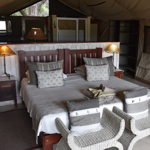
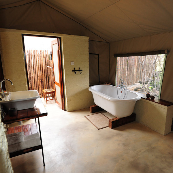
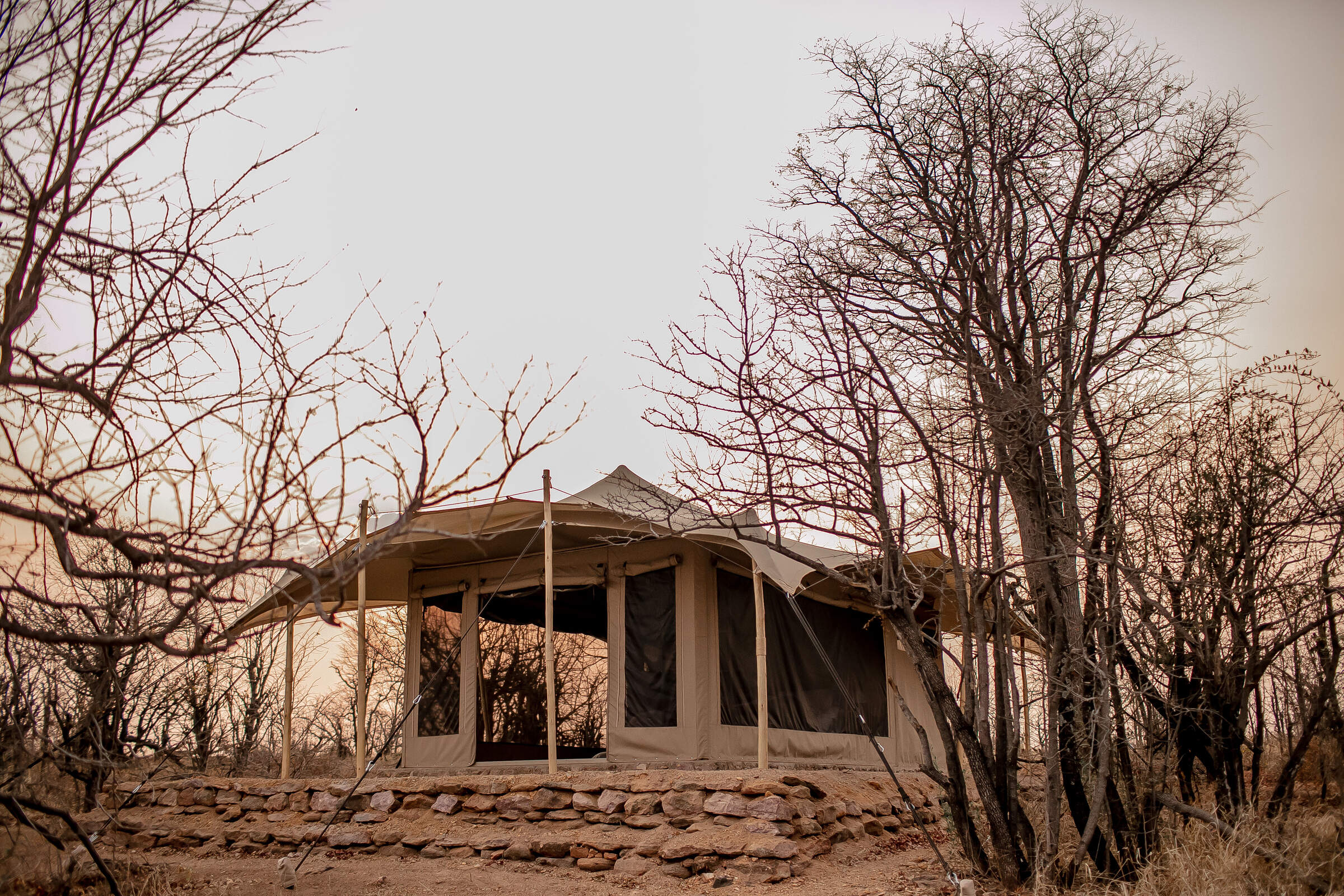
Each of the chalets is formed from a smart new canvas tent hung within a thatched A-frame structure supported by substantial timber frames, effectively acting as an outer shell. The tents have been specially tailored to let in light and for optimum airflow. When we stayed in November 2017, we particularly liked the large mesh window that makes up the front of the room, with a door inset, making the most of the views and admitting light and air. Additionally, each bedroom has a cooling fan for warm nights.
Inside, double or twin beds are backed by a solid partition, separating the bedroom from an area containing storage racks for luggage and clothes, and leading off into the bathroom. Family rooms are larger, with a second bedroom area, taking up to four guests with one shared bathroom.
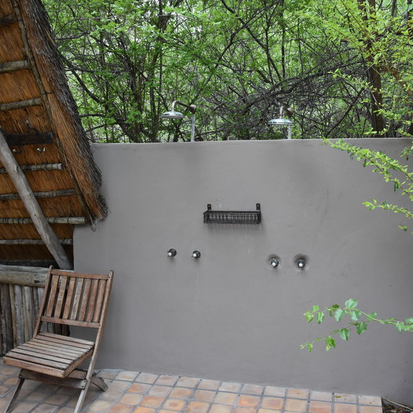
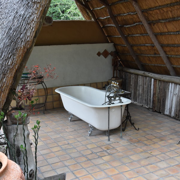
In the en-suite bathroom you’ll find a washbasin with hot and cold running water, a flush toilet (in a separate cubicle with a door), an indoor bath or shower, and an outdoor shower, with complimentary toiletries provided. The honeymoon chalets have a partially covered outdoor bathroom with a bath.
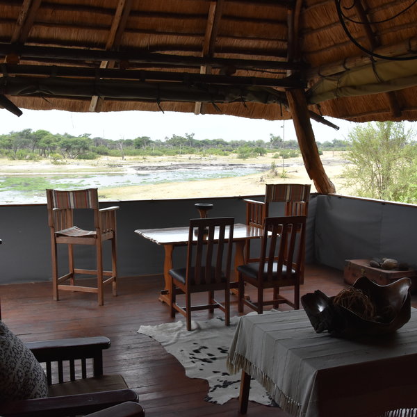
At the front of each chalet is a covered veranda where you can sit and enjoy views stretching across the vlei towards the waterhole.
Three of the chalets (two family and one honeymoon chalet) can be booked on a private, self-contained basis, with its own central area and a staff team including a private guide and chef. Known as The Private Hide, this would suit a couple, a small group of friends or a family of up to ten guests.
At the opposite end of the camp, in a similar style to the Private Hide, the manager's former residence and an adjacent family tent have been converted into Tom's Little Hide: a private safari “house” that can accommodate between four and ten guests.
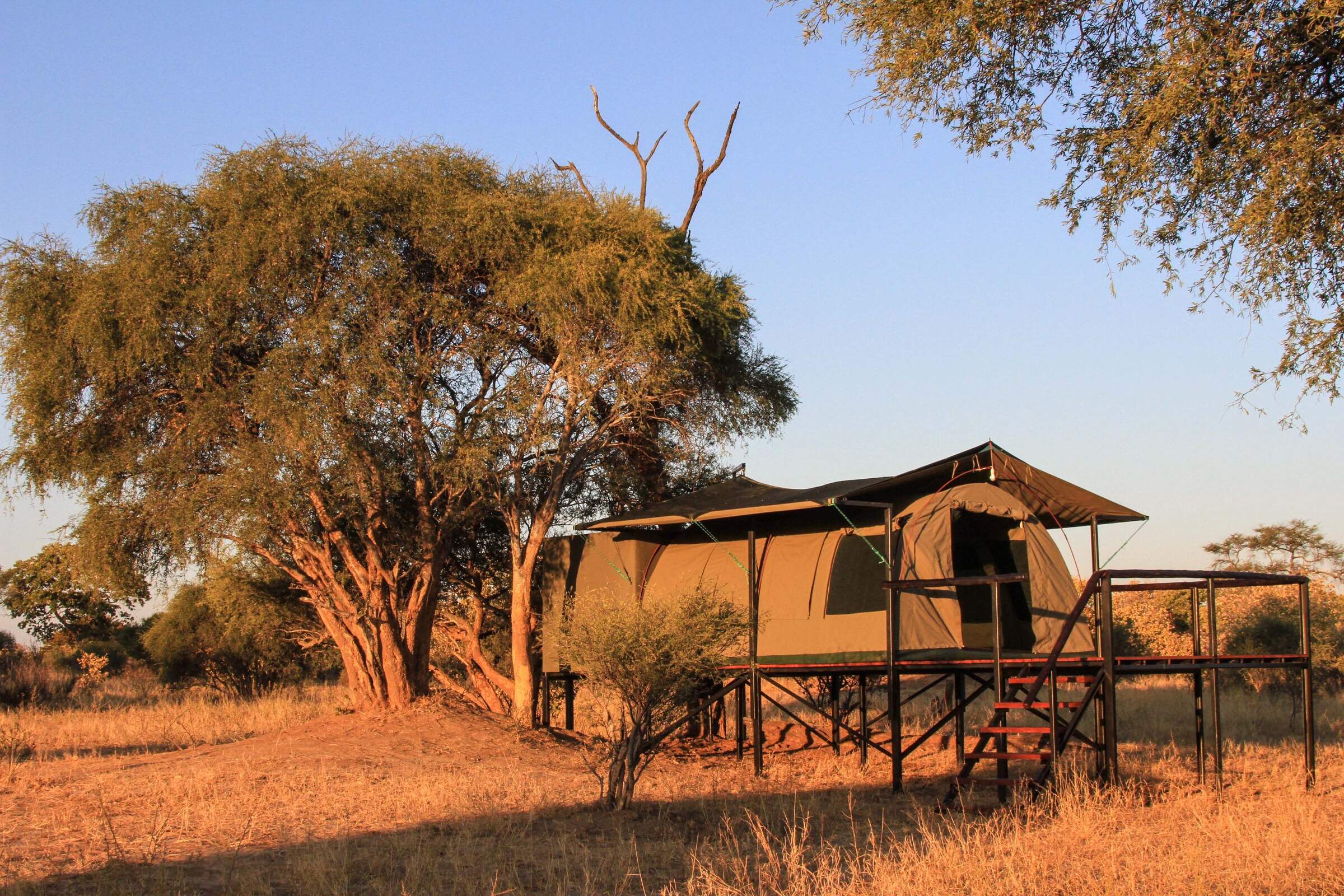
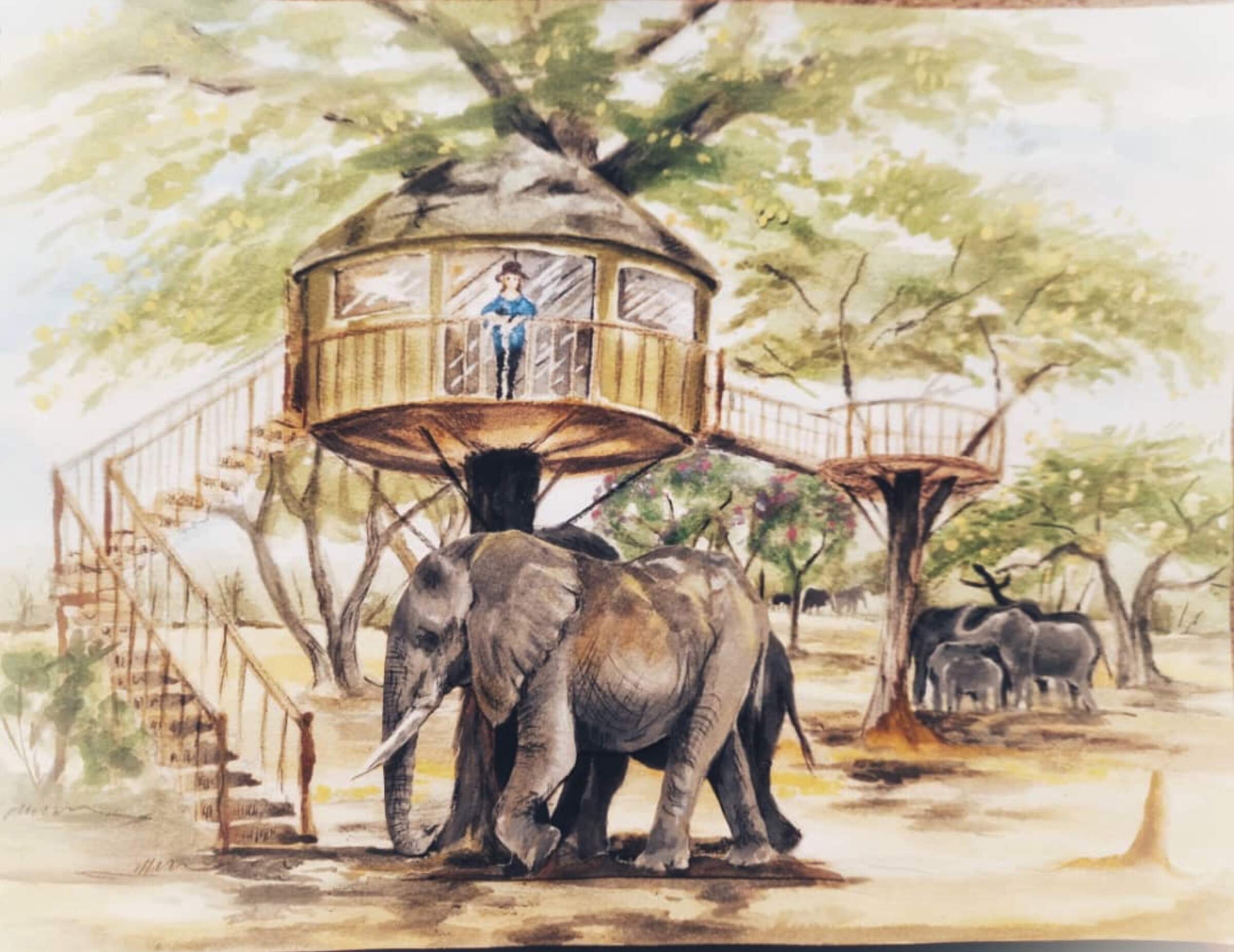
For something really special, we recommend a night sleeping out in the Dove's Nest, a treehouse that enjoys an exclusive view of a natural pan and allows guests the chance to spend a night even closer to mature.
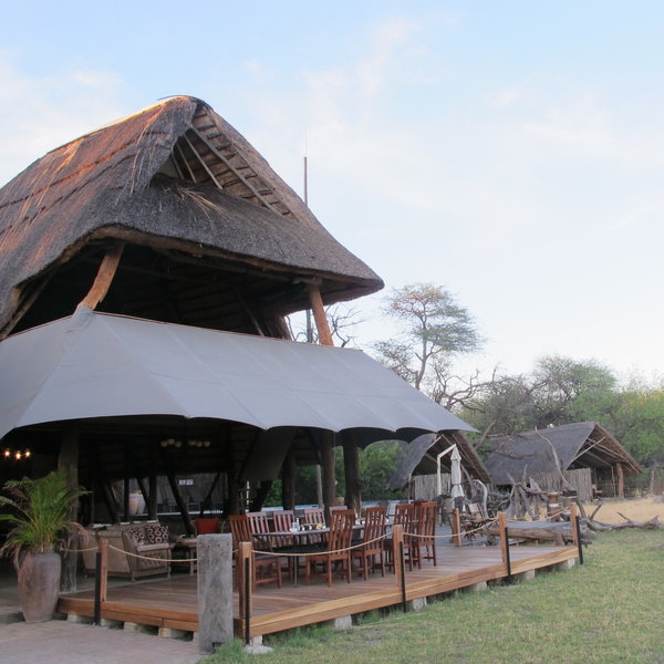
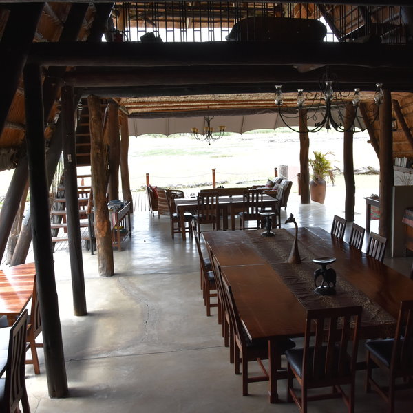
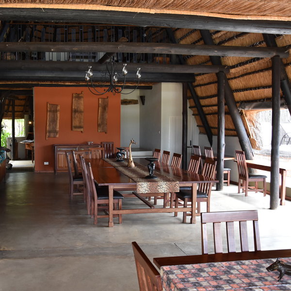
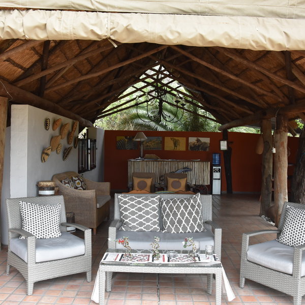
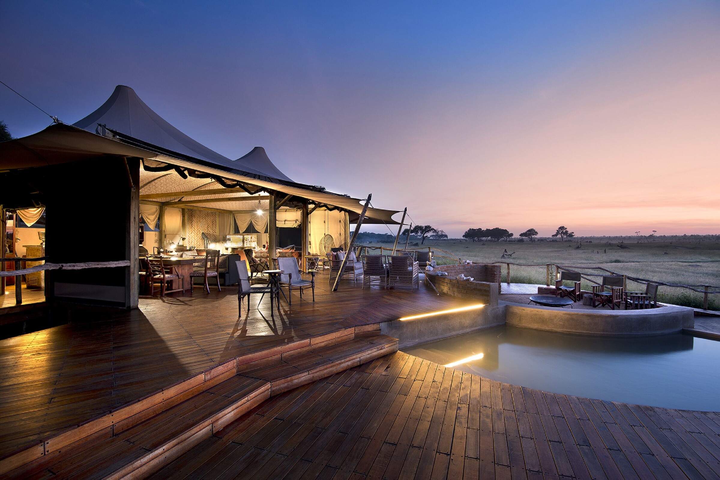
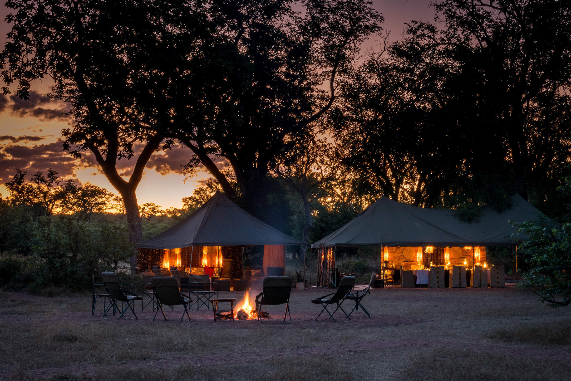
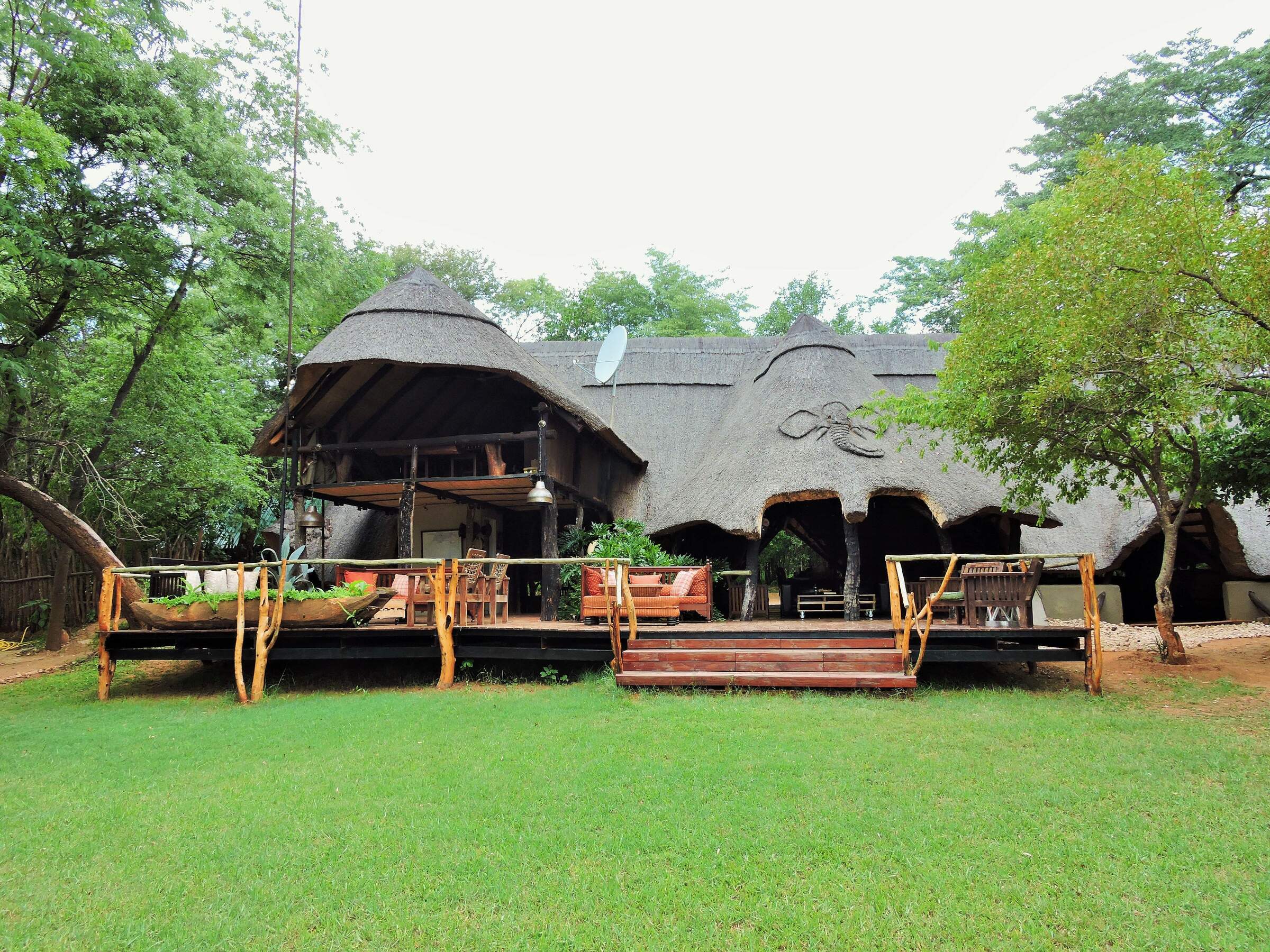
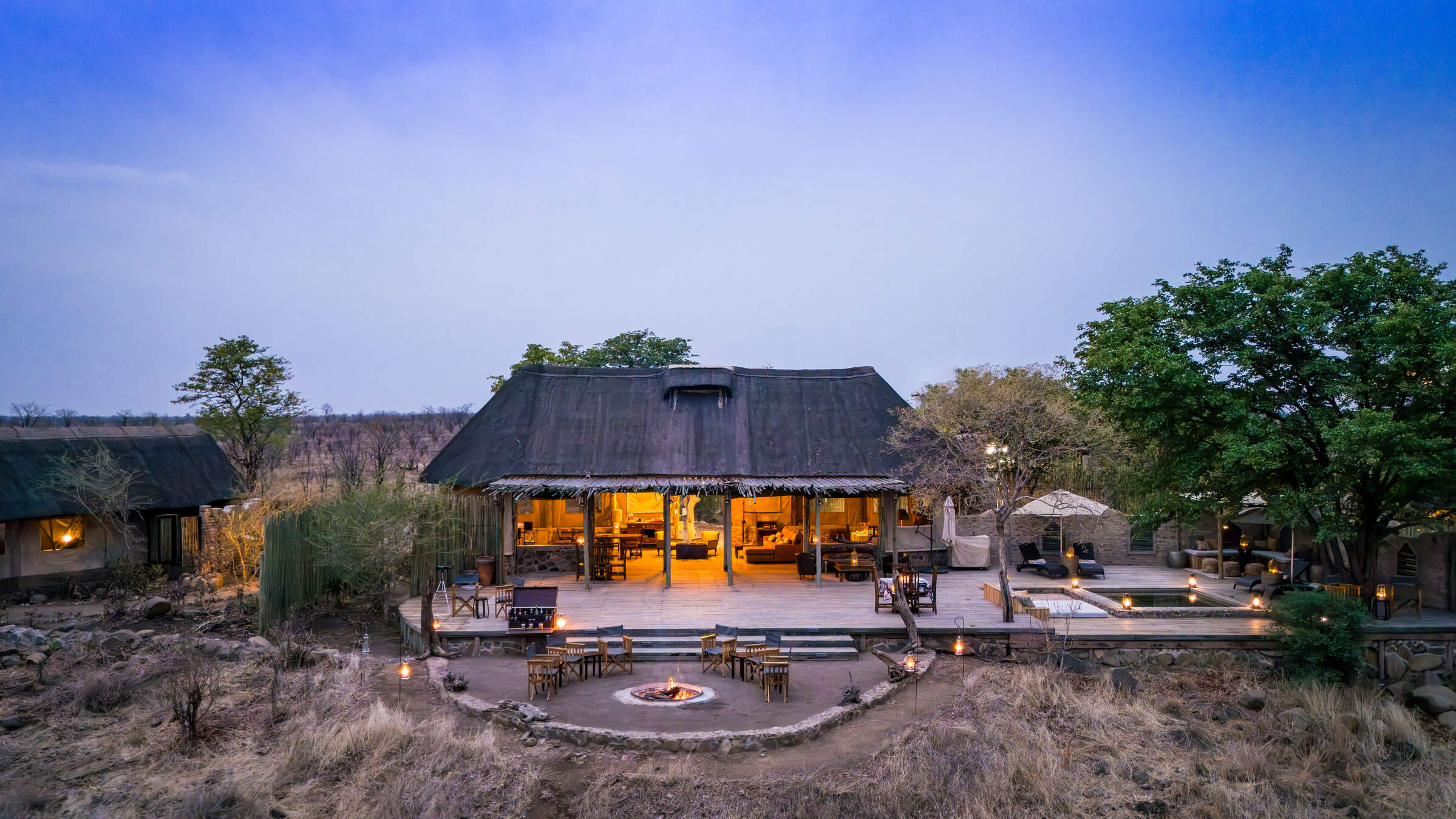
At the heart of The Hide itself is a large split-level main area known as The A-Frame. The lower level features comfortable chairs, a large dining table, reference material, and communal binoculars to enjoy the pan and vlei's sweeping views. Meals are laid-back occasions, with everyone, including the hosts and guides, generally dining together around the huge teak table within The A-Frame – or on its front deck. When the camp is busy, guests may dine at smaller, separate tables – and during quiet periods, lunch is sometimes taken in the bush.
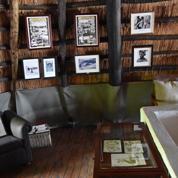
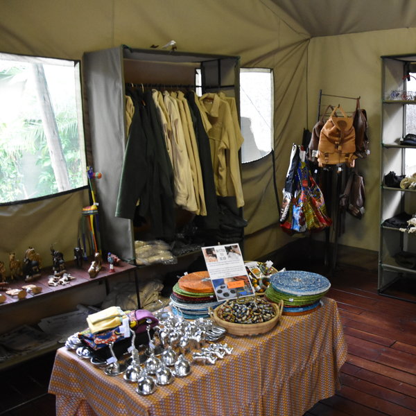
The top of The A-Frame is split into two: the front occupied by a lounge with a view; the back by a small museum. This area was due for refurbishment shortly after our visit to open up the front of the building to improve the light and the views of the waterhole. Newer to the camp is a smaller A-frame housing another lounge and the bar, while a well-stocked curio shop, a seating area where WiFi can be accessed, and the office are tucked away behind.
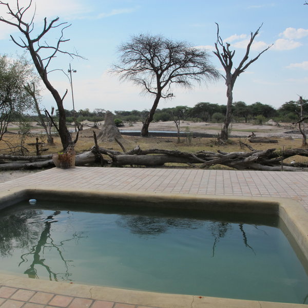
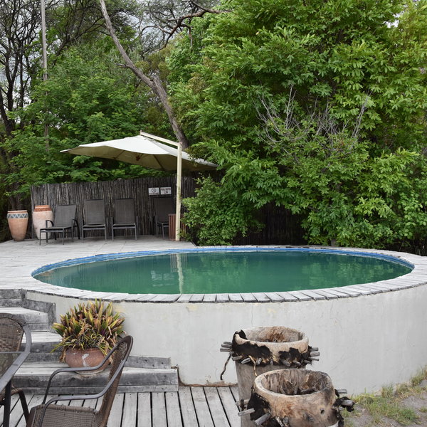
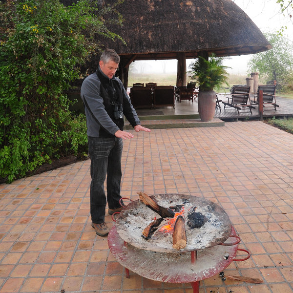
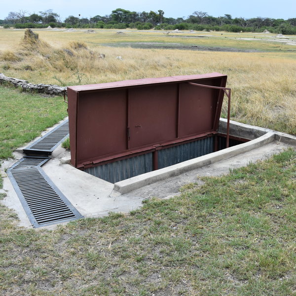
Outside, a plunge pool is built into a raised wooden deck, and there’s a separate campfire where guests tend to gather before dinner. More unusual, though, are two submerged hides with views of the waterhole. The first, reached from the camp by way of an underground tunnel, can take up to ten people and overlooks a trough favoured by elephants. The second, to the side of the waterhole, can take just three people but is in a great position for watching wildlife drink and interact. Guests are escorted here by a guide and provided with a cooler of drinks and a radio so you can contact the camp when you are finished.
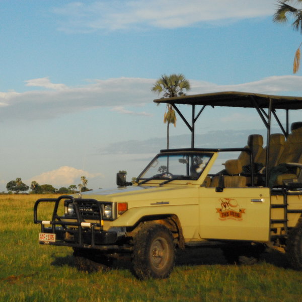
Activities from The Hide are flexible, depending on guests’ interests and wildlife action, with a high standard of guiding. Walks and night drives are operated on the 5km2 private concession, with choices including morning game drives, morning drive and walk combinations, afternoon game drives or walks, and after-dinner night drives.
The camp's location, fairly close to the Bulawayo/Victoria Falls railway line that marks the park's boundary, means that you might hear the occasional train in the distance to remind you of civilisation. In fact the Rovos Rail trains actually calls in at The Hide on their Victoria Falls–Pretoria route – such that on our last visit we could hear the distant hum of the train parked in the siding and the occasional blast of its whistle. However, wildlife ignores the tracks, frequently crossing from one side to the other, so this doesn't affect your game-viewing experience here.
Activities
4WD Safari
Birdwatching
Guided walking safari
Night drive
Private activities
Sleeping under the stars
Families & children
- Attitude towards children
- The main lodge accepts only children aged 12 and over, but The Private Hide and Tom’s Little Hide have no age restrictions.
- Property’s age restrictions
- Children of all ages are welcome for private bookings of Tom's Little Hide or The Private Hide. Tom's Little Hide is the better option for younger children as it's more enclosed. Note that children under the age of 16 years are not permitted to do walking safaris.
- Special activities & services
- The Hide's main camp has two family chalets sleeping up to four people. Their double tents are spacious, and you can also accommodate an extra bed for one child sharing with two adults in a “deluxe” chalet. A small selection of games and a pool offer entertainment between safari activities; safari stories and colouring books are provided; and the camp team is happy to spend time with youngsters in the museum and submerged hide.
- Equipment
- None
- Generally recommended for children
- The Hide, and in particular Tom’s Little Hide, are a great option for families with children. A small selection of games and a pool offer entertainment between safari activities, safari stories and colouring books are provided, and the camp team are happy to spend time with youngsters in the submerged hide and museum.
- Notes
- This is an open safari camp and dangerous big game will wander through regularly, so children must be under supervision at all times.
Food & drink
- Usual board basis
- Full Board & Activities
- Food quality
- In our experience, including our visit in November 2017, the food at The Hide is very good. The lodge is happy to cater for vegetarians and other dietary requirements with advance notice.
Breakfast is usually a good selection of fruits, cereals, seeds and grains, yoghurt, and muffins or scotch pancakes. This is accompanied by eggs cooked to order, and a choice of bacon, sausages, beans and tomatoes.
Lunch, after the morning activity, is generally buffet-style, with everyone helping themselves. We had fish with couscous and a selection of salads, followed by a passion-fruit mousse.
Afternoon tea is served at 4.00pm, before your afternoon activity. Tea, coffee, iced coffee and cold rooibos tea is accompanied by one sweet and one savoury offering, such as bite-sized tuna parcels and delicious fresh muffins.
Our three-course dinner started with an aubergine (eggplant) tower with tomato relish, followed by a buffet of roast pork with crackling, apple sauce, roast potatoes and mixed seasonal vegetables. The meal was nicely finished off with a self-saucing chocolate pudding. - Dining style
- Group Meals
- Dining locations
- Indoor and Outdoor Dining
- Further dining info, including room service
- None
- Drinks included
- Soft-drinks and wines, spirits and beers are included in the price. High-end liqueurs, champagne, imported wines (except most South African wines) and spirits are not.
To help reduce the waste of plastic bottles, guests are supplied with their own glass water bottle on arrival. This can be refilled with filtered water in the main area as required.
Our travellers’ wildlife sightings from The Hide
Since mid-2018, many of our travellers who stayed at The Hide have kindly recorded their wildlife sightings and shared them with us. The results are below. Click an animal to see more, and here to see more on our methodology.

100% success

100% success

100% success

100% success

92% success

92% success

83% success

71% success

50% success

45% success

30% success

30% success

13% success

0% success

0% success

0% success

0% success

0% success
Getting there
- Location
- Hwange National Park, Zimbabwe
- Ideal length of stay
- If The Hide is the only camp you visit in Hwange National Park, we recommend a 3–4 night stay to make the most of this top wildlife area. Alternatively, stay 2–3 nights and combine The Hide with another camp in a different part of Hwange.
- Directions
- Guests can be picked up either from Hwange Main Camp, which is just over an hour's game drive from The Hide, or from Hwange Airport, about 90 minutes' game drive away. Depending on your transfer times, you may stop for a picnic lunch overlooking one of the park's waterholes on route.
- Accessible by
- Fly-and-Transfer
Special interests
- Family safaris
- Tom's Little Hide and The Private Hide can be booked exclusively for families with children of all ages. This is one of Zimbabwe's best family safari options, with comfortable family rooms, private and flexible activities, and a private hosting team.
- See ideas for Family safaris in Zimbabwe
- Photography safaris
- The Hide makes a perfect stop on a photography holiday to Zimbabwe. Of its two photographic hides, one is accessed via an underground tunnel from the heart of the camp so that guests can get up close with wildlife at the waterhole at any time of day.
- See ideas for Photography safaris in Zimbabwe
- Private safari camps & lodges
- Tom’s Private Hide and The Private Hide, next to The Hide in Hwange National Park, are ideal for a private safari holiday in Zimbabwe. You can organise activities according to your interests and needs with your own guide, vehicle and hosting team.
- See ideas for Private safari camps & lodges in Zimbabwe
Communications
- Power supply notes
- A back-up generator means that the power supply at The Hide is more dependable than at many more remote camps in Hwange. Solar lamps are included in the rooms in the unlikely event that other power sources should fail.
There are three-pin, UK-style sockets, available in the rooms for charging equipment. Hairdryers are not provided in the chalets, but the camp does have one that can be requested for use. - Communications
- Complimentary WiFi is available in a seating area adjacent to the office.
- TV & radio
- None
- Water supply
- Borehole
- Water supply notes
- All the rooms have hot and cold running water and flush toilets.
Health & safety
- Malarial protection recommended
- Yes
- Medical care
- All the guides are trained in first aid and the camp has a good first aid kit on site. The nearest doctors are in Hwange Town or Victoria Falls, which can be accessed by air in an emergency.
- Dangerous animals
- High Risk
- Security measures
- A canvas bag with a key is provided in each room. Guests can put their valuables in this and give it to the management to lock away in the office. Security guards patrol the camp at night, mostly to keep an eye on big game within the camp perimeter. Guests are escorted to and from their rooms after dark, and whistles are provided in the rooms to attract attention in case of an emergency.
- Fire safety
- Fire extinguishers are provided in each chalet and in various locations around The Hide.
- Swimming pool warning
- Depth markings at The Hide’s pool are limited. Travellers are advised to take care when entering the water and to avoid jumping or diving.
Useful info
- Disabled access
- In Place
- Laundry facilities
- The laundry service here is complimentary, although for cultural reasons, underwear can't be washed. Washing powder is provided in the rooms for guests who wish to do their own and for washing delicate garments.
- Money
- A canvas bag with a key is provided in each room. Guests may put their valuables in this and give it to the managers to lock away in the office.
For guests who would like to leave a tip at the end of their stay, two tip boxes are provided in the office: one for your guide and one for general staff. - Accepted payment on location
- Payments may be made in US dollars, with South African rand usually accepted, but The Hide does not have the facilities to process card payments.
Plan and book your trip with Expert Africa
All of our trips are tailor-made, so we'll always adapt them to suit you. Talk to an Expert and let us plan and arrange your perfect trip.

Talk to an Expert
Call or email us now! We’ll match you with the Specialist in our team who is best suited to help you. Then together we can start planning your trip.

Set up your itinerary
Based on our experience and your ideas, your specialist will create a detailed, costed itinerary. We’ll refine it together, until we have a trip that you’re perfectly happy with.

Prepare for your trip
The same Specialist will make the seamless arrangements for your trip, send you detailed travel documents, and be available to answer any questions before you depart.

Travel with peace of mind
After you set off, you’ll be cared for by our partners in Africa, most of whom have worked with Expert Africa for decades. And if you ever need us urgently, we’re available 24/7.

When you return
We love to learn about your trip, and so will always be grateful if you’ve the time to give feedback to your Specialist when you return.
The Hide's location
Look closer at the environment and surroundings of The Hide.
Other lodges in Hwange National Park
Alternative places to stay in this same area.
Camp Hwange
Overlooking a waterhole in a remote part of Hwange National Park, Camp Hwange offers great guiding in a pristine wilderness at reasonable prices.
Somalisa Camp
Somalisa is a luxurious, yet remote, safari camp in Hwange National Park, offering walking safaris and game drives.
Hwange Bush Camp
Hwange Bush Camp is a small seasonal camp offering comfortable tents, great food, and superb guiding, and is often used by exclusive groups.
Little Makalolo Camp
Tucked away in Hwange National Park overlooking a waterhole, Little Makalolo Camp combines top guiding with excellent wildlife watching.
Somalisa Expeditions
A simple but stylish camp, Somalisa Expeditions sits in the heart of Hwange National Park, offering walking safaris and game drives.
Davison's Camp
Within the Linkwasha Concession, Davison's Camp offers superb value for money, morning walking safaris and spot-lit drives after dark.

Bomani Tented Lodge
Bomani is a down-to-earth lodge with a range of activities in a remote region of western Zimbabwe, adjacent to Hwange National Park.
Nehimba Lodge
Nehimba is a comfortable, good-value camp in a remote area of Hwange National Park, teeming with wildlife.
Khulu Bush Camp
Just outside Hwange National Park, Khulu Bush Camp features a waterhole popular with wildlife, especially elephants and offers excellent value for money.
Verney's Camp
Verney's Camp is one of the newest offerings in Hwange, located in the wildlife rich, open landscape in the south-eastern section of the park.
Somalisa Acacia
Somalisa Acacia is a family-friendly, yet remote and luxurious safari camp in Hwange National Park.
Linkwasha Camp
In its own private concession within Hwange National Park, Linkwasha offers excellent wildlife sightings and luxurious surroundings.
Jozibanini Camp
Remote and rugged, Jozibanini is one of the most remote camps in Zimabwe's largest National Park. Stay here for a real wilderness experience.
Ivory Lodge
Just outside Hwange National Park, the small Ivory Lodge is a great place to see large herds of elephant as well as smaller plains game.
Sable Valley Lodge
Set on the 12km Dete Vlei, the recently upgraded and family-friendly Sable Valley sits in a private reserve within easy reach of Hwange National Park.
Camelthorn
Camelthorn is a stylish lodge with a range of activities in a remote region of western Zimbabwe, adjacent to Hwange National Park.
Deteema Springs Camp
In the remote north-west of Hwange National Park, Deteema Springs is a well-designed but unpretentious tented camp that offers good service and excellent wildlife potential.
Daka Camp
One of the most remote camps in Hwange National Park, Daka Camp, like the smaller Daka Expeditions, sits almost on the border with Botswana.
Khulu's Retreat
Just outside Hwange National Park, Khulu's Retreat is an exclusive private villa and is a great place to spoil yourself on a safari in Zimbabwe.
Camp Chitubu
Nestled in the rugged north of Hwange National Park, the unpretentious yet comfortable Camp Chitubu has a strong focus on excellent guiding.
Tum Tum
The Tum Tum Treehouses are due to open in late 2025. Details on this exciting development are still scarce, so watch this space.
When to go to Hwange National Park
Our month by month guide: What it's like to visit The Hide in Hwange National Park
Jan
Feb
Mar
Apr
May
Jun
Jul
Aug
Sep
Oct
Nov
Dec
Zimbabwe in January
January falls in the middle of Zimbabwe’s rainy season and is the wettest month of the year. Heavy rainfall occurs most days, flooding seasonal rivers and waterholes, with the occasional sunny spell.
With the high levels of precipitation the wildlife in the national parks becomes widely dispersed, taking advantage of the abundance of food and water, and is easily hidden by the thick, green bush.
While sightings of larger animals are possible, and many species drop their young at this time, game viewing is often sparse. However, many migratory species of bird arrive in Zimbabwe making it a peak month for birding.
The rains create incredibly sticky mud in Mana Pools National Park, preventing access and causing camps to close for the season. The majority of the camps in other parks remain open, with low rates attracting a smattering of visitors.
- Peak of the rainy season: hot & humid with heavy rain most days
- Bush exceptionally thick and green, with poor game viewing
- Species such as impala drop their young
- All camps in Mana Pools closed
- Very few visitors, and low rates at open camps
Our view
A time to avoid if possible
Weather in January
Zimbabwe in February
February remains well within Zimbabwe’s rainy season. Although total rainfall drops, relatively short thunderstorms can still be expected most afternoons. On the plus side, there is a greater chance of some sunshine in-between.
Much of the country remains waterlogged, closing access to Mana Pools and severely restricting walking safaris in other parks. While game drives and canoeing remain an option, the abundance of water disperses animals, and thick grass can make it difficult to spot larger species, but birding remains excellent. Conversely, this is a great time of year to view the landscape, and is excellent for photographers. Sporadic cloud cover and clear air can make for some spectacular sunsets too, particularly over Lake Kariba and the Zambezi River where the reflections off the water add to the beauty.
- Generally wet with frequent thunderstorms & hot humid days
- Poor wildlife viewing due to dispersed animals & thick bush
- Clear air, green landscapes & exceptional sunsets
- All camps in Mana Pools closed
- Very few visitors & low rates at camps that are open
Our view
This is not a great time to visit
Weather in February
Zimbabwe in March
March is the final month of Zimbabwe’s rainy season, when the rains start to trail off and sunny days become the norm. However, some days the clouds can still build, breaking into thunderstorms in the afternoon.
Mana Pools remains closed throughout the month but the majority of camps in Hwange, Matusadona and Gonarezhou remain open. Here, the landscape is green and alive, with migrant species of birds taking advantage of the abundant insect life. Larger animals remain elusive though, and walking safaris remain restricted.
By this time of year, the rains have normally trickled down to the Zambezi River and the flow of water over the Victoria Falls starts to increase, but without kicking up too much spray to obscure the views.
- Last month of the rainy season: hot, humid days with occasional storms
- Lush vegetation means good birding, but poor game viewing
- Views of the Victoria Falls improve
- All camps in Mana Pools closed
- Open camps have few visitors & low rates
Our view
This is not a great time to visit
Weather in March
Zimbabwe in April
April marks the end of Zimbabwe’s rainy season and the end of summer. Clear skies are the norm, with just the occasional shower. Temperatures start to drop, failing to reach 30ºC most days and dropping down to around 10ºC at night.
As the rain fades the landscape starts to dry out. While the vegetation remains thick and green, the soil in Mana Pools dries enough for camps to open, and the only camps to remain closed are the most remote bushcamps in Hwange. Although viewing of larger animals remains tricky, the improved weather starts to draw back visitors, as do prices significantly below those in the peak season.
The Zambezi River and flow of water over the Victoria Falls is at its highest, although large amounts of spray diminish views of the waterfall itself.
- Transitional period, with much lower rainfall & falling temperatures
- Wildlife is still dispersed & hard to see, but sightings improving
- Views of the Victoria Falls often obscured by spray
- Camps in Mana Pools open
- Visitors start to return & camps increase their rates
Our view
A good time to visit, with pros & cons
Weather in April
Zimbabwe in May
The first month in the dry season, May is also Zimbabwe’s first month of winter. If the rains are particularly late in a given year, you may catch the odd shower, but you can expect clear and sunny days the majority of the time. While it’s warm in the daytime, temperatures drop to single digits at night, so bring a warm jumper and gloves for early morning drives.
With the rain having cleared the air, the sky is bright blue, and it’s the best time of year for photography.
Even the most remote camps in Zimbabwe are now open. With the lack of rainfall, vegetation dies back significantly, and seasonal rivers return to sand. Not only does this open up the possibility of walking safaris, but wildlife viewing becomes much more reliable.
- Start of the dry season, with milder days and cold nights
- Game viewing significantly improves as vegetation dies back
- Vegetation starts to turn from green to brown
- Best time for photography with crystal clear air
- Visitors start to return; all camps open & rates increasing
Our view
A very good time to visit
Weather in May
Zimbabwe in June
During June you can virtually be guaranteed of dry and sunny days, although temperatures continue to drop, and can get close to freezing at night in Hwange National Park. Jumpers, jackets and gloves are strongly recommended for early mornings and evenings.
The opportunities for wildlife viewing improve throughout the month as the landscape rapidly dries, and the animals start to gather on the banks of the Zambezi River and around Hwange’s waterholes.
Water levels in the Zambezi River start to drop, reducing the amount of spray kicked up at the Victoria Falls and greatly improving visibility, but still allowing a full curtain of water to cascade over the edge.
- Middle of winter, with night-time temperatures close to freezing
- Game viewing significantly improves throughout the month
- Views of the Victoria Falls are at their best
- Noticeable increase in visitor numbers
- Camps considerably more expensive
Our view
A very good time to visit
Weather in June
Zimbabwe in July
July sits in the middle of Zimbabwe’s dry season. Although it’s warm at midday, temperatures are generally cold and in Hwange it’s been known to drop below freezing at night, with the lower-altitude Mana Pools feeling a bit warmer.
With wildlife clustering around the few remaining waterholes, sparse vegetation, and some of the best views of the Victoria Falls, this is one of the most popular times to travel, with camps charging peak season rates to reflect this. That said, visitor numbers to the country in general remain low, and outside of the Victoria Falls it’s rare for any areas to feel crowded.
- Middle of the dry season with almost no chance of rain
- Clear sunny days, but very cold nights
- Wildlife viewing good; game drives and walking safaris unrestricted
- Views of the Victoria Falls at their best
- Camps charging peak season rates
Our view
A very good time to visit
Weather in July
Zimbabwe in August
While August is the end of winter and temperatures are starting to creep up, mornings and nights are still cold, and game drives in open vehicles can feel particularly chilly. Well into the dry season, the landscapes will have mostly transformed from green to brown and wildlife viewing in Zimbabwe’s national parks is approaching its best. Due to dust kicked up into the atmosphere and smoke from bush fires you may start to notice a haze on the horizon, but this doesn’t significantly impact photography.
August is one of the most expensive months, and the pleasant weather and decent game viewing attracts lots of visitors. While the national parks rarely feel crowded, Victoria Falls accommodation can sell out a year in advance.
- Warm, sunny days but cold mornings & nights; almost no chance of rain
- Wildlife viewing nearly at its best
- Landscape turns brown, & an atmospheric haze develops
- All camps charging peak season rates
Our view
Fantastic: the very best time to visit
Weather in August
Zimbabwe in September
Temperatures in September rarely drop below 15ºC, but are yet to reach the oppressive highs of summer. It will normally have been five months since the last drop of rain, so antelope and elephants cluster around whatever water remains, with predators never too far away.
The landscape is very brown, and the haze building on the horizon takes some of the colour out of the sky, so while animal subjects are plentiful, the background is not ideal for photography.
The combination of incredible wildlife viewing, hot and sunny weather, and cheaper flights outside of the school holidays make this the most popular time of year to travel, and availability at the camps can become limited up to a year in advance.
- The best month for weather, with a pleasantly warm temperature range
- One of the best months for game viewing
- Victoria Falls starting to dry but still impressive on Zimbabwean side
- All camps are charging peak season rates
- Most popular time to travel, & space can be limited
Our view
Fantastic: the very best time to visit
Weather in September
Zimbabwe in October
October is the last month of the dry season with little chance of rain but building humidity. While the higher elevation of Hwange National Park limits temperatures to the 30s Celsius, they can easily top 40ºC in Mana Pools.
With little vegetation or water, wildlife is drawn to the few remaining water sources and viewing is at its best; visitors who brave the heat can be rewarded with some exceptional sightings, although haze in the air diminishes photos. Maximum visibility and dense wildlife concentrations can also make for very rewarding walking safaris, although the heat can make them uncomfortable.
Water levels in the Zambezi at the Victoria Falls drop significantly, and large stretches of the waterfall are a dry cliff-face – although it never dries completely. Camp rates remain at their peak, but visitor numbers drop as people avoid the heat.
- Last month of the dry season; very hot with building humidity
- Wildlife viewing at its very best
- Dust & smoke in the air diminish photographic opportunities
- Victoria Falls starting to look very dry
- Camp rates remain at their peak
Our view
A very good time to visit
Weather in October
Zimbabwe in November
November is a transitionary period, with high temperatures and humidity. While they can’t be predicted with any precision, the first rains normally arrive halfway through the month, in the form of thunderstorms lasting a few hours each day.
Early November is a popular time to travel as the camps drop their rates, so if you’re lucky you can get peak-season game viewing at low-season rates. This is a gamble though as if the rains do arrive, animals are no longer limited to a few dangerous waterholes and will disperse into the bush. While all the camps in Mana Pools intend to remain open, the rains can make the airstrips unusable so you may find yourself moved to a different park, a risk that increases through the month.
- Typically the start of the rains in Zimbabwe
- Temperatures & humidity levels remain high
- Wildlife viewing rapidly diminishes as the rains arrive
- Camps remain open, but risk early closure in Mana Pools
- Much cheaper time to travel as camps drop their rates
Our view
A good time to visit, with pros & cons
Weather in November
Zimbabwe in December
By December the rainy season has begun in earnest; this is one of the wettest months in Zimbabwe, with heavy thunderstorms most afternoons and occasionally continuous rain for a couple of days. While temperatures start to cool down the high levels of humidity can make the heat feel more oppressive.
With the rains comes an explosion of green growth, and the dust and smoke are washed out of the air. The resulting scenery – with the occasional bright blue skies – can be fantastic for photographers. Thick vegetation and plentiful water makes viewing of larger animals tricky, but with migratory species arriving the birding is at its best.
All camps in Mana Pools and the remote Hwange camps close, with those remaining open charging their lowest rates.
- One of the wettest months in Zimbabwe
- High temperatures & levels of humidity
- Wildlife viewing poor, but birding good
- Lush green landscapes & clear air; great for landscape photography
- All camps in Mana Pools closed
Our view
This is not a great time to visit
Weather in December

Looking for inspiration on where to travel next?
Visit our trip chooser to explore your options and find inspiration for your perfect African adventure
Inspire me