Damaraland
Damaraland
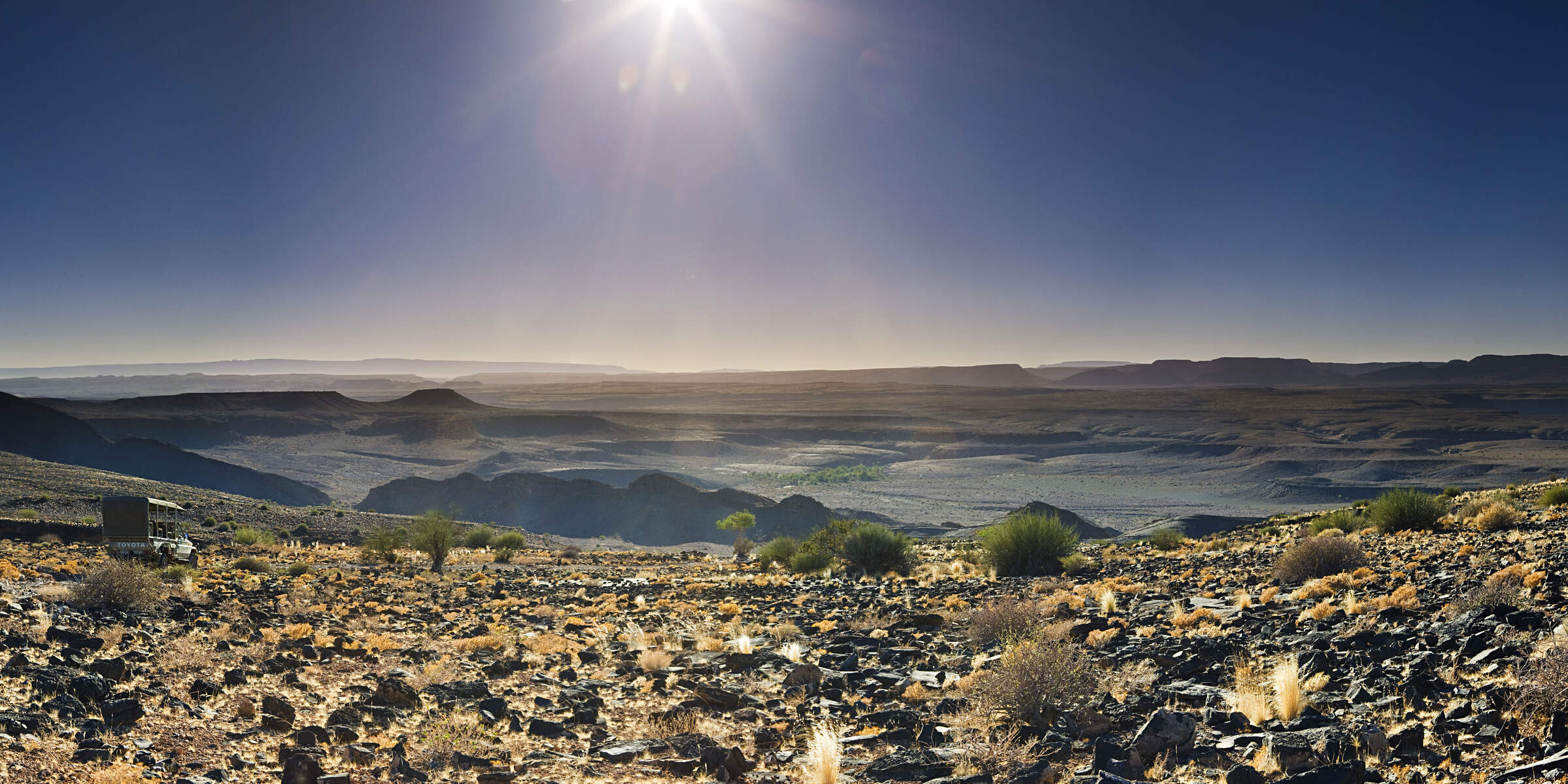
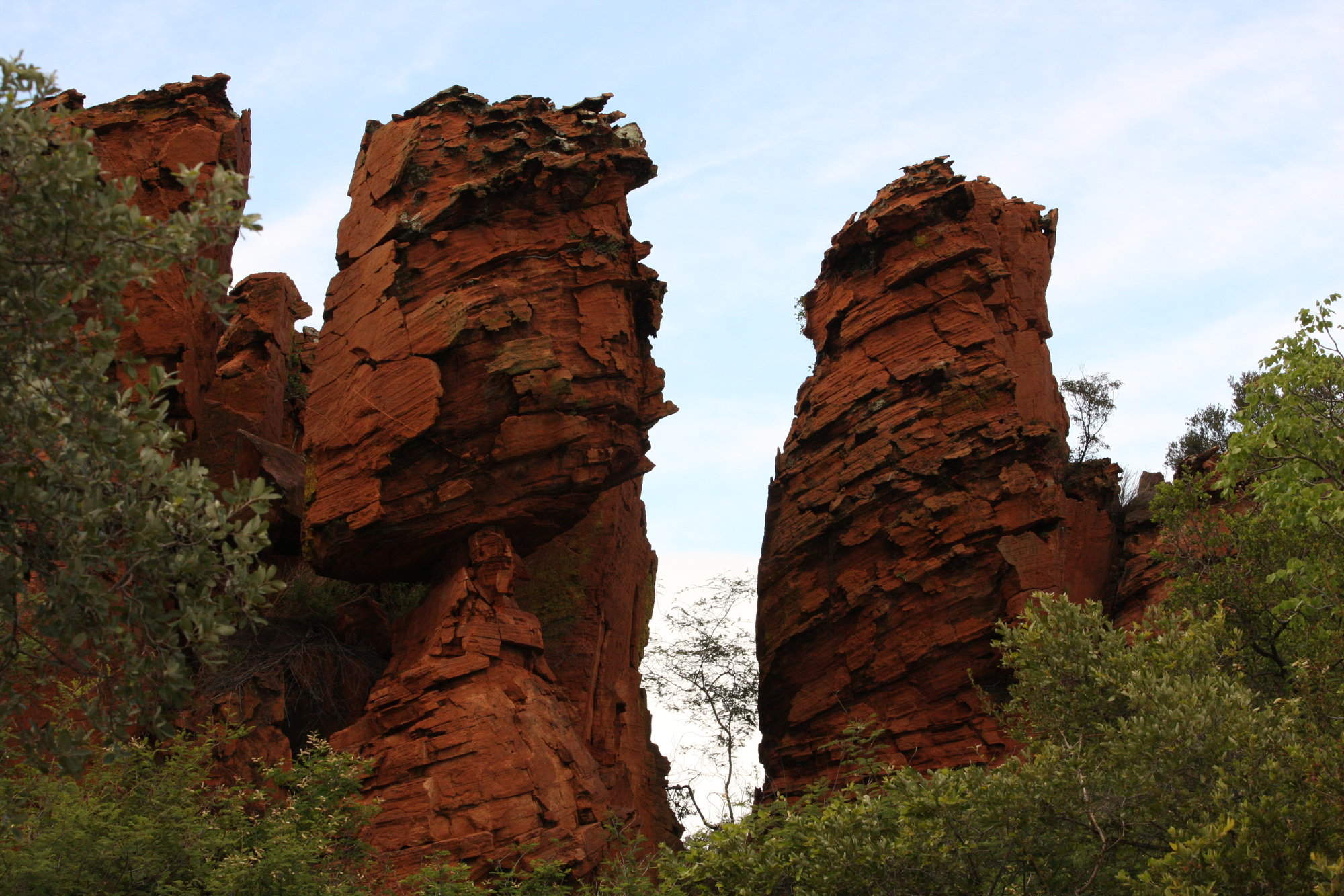
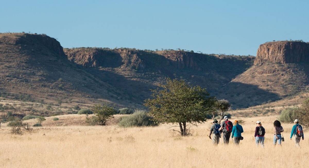
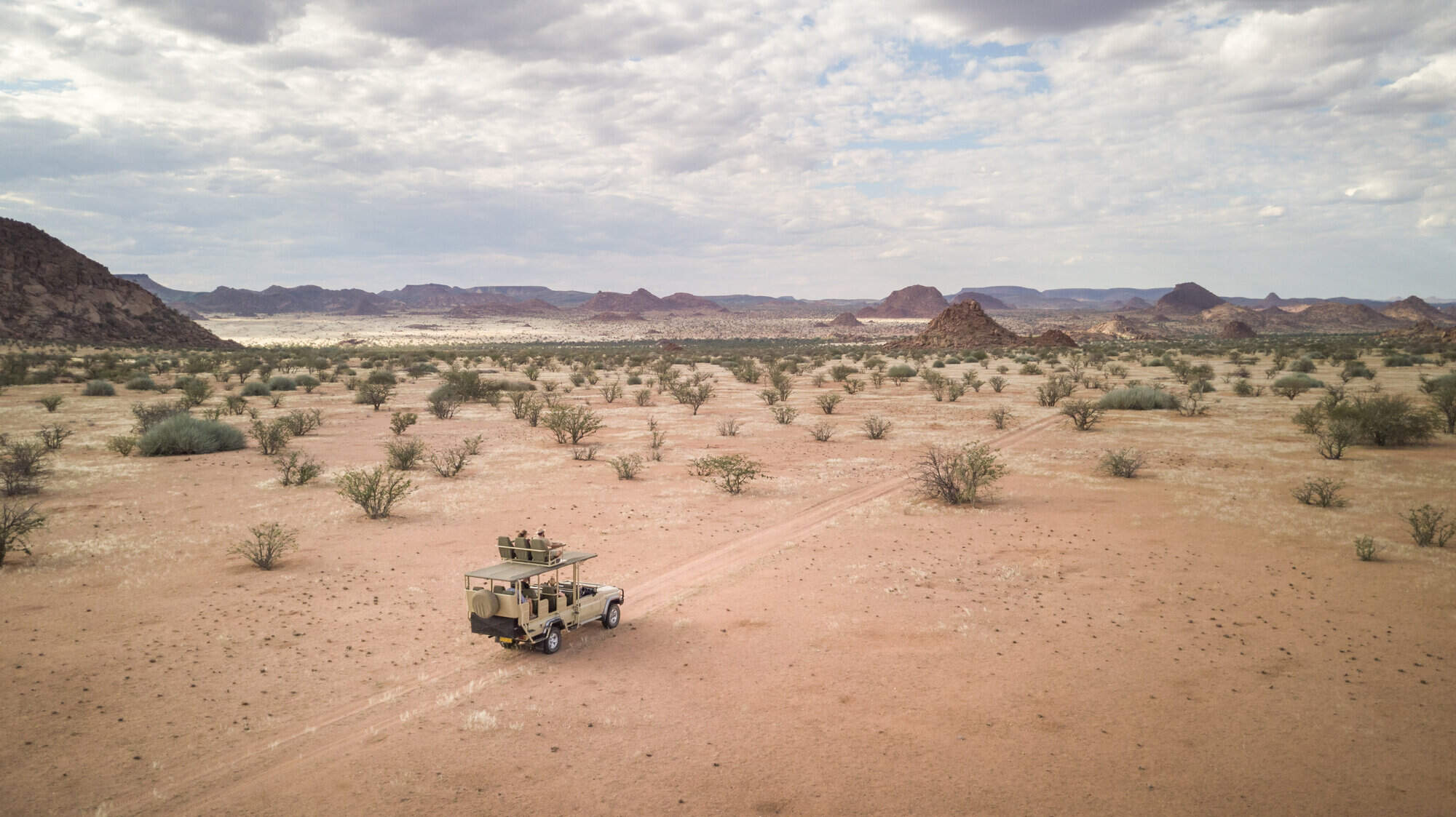
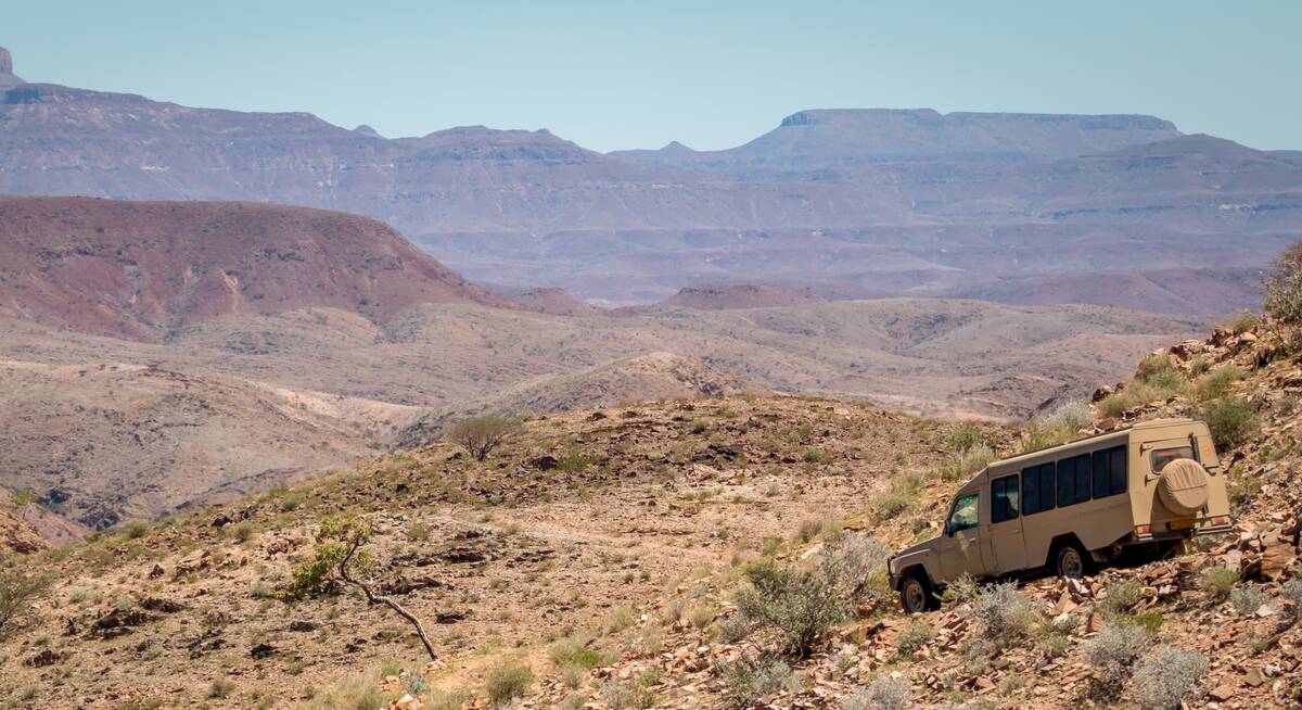
Craggy mountains and table-flat plateaux unfolding towards deep-red kopjes and oft-dry plains: rocks are the key to Damaraland’s scenic beauty.
With no permanent rivers, few inhabitants and a smattering of wildlife, this is a place to unwind, to watch and to wonder.
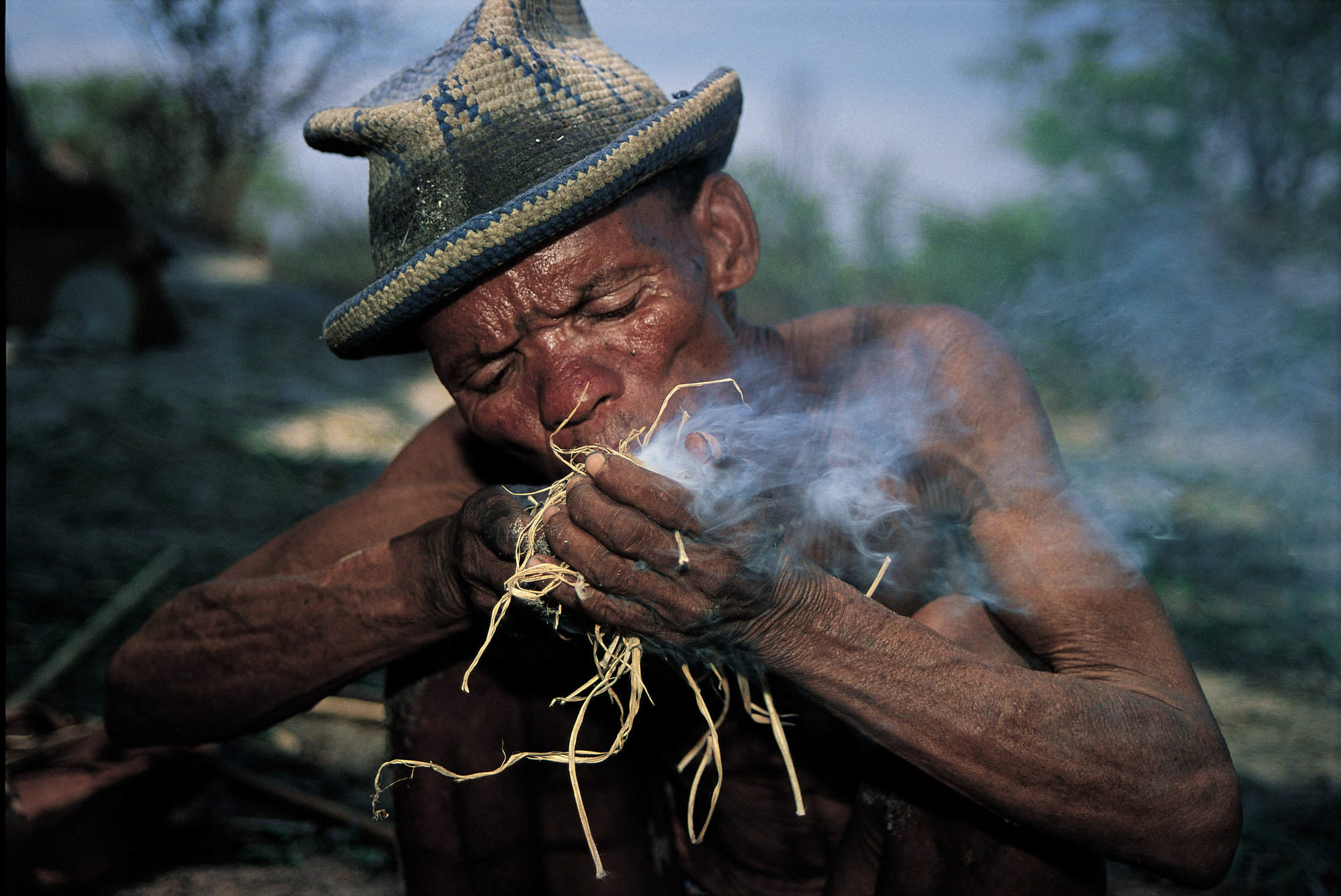
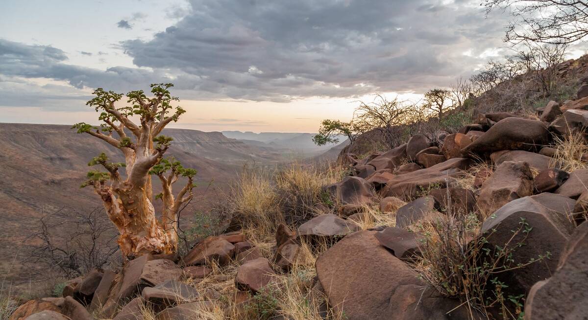
In the south, these hills have been home to the San for millennia, their paintings adorning rockfaces from the Brandberg Massif – Namibia’s highest mountain – to the outstanding World Heritage “art gallery” at Twyfelfontein. Spitzkoppe, too, has its own secret stash, hidden among the deep-red kopjes that rise up into the spectacular “Matterhorn of Africa”.
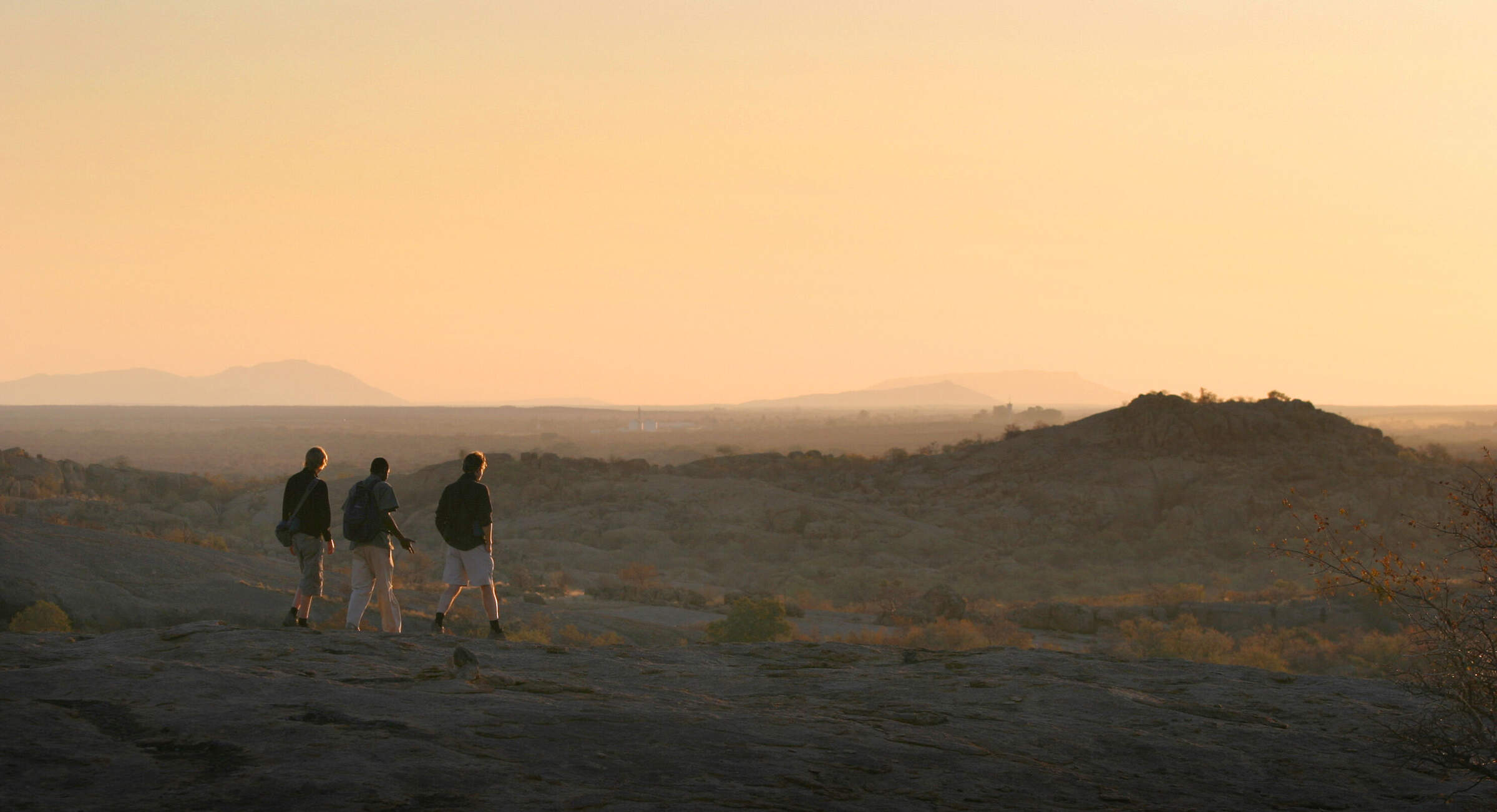
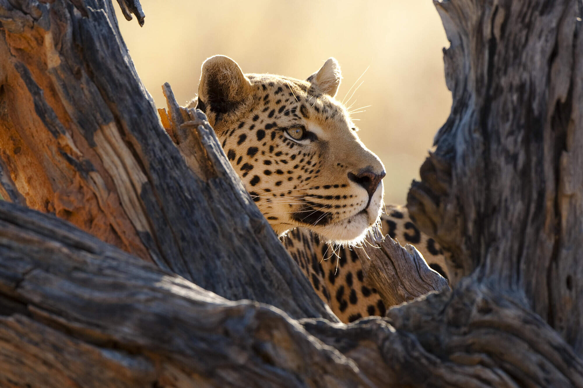
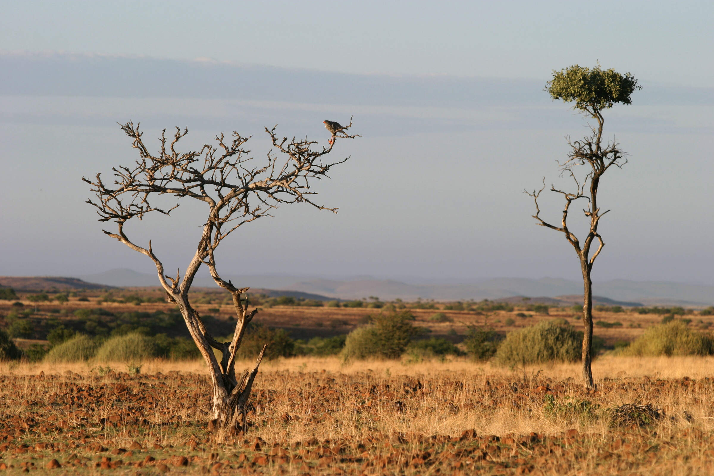
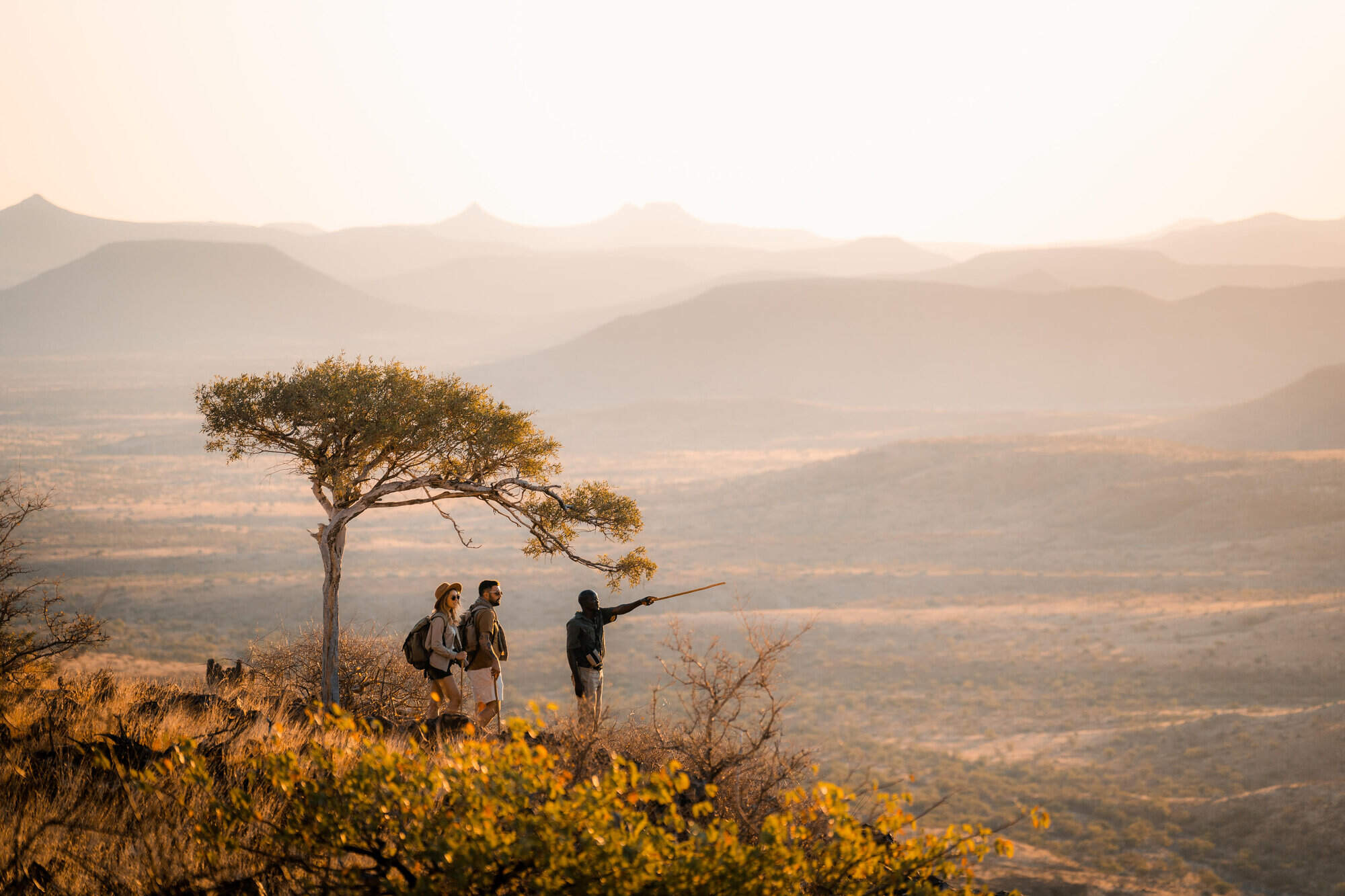
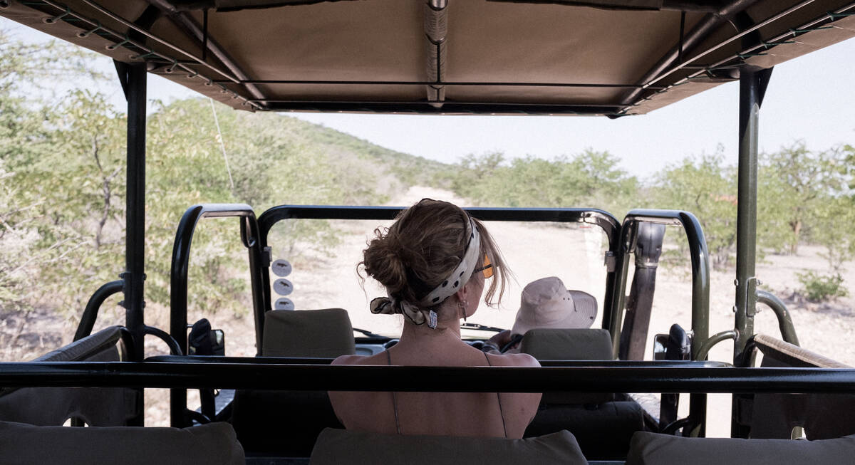
It’s a landscape made for walking, from gentle sunset ambles and more challenging half-day hikes to technical ascents suited only to the experienced climber. Leopards, although rarely seen, inhabit these hills; klipspringers jump nimbly across impossible drops, and high above, snake eagles and vultures circle in search of prey.
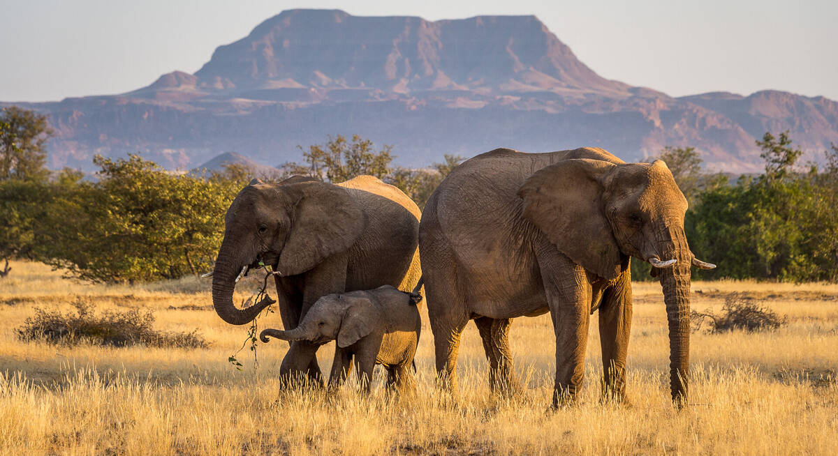
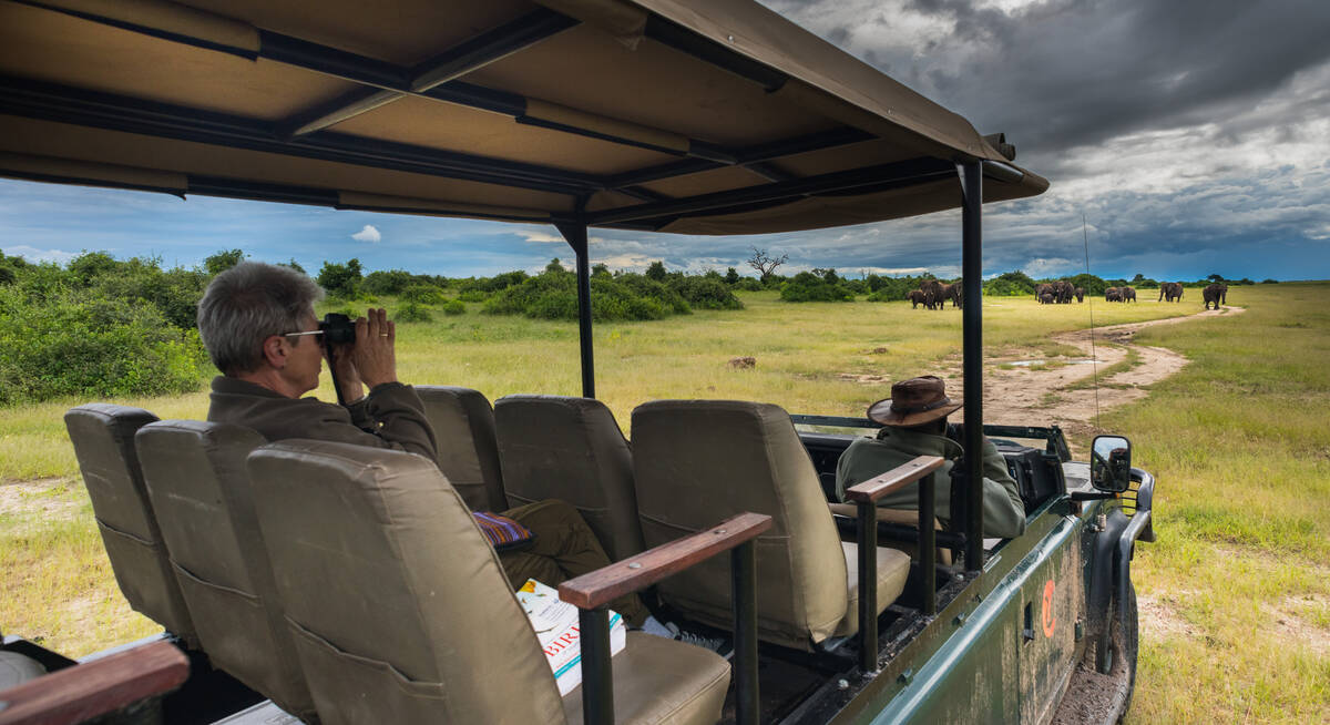
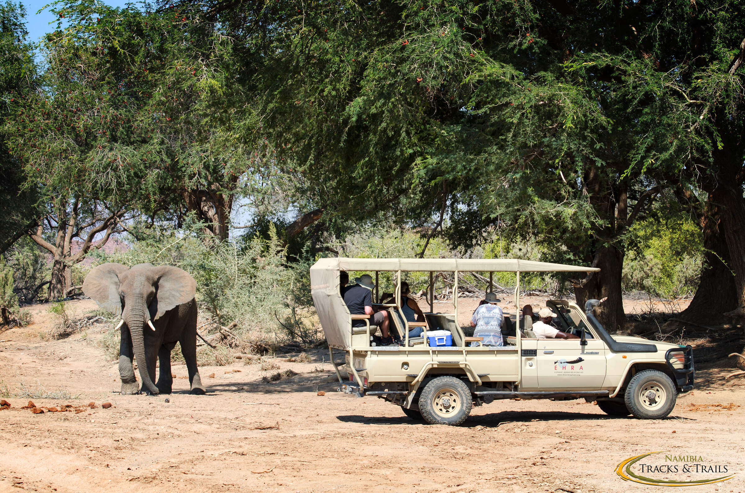
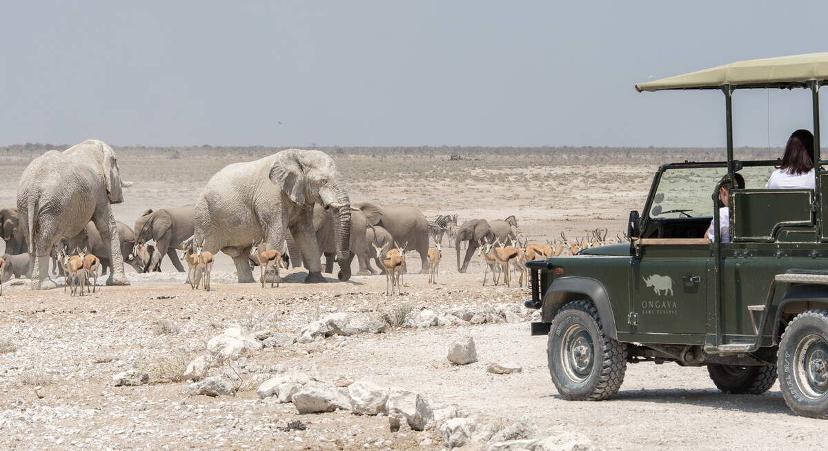
As the year wears on, desert-adapted elephants are drawn to the Huab River, whose last vestiges of life-giving water before the rains are crucial to their survival. Waterbirds such as the hamerkop take full advantage, while bee-eaters add a touch of colour, and out on the plains, the smart-looking Rüppell’s korhaan comes into its own.
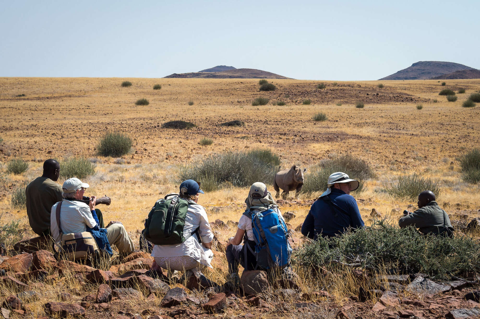
Further north, where ancient lava fields rise up above the plains, vegetation increases – and with it the wildlife: both resident individuals and migrant herds. This is the realm of the black rhino, watched over by a handful of lodges whose guides specialise in tracking these antediluvian creatures on foot – a heart-stopping, unmissable adventure.
Damaraland was in the forefront of a new generation of partnerships, with some of its lodges now owned and run jointly with the community. It’s a win-win situation that brings training, jobs and a sustainable future to the people, while for the visitor, it adds a personal dimension to an already exceptional trip.

Best safaris in Damaraland
Embarking on a holiday in Damaraland is like stepping into a living, breathing canvas of Africa's untamed beauty. This rugged region of Namibia offers an extraordinary blend of dramatic landscapes and unique wildlife encounters, making it high on the list for any discerning traveller. To enrich your journey, consider combining your Damaraland adventure with other iconic Namibian destinations such as the wildlife-rich Etosha National Park or the awe-inspiring dunes of the Namib-Naukluft, not forgetting the vibrant capital city of Windhoek.
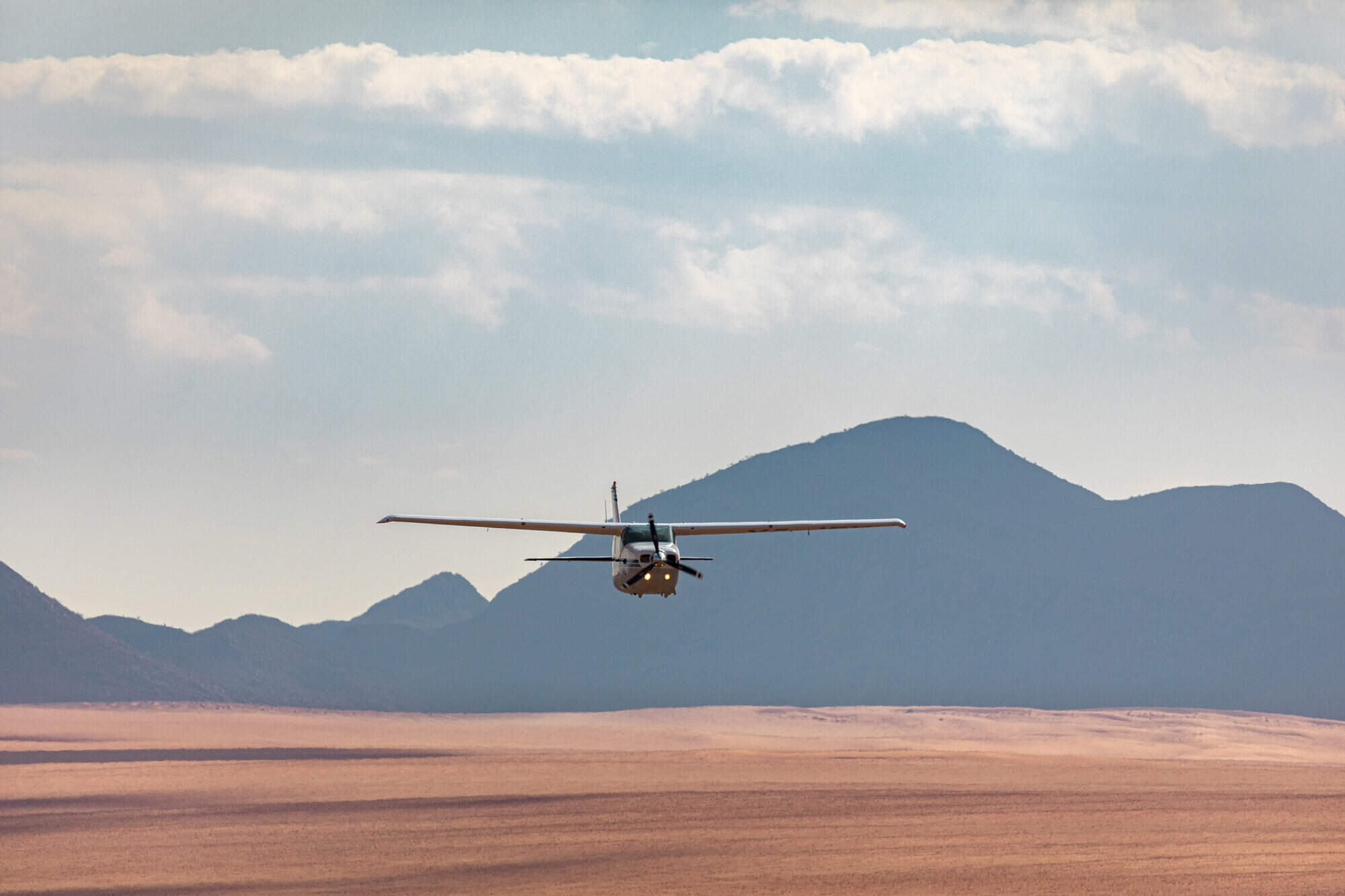
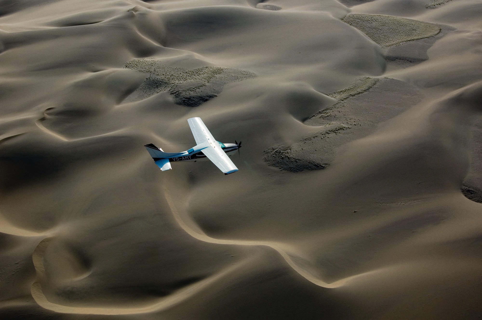
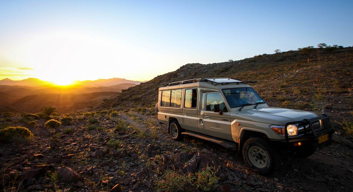
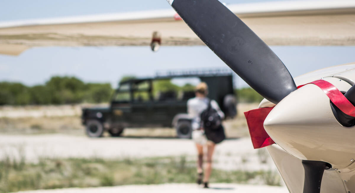
Among our most popular suggested holidays in Damaraland are the Caracal Self-drive Safari, where you can explore at your own pace, and the Hoopoe Fly-in Safari, offering a bird's-eye view of the stunning terrain. For those seeking a mix of independence and guided experiences, the Dune Lark Fly & Drive Safari is ideal. Other favourites include the Pygmy Mouse Self-drive Safari and the luxurious Bateleur Fly-in Safari.
Remember, though, that all these are just ideas. We'll always tailor-make a trip for you: just give us a call.
Chongololo Self-drive Safari
21 days • 11 locations
WINDHOEK AIRPORT TO WINDHOEK AIRPORT
This self-drive safari focuses on the best walking experiences in Namibia. Get your boots ready for the apricot dunes of the Namib Desert and the ancient hills of Damaraland.
US$9,020 - US$9,960 per person
Hartebeest Self-drive Safari
16 days • 8 locations
WINDHOEK AIRPORT TO WINDHOEK AIRPORT
This self-drive safari focuses on the best cultural experiences in Namibia. Visit a Himba village and enjoy three days living with the San Bushmen interspersed with some excellent wildlife watching.
US$4,590 - US$4,860 per person
Hoopoe Fly-in Safari
11 days • 4 locations
WINDHOEK AIRPORT TO WINDHOEK AIRPORT
This relaxed fly-in safari reveals Namibia at its best. Generous timings and a wide choice of activities help travellers to enjoy the best of the country’s most spectacular areas.
US$7,980 - US$10,310 per person
Dune Lark Fly & Drive Safari
14 days • 8 locations
WINDHOEK AIRPORT TO WINDHOEK AIRPORT
A combination fly-in self-drive exploration of Namibia, with quick, easy and scenic flights in and out of Sossusvlei before a classic road trip adventure of the country’s rugged north.
US$5,400 - US$5,800 per person
Black-faced Impala Guided Safari
13 days • 6 locations
WINDHOEK AIRPORT TO WINDHOEK AIRPORT
A unique mix of luxury and adventure in our original, and perhaps most varied, destination on a privately guided Namibian overland safari. Perfect for families, friends or couples travelling together.
US$13,480 - US$15,710 per person
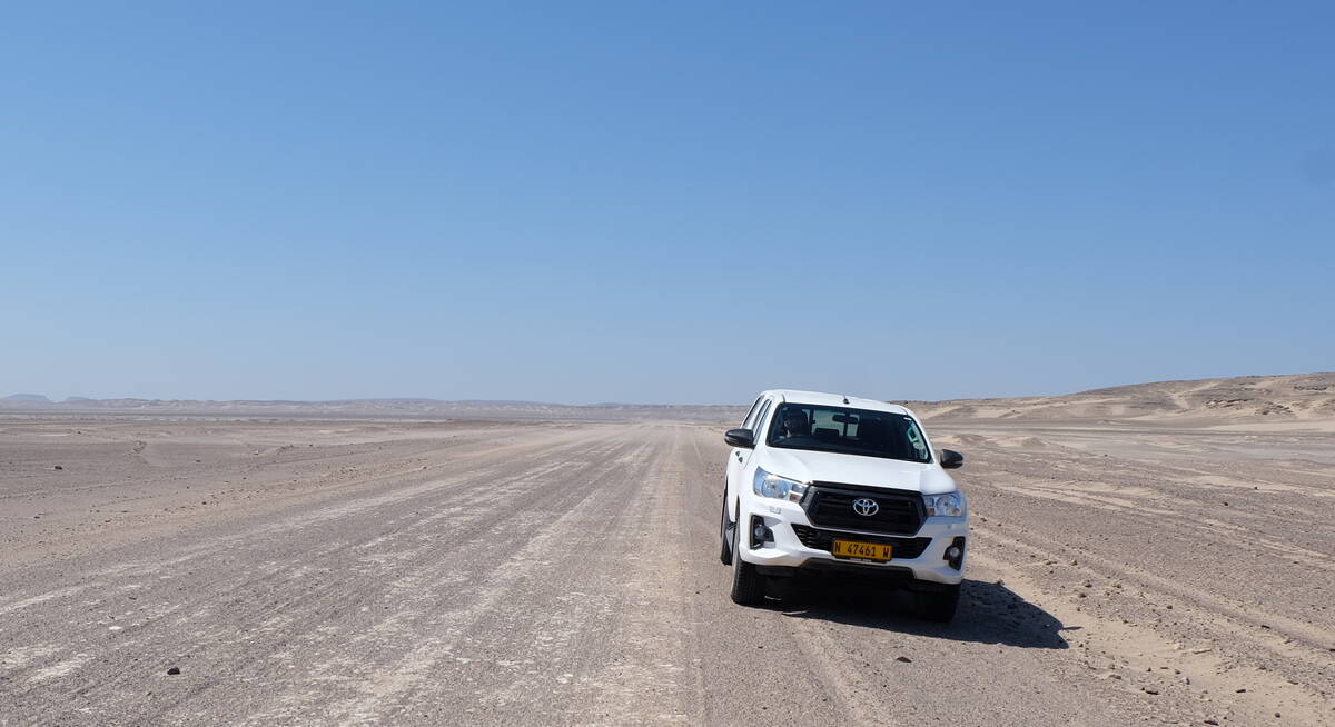
Caracal Self-drive Safari
14 days • 8 locations
WINDHOEK AIRPORT TO WINDHOEK AIRPORT
The quintessential Namibian self-drive adventure exploring the highlights from Sossusvlei and the Namib Desert to Damaraland’s wilderness and a safari in Etosha. A great mix of accommodation and excellent value.
US$3,310 - US$4,150 per person
Pygmy Mouse Self-drive Safari
18 days • 10 locations
WINDHOEK AIRPORT TO VICTORIA FALLS AIRPORT
A truly epic southern African self-drive safari adventure from Namibia’s mountains and deserts, along the lush Caprivi Strip to Botswana and Victoria Falls in Zimbabwe, staying at luxury lodges throughout.
US$8,730 - US$10,440 per person
Bateleur Fly-in Safari
7 days • 4 locations
WINDHOEK AIRPORT TO WINDHOEK AIRPORT
Classic fly-in Namibian safari staying at excellent camps. Explore Sossusvlei’s dunes and track Damaraland’s desert elephants before a safari in Etosha. Incredible scenery, good wildlife viewing and authentic cultural experiences.
US$7,190 - US$9,250 per person
Most recent reviews of our safaris to Damaraland
Click below to browse all 1126 reviews from Damaraland. All from our travellers; all are in full & unedited.
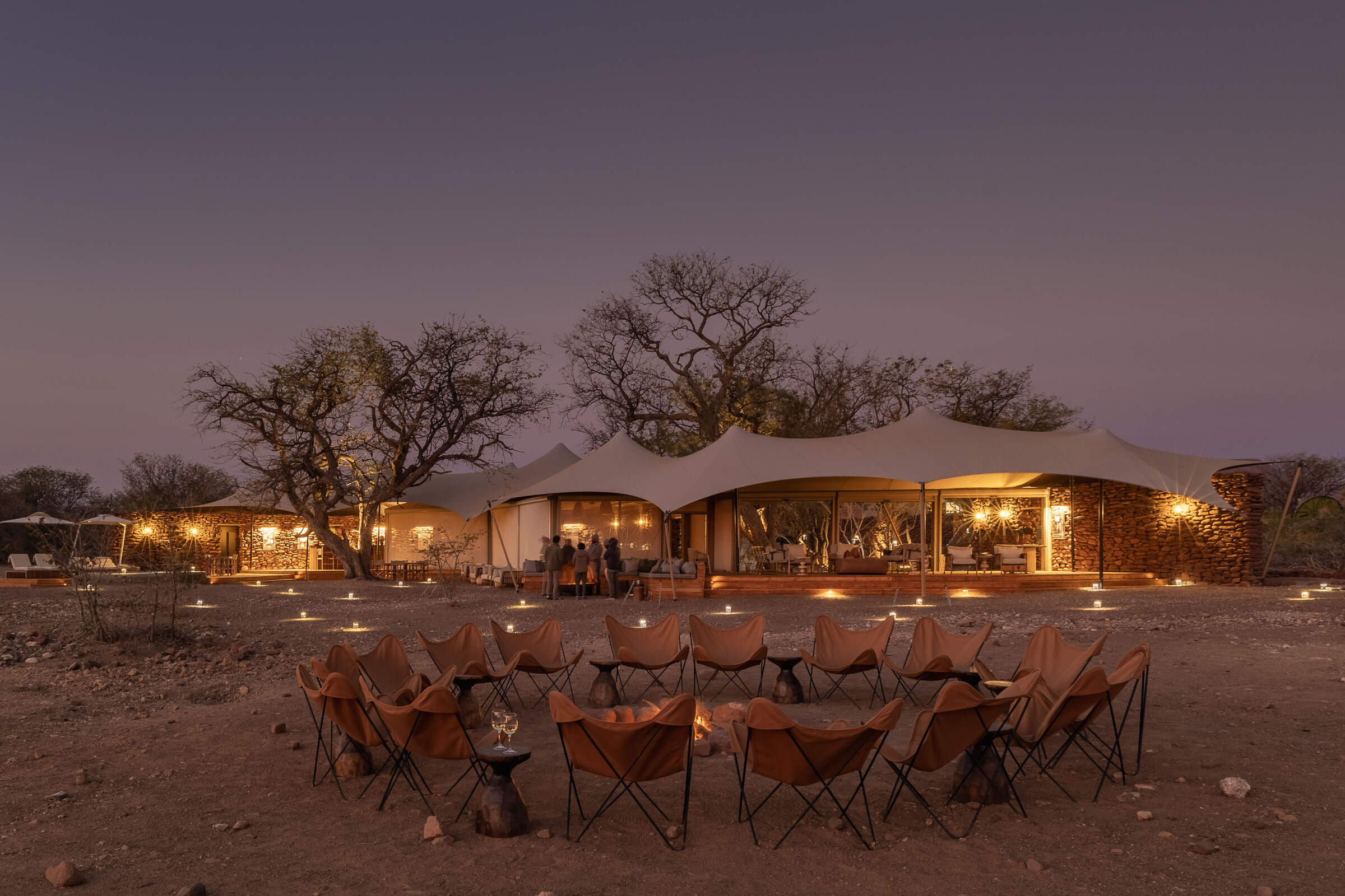
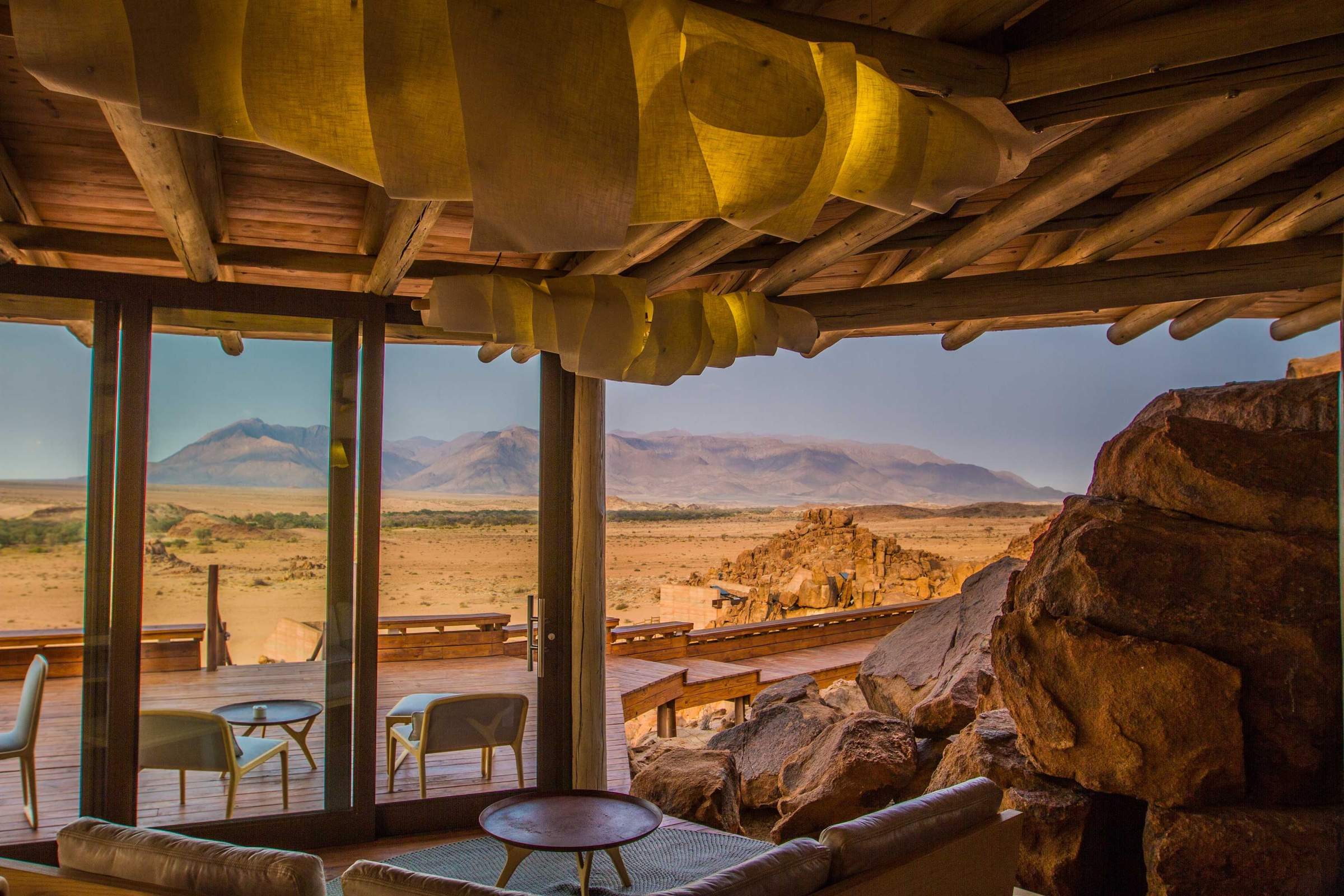
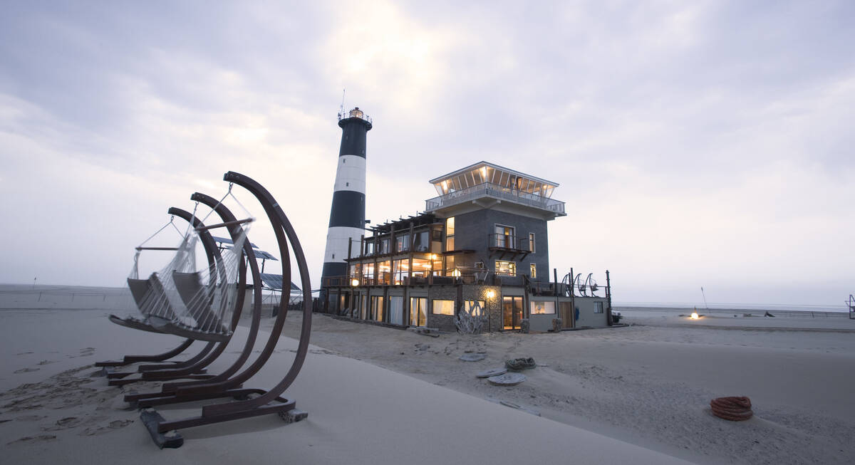
Where to stay in Damaraland
Damaraland offers a diversity of places to stay, each providing access to rugged landscapes and rich wildlife.
Options range from rustic mountain camps with panoramic views to intimate desert lodges, allowing you to experience the thrill of tracking desert-adapted elephants or marvel at ancient rock engravings. Each lodge ensures an authentic, personalised stay, immersing you in the heart of Africa's wilderness. Contact us for our advice on the best fit for you.
Doro Nawas
Comfortable rooms and a convenient location make the community run Doro Nawas a great base for exploring Damaraland.
Mowani Mountain Camp
Mowani is a beautiful and stylish mountain retreat in southern Damaraland; it makes a great base for visits toTwyfelfontein.
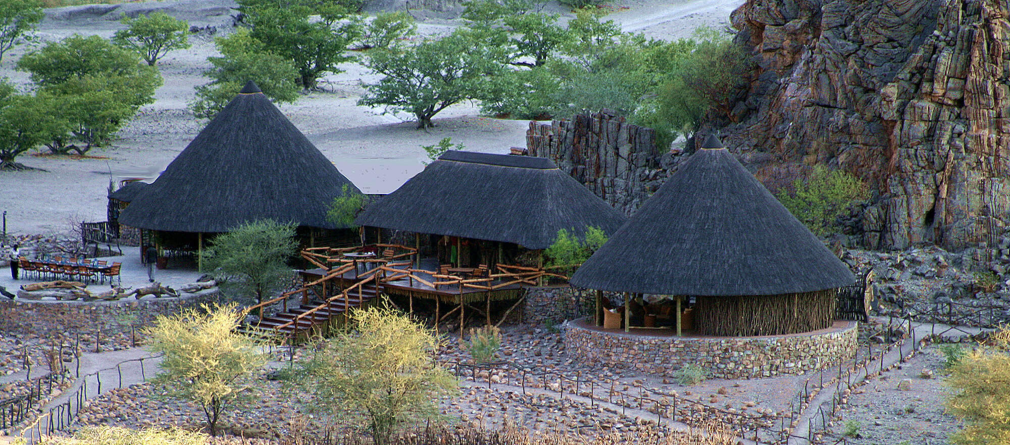
Damaraland Camp
Setting the standard for community partnerships, Damaraland Camp offers a beautiful location, a range of activities – and a genuine welcome.
Camp Kipwe
With unusual, igloo-like rooms, open-air bathrooms and beautiful scenery, Camp Kipwe is well placed for nature and cultural excursions.
Desert Rhino Camp
Desert Rhino Camp offers a rare opportunity to track black rhino on foot in one of the last true wilderness areas – an amazing experience.
Etendeka Camp
Etendeka is an owner-run camp in the remote and less visited north of Damaraland. The camp is renowned for it's spectacular guided walking trails.
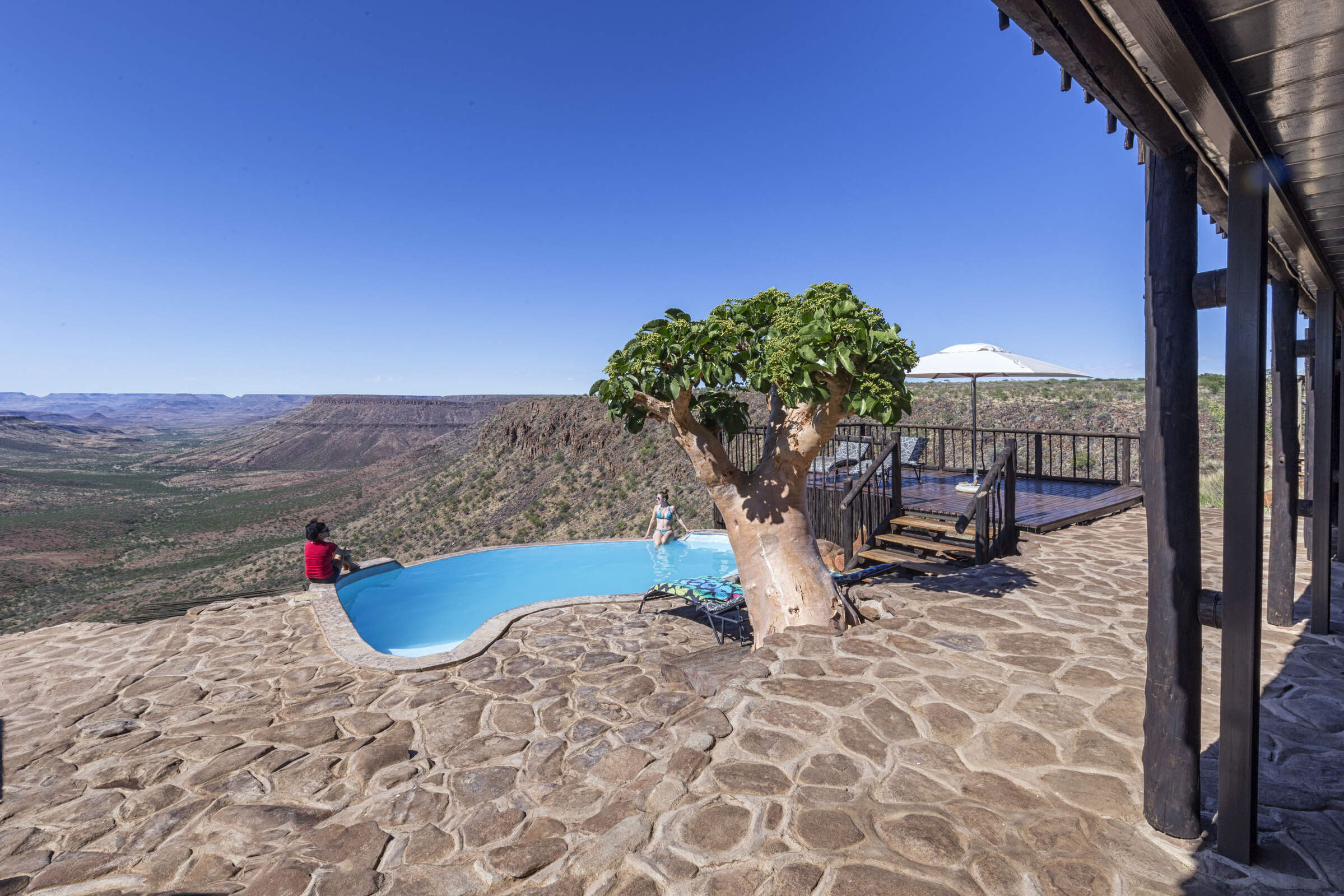
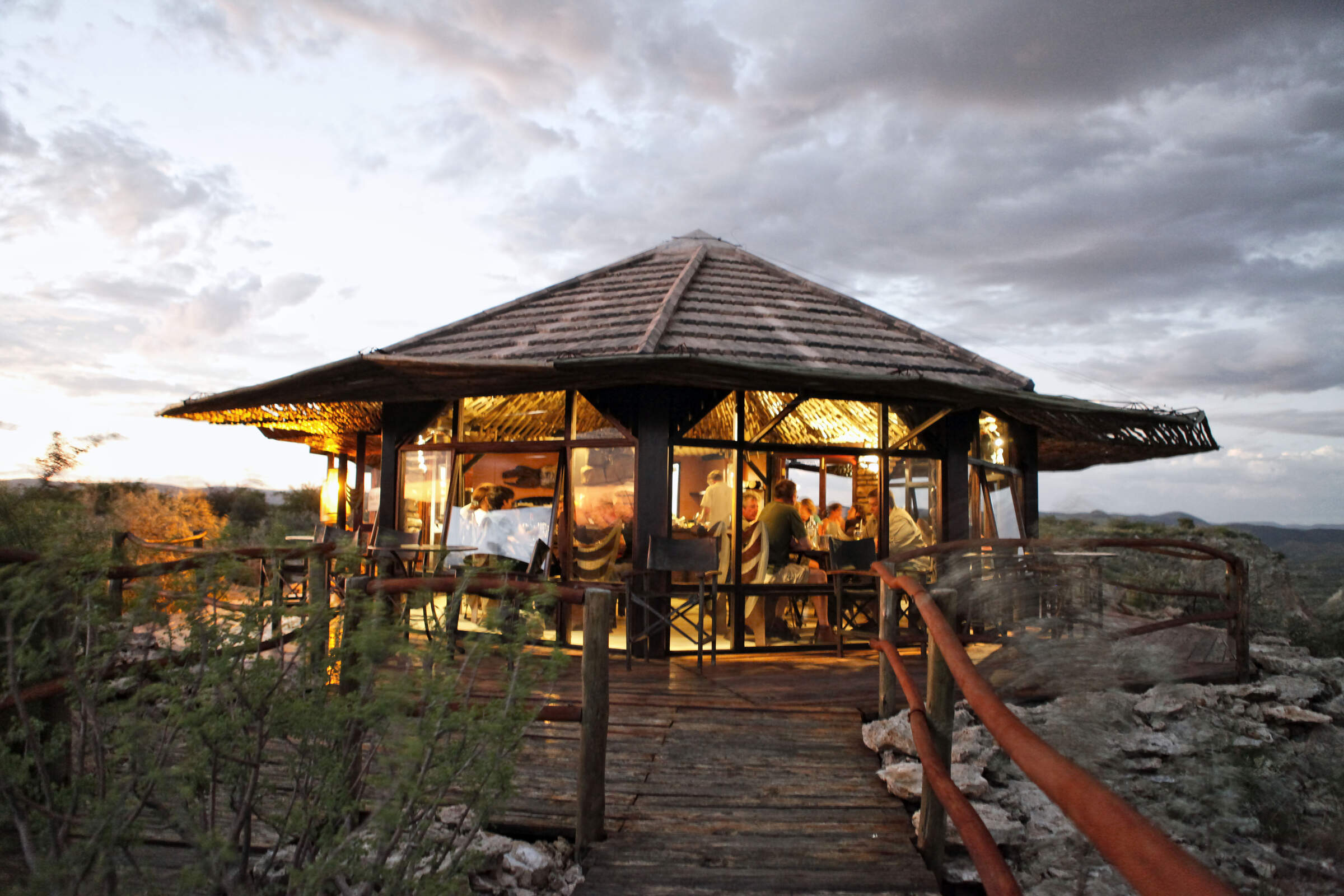
Grootberg Lodge
On the edge of an ancient plateau Grootberg Lodge has a stunning location and arguably the best views of any lodge in Namibia.
Twyfelfontein C'try Lod.
A large lodge set among the rocks, Twyfelfontein Country Lodge is a convenient base for visiting the rock engravings, which are only 4km away.
Spitzkoppen Lodge
Spitzkoppen Lodge provides stylish accommodation in an area of scenic grandeur with guided access to sites of ancient Bushman rock art.
Palmwag Lodge
Palmwag Lodge has a great location by a spring in the Uniab River and offers access to an area where you can see a variety of desert-dwelling animals.
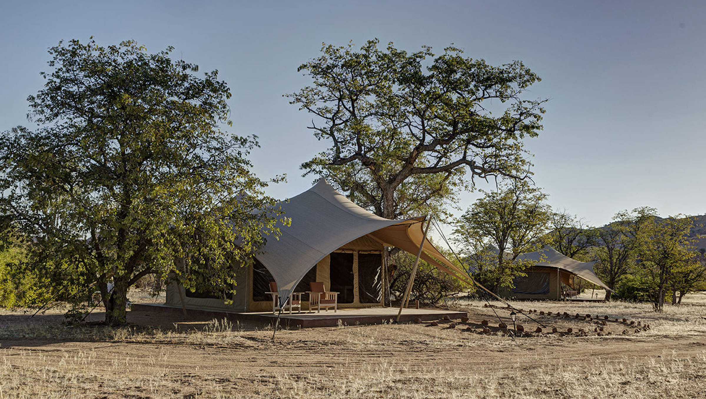
Huab Lodge
Huab is a classic little Namibian Lodge which is slightly off the beaten track in a lesser visited part of Damaraland.
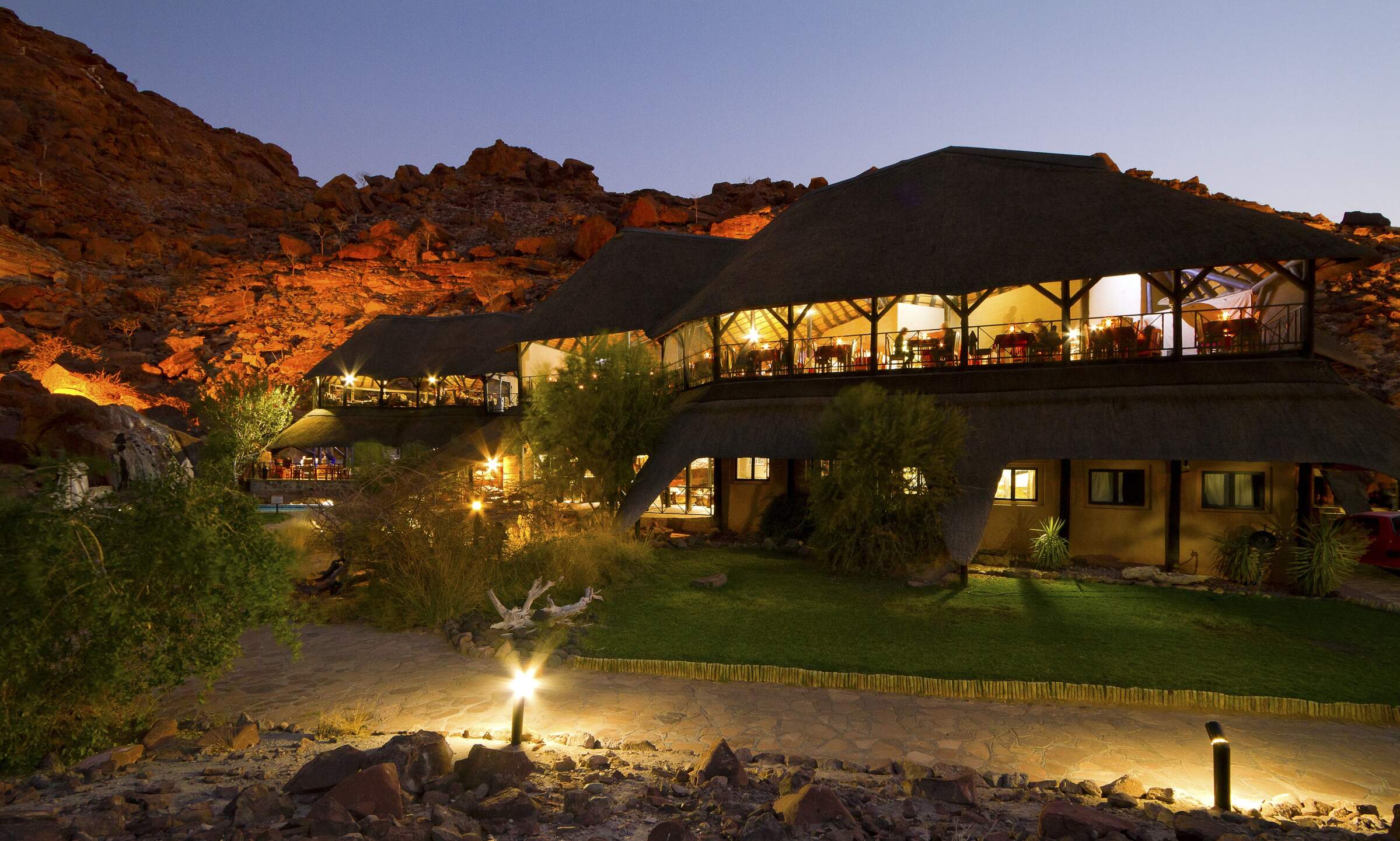
Brandberg White Lady
Brandberg White Lady Lodge, nestled at the foot of its namesake, makes a good base from which to visit bushman rock paintings including the 'White Lady'.
Vingerklip Lodge
Vingerklip Lodge occupies a lovely location, but is a little too far east for guests to visit Damaraland's main attractions.
Khowarib Lodge
Khowarib Lodge has a great location overlooking the Hoanib River. This is one of the few places to offer authentic Himba village visits.
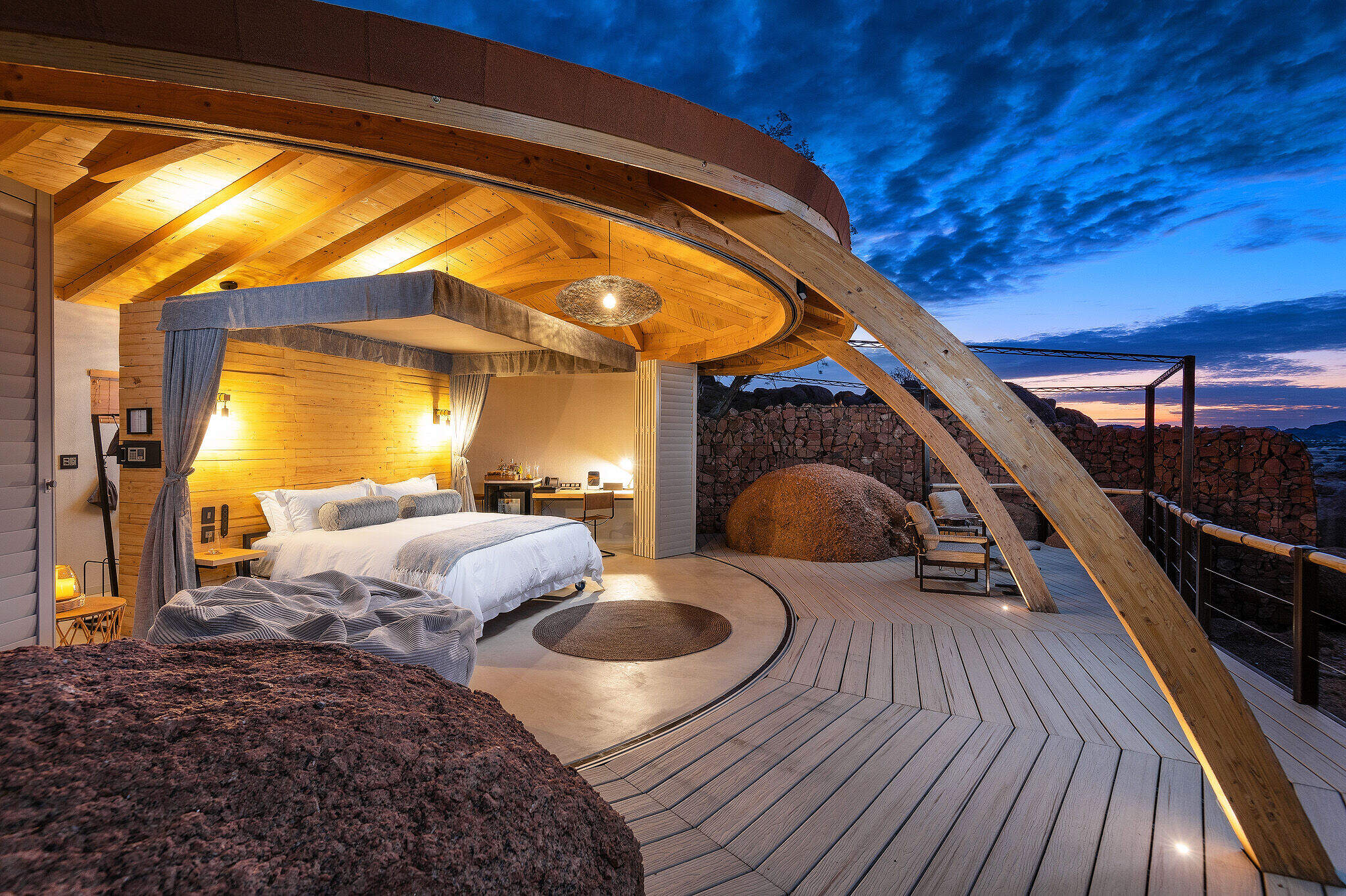
Onduli Ridge
Onduli Ridge is a luxurious, low-impact luxury camp offering top-notch guiding in a remote wilderness area of Damaraland.
Malansrus Camp
Within easy reach of Twyfelfontein, Malansrus offers a simple but comfortable base for visits to the rock engravings or seek out desert-adapted elephants.
Etendeka Walking Trail
The Etendeka Walking Trail promises to offer a back-to-basics walking and camping experience in one of Namibia's most remote and untouched wilderness areas.
Ozondjou Trails
The simple Ozondjou Trails gives a unique perspective on living with Damaraland’s desert-adapted elephants and how tourism is key to protecting them and the livelihood of the people.
Palmwag Sleep-out
Palmwag Sleep-out is a simple camping experience and a great way to enjoy the remote beauty of the vast Palmwag Concession
Camp Doros
Small, intimate and with excellent eco-credentials, Camp Doros is set above an ephemeral river within a remote community concession of Damaraland.
Sorris Sorris Lodge
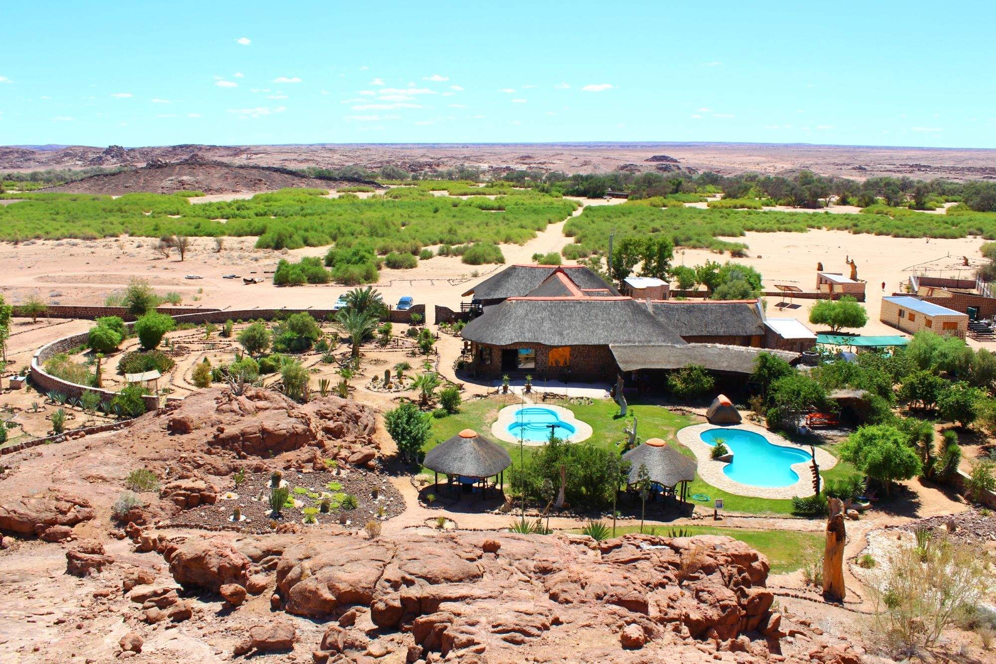
Overlooking the Brandberg Massif, Sorris Sorris is probably the most luxurious lodge in southern Damaraland.
Our travellers’ wildlife sightings in Damaraland
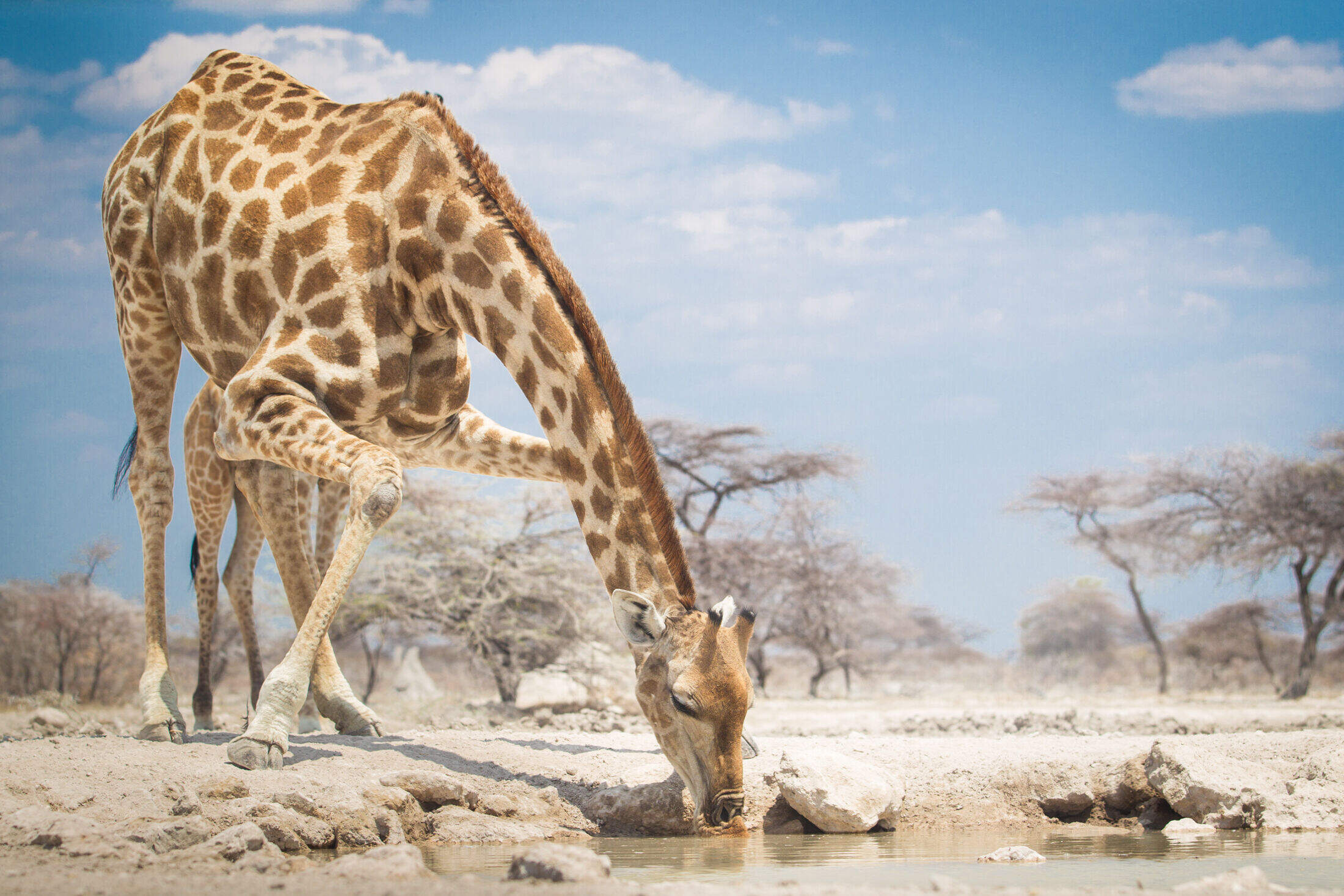
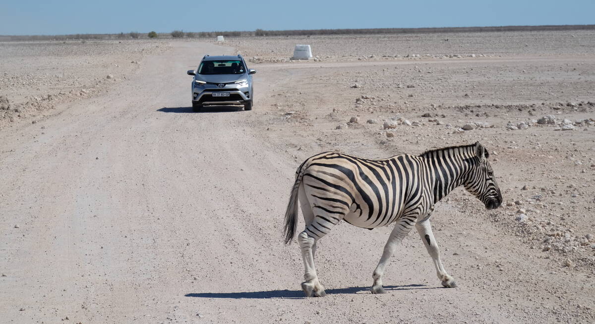
Damaraland's wildlife is a testament to nature's adaptability and resilience. Desert-adapted elephants with larger feet and leaner bodies roam the arid landscape. Giraffes step gracefully over the terrain, while the striking oryx, with its long, straight horns, symbolises survival in harsh conditions. Even the region's zebras, especially the Hartmann's mountain zebra, have evolved to endure long periods without water.
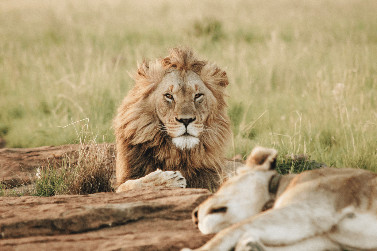
The black rhino, once on the brink of extinction, is now making a comeback in this wilderness area, thanks to conservation efforts. Meerkats, ever vigilant, stand on guard, and both spotted and brown hyenas contribute to the rich predator tapestry. Very occasionally, desert-adapted lions are spotted, hinting at their remarkable survival skills, and leopards – though rarely seen – navigate the rocky outcrops.
Click on a species below for more information on the top locations in Damaraland for wildlife sightings, or see our interactive map showing the best locations for individual wildlife species in Namibia. Read how this wildlife survey works.

72% success

60% success

54% success

39% success

28% success

20% success

7% success

6% success

4% success

4% success

1% success

1% success
When to go to Damaraland
In Damaraland, each season offers unique experiences.
The rainy season, from November to April, features sporadic showers and a greener landscape, with wildlife spread across the rejuvenated terrain. From May to October, the dry season brings clear skies, cooler nights, and improved chances of seeing wildlife. It is during this time that desert-adapted elephants and other animals are more easily seen in areas like the Ugab and Aba-Huab riverbeds and the Palmwag Concession. The rock art at Twyfelfontein and the dramatic landscapes of Spitzkoppe and Brandberg are accessible year-round, each season providing unique photographic opportunities.
Click on the months below for a detailed guide on when to visit Damaraland:
Jan
Feb
Mar
Apr
May
Jun
Jul
Aug
Sep
Oct
Nov
Dec
Damaraland in January
In Damaraland, January marks the start of the rainy season. The rains, though often light and localised, bring life to the desert landscape.
At Twyfelfontein, the rock engravings glisten after sporadic showers. Some days are clear and hot, with temperatures around 30°C/86°F, while others see dramatic thunderstorms. These can create flash floods in ephemeral riverbeds like the Ugab, temporarily transforming the arid terrain. The greening landscape provides a refreshing backdrop for the ancient rock art at Brandberg Mountain.
Many birds in the region are in full breeding plumage, with migrant species adding to the variety. Wildlife, including the desert-adapted elephants, disperses across the rejuvenated landscape, making sightings more challenging, but rewarding. The Damara Living Museum offers insights into how local communities adapt to these seasonal changes.
- Variable weather: hot, dry or humid with rain
- Occasional localised thunderstorms
- Wildlife dispersed, harder to spot
- Stark mountains against atmospheric skies
- Few tourists, low rates at accommodations
Our view
This is not a great time to visit
Weather in January
Damaraland in February
February is typically the wettest month in Damaraland, though rainfall remains patchy across this predominantly arid region.
The Spitzkoppe granite peaks against thunderous, atmospheric skies create dramatic vistas for photographers. Some days are clear and hot, while others see afternoon thunderstorms that briefly but dramatically charge the landscape. These rains can make travel more challenging, especially to remote sites like the Epupa Falls. However, the landscape feels vibrant and alive, with insects and smaller animals more easily spotted, and seasonal flowers blooming. Many birds and animals are raising their young, offering unique wildlife viewing opportunities.
Despite the rains, the rock art at Twyfelfontein and the Petrified Forest remain accessible.
- Hot and humid with occasional rain showers
- Thunderstorms meander over the landscape
- Birdlife spectacular, migrant species present
- Wildlife harder to see, but landscape lush
- Low tourist numbers, great for solitude
Our view
This is not a great time to visit
Weather in February
Damaraland in March
March in Damaraland usually sees the main rains tailing off, though precipitation varies greatly across the region. Many days are clear, with strong sun driving temperatures up, while others may experience light rainfall.
The landscape often appears vivid and green, providing a striking contrast to the bare rocky outcrops of Spitzkoppe and Brandberg. Animals such as springbok and mountain zebra may be finishing raising their young. Small herds of plains game such as these can be more visible against the greener backdrop. The Damara Living Museum showcases how local communities adapt to these seasonal changes. The clearer skies towards the end of the month make for excellent stargazing at lodges where you can move your bed to sleep under the stars.
- Weather becoming drier as month progresses
- Animals looking healthy after months of plenty
- Balmy nights sleeping under star-filled skies
- Migrant birds begin to depart
- Few tourists, rates often low at lodges
Our view
A good time to visit, with pros & cons
Weather in March
Damaraland in April
April in Damaraland is typically dominated by dry weather, with decreasing chances of rain. Temperatures begin to fall, but days remain pleasantly warm. The rains often leave the landscape verdant, creating stunning photo opportunities at sites like the Etendeka Plateau and Klip Valley.
Animals are in fantastic condition, often with fast-growing young in attendance. The desert-adapted elephants may be more easily spotted as they begin to return to the riverbeds to feed on Ana and Camelthorn trees. With dust washed from the atmosphere, photographers can capture clear shots of spectacular landscapes. Stargazers will enjoy increasingly clear night skies. In the Palmwag Concession, water and food remain in plentiful supply, so finding mammals such as black rhino can still be challenging, but worth the effort.
- Cooler nights, days still warm and pleasant
- Landscape still green from recent rains
- Air clear, for crisp photographs
- Wildlife starting to become easier to find
- Easter sees an increase in visitors
Our view
A good time to visit, with pros & cons
Weather in April
Damaraland in May
By May, Damaraland is usually drying out fast. If rains have been good, the land remains green, especially around natural springs found in valleys and craggy rocksides. The air quality and clarity can be amazing, making this an ideal month for photography at sites like Twyfelfontein and along the remote Hoanib riverbed.
Temperatures are moderate, typically warm with crisp, clear mornings and blue skies. Evenings are cool enough to wear an extra layer. Many lodges still charge low season prices, offering good value. The combination of increasingly good wildlife sightings, beautiful landscapes, and crystal-clear air make May one of the best months to visit Damaraland. It's an excellent time to explore the region's geological wonders, such as the ancient Etendeka lava flows.
- Lovely weather: warm days, cool nights
- Landscape drying out, still some greenery
- Clear, sharp colours for photography
- Wildlife more visible along scenic riverbeds
- Low visitor numbers, moderate lodge rates
Our view
A very good time to visit
Weather in May
Damaraland in June
June sees Damaraland dry and clear, with blue, largely cloudless skies. Days are often lovely and warm, but nights can be cold, sometimes below freezing in desert areas.
Visitors should pack warm clothing for early morning nature drives to spot desert-adapted elephants or black rhinos. Most outdoor pools are too cold for swimming, except for the very dedicated. It’s a particularly good climate for walking; either short walks or perhaps a multi-day hike on the Etendeka Plateau.
Historically, June prices have been low, but Damaraland's increasing popularity means many lodges now consider it high season.
- Clear, bright days and cold nights
- Wonderful for stargazing and night walks
- Good wildlife viewing in remote wildernesses
- Hiking comfortable in cooler temperatures
- Moderate lodge rates, increasing bookings
Our view
A very good time to visit
Weather in June
Damaraland in July
July in Damaraland offers fairly warm temperatures above 20°C/68°F in the middle of the day, but often cold nights. Visitors should dress in layers and be prepared for chilly mornings and evenings.
Rain is extremely rare, and clear skies make for great photographs of the sandstone mountains in morning and evening light. As vegetation shrivels, animals gather near food and water sources, making sightings of desert-adapted wildlife more likely. Elephant herds are more regularly seen along dry riverbeds during this period.
Lodges charge high season rates, and many are booked up well in advance, especially during European school holidays.
- Dry days, clear skies, crisp cold nights
- Peak time for wildlife viewing in Damaraland
- Desert-adapted elephants more easily spotted
- Wonderfully cool for day walks and longer hikes
- High season rates, book accommodations early
Our view
A very good time to visit
Weather in July
Damaraland in August
August is the height of Damaraland's winter. Expect cloudless skies and usually warm sun during the day, but nights can drop to freezing in desert areas. Visitors should bring warm clothes for nature drives and walks in chilly mornings and evenings.
The landscape begins to change from green to golden grasses and stark hillsides. Wildlife sticks close to dry river-beds where desert-adapted elephants dig for water, creating waterholes for other animals.
The clear, dry conditions make it an excellent time for hiking and exploring geological features like the Organ Pipes and Burnt Mountain.
August is the most popular time to visit Damaraland, especially for families. Booking well in advance is essential.
- Perfect weather for outdoor activities
- Excellent wildlife viewing opportunities
- Popular time for hiking and tracking rhino on foot
- Good time for cultural experiences at Damara Living Museum
- Peak season, lodges booked up well in advance
Our view
Fantastic: the very best time to visit
Weather in August
Damaraland in September
September in Damaraland brings blue, cloudless skies and fantastic wildlife viewing. Rain is almost unheard of, and as the month progresses, days and nights quickly get warmer. Daily maximums can reach the low 30s Celsius/mid-80s Fahrenheit, though low humidity keeps it comfortable. The air becomes dustier, occasionally affecting visibility for photographers at sites like Twyfelfontein or Brandberg.
In the Palmwag Concession and along the Ugab River, animals congregate around remaining water sources, making September one of the best months for game viewing, especially for desert-adapted elephants and black rhinos, but also desert-adapted lion. It's a popular month for visitors, particularly safari enthusiasts seeking sightings of these unique sub-species.
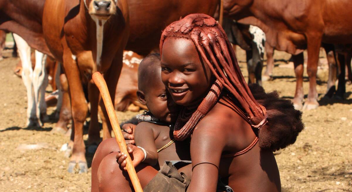
The Himba at Khowarib provide insights into how local communities adapt to the dry season.
- Warm days, nights getting warmer
- Landscape golden brown, very photogenic
- Prime time for seeing desert-adapted wildlife
- Air can be hazy with dust
- High season rates, book well in advance
Our view
Fantastic: the very best time to visit
Weather in September
Damaraland in October
Damaraland is usually at its hottest and driest in October. Temperatures build throughout the month, with daily highs potentially exceeding 40°C/104°F towards the end. The extreme dryness, though, makes even these high temperatures bearable.
Wildlife watching is at its best, particularly in areas like the remote Palmwag Concession and along the Hoanib River. October is popular among wildlife enthusiasts, as shyer species such as brown hyena and cheetah are more regularly seen. However, dust and occasional smoke may make the air hazy, challenging landscape photographers but creating beautiful sunsets.
Visitor numbers can decrease towards the end of the month, potentially allowing for last-minute bookings at some lodges.
- Hot and dry, true desert conditions
- Wildlife congregates at remaining water
- Excellent month for photographing sunsets
- Peak tourist time, expect higher rates
- Unusual species like brown hyena more regularly seen
Our view
A very good time to visit
Weather in October
Damaraland in November
November in Damaraland is unpredictable; sometimes dry and hot, sometimes cloudier and cooler. Typically, mornings are hot and clear, with clouds gathering from the afternoon. Humidity builds, occasionally resulting in spectacular thunderstorms with convection rainfall in late afternoons. These storms are usually localised and may not reach desert areas.
Places receiving good rain, like parts of the Palmwag Concession, quickly turn green, softening the landscape. Many mammals give birth, offering unique wildlife viewing opportunities. Once rains settle in waterholes, wildlife disperses in search of food, making game viewing more challenging. However, this is an excellent time for birdwatchers, with migrant species arriving and taking on breeding plumage.
The rock art at Twyfelfontein and Brandberg can be particularly striking after light rains.
- Variable weather, possibility of rain
- New growth if rains arrive, landscape greens
- Wildlife viewing still good, with babies often born
- Shoulder season rates offer better value
- Birdlife increases with migrant arrivals
Our view
A good time to visit, with pros & cons
Weather in November
Damaraland in December
December is often a dry month between November’s short rains and the main rains in January, and is one of its hottest months. Occasional short, often spectacular thunderstorms are often highly localised and generally welcomed, clearing the air of dust and allowing plant life to flourish. This creates a green carpet across the usually arid landscape, providing food for young animals.
Wildlife, including the desert-adapted elephants, disperses widely as food is more plentiful, making game viewing in areas like the Palmwag Concession more challenging. But sightings in early December can be enjoyed and photographed at leisure often with few or no other viewers. Many birds are breeding, sporting their most colorful plumage.
Christmas and New Year fall within local summer holidays, so accommodation options can be surprisingly busy, especially in cooler areas near the coast.
- Hot days, possibility of refreshing showers
- Landscape may become green with early rains
- Good time for seeing young animals
- Desert-adapted species less concentrated
- Holiday season brings more visitors
Our view
This is not a great time to visit
Weather in December
Damaraland: In detail
Damaraland
Outside of any national park, the huge tracts of Damaraland’s semi-desert wilderness are spectacular. This is home to the country’s famous desert-adapted elephants and black rhino, and also to a few small communities who are benefiting from the visitors who come here.
In the south, bare granite domes spring up from gravel plains like sentinels; walk amongst them to find caves and shelters adorned by a wealth of Bushman rock art. In the north, flat-topped mountains and the lava sheets of Etendeka dominate the landscape.
Here are some of the highlights of the region:
Spitzkoppe
Brandberg
Walking alone into the mountains is no longer permitted, so travellers visiting on holiday will need to take a guide from the Dâureb Mountain Guide Centre on the eastern side of the mountains.
Rock paintings on Brandberg Massif
This area has been occupied by Bushmen for several thousands of years and still holds a wealth of their artefacts and rock paintings, of which only a fraction have been studied in detail, and some are undoubtedly still to be found. The richest section for art has so far been the Tsisab Ravine, on the northeastern side of the massif.
The White Lady of Brandberg
The figure of the "white lady" stands about 40cm tall, and is central to a large frieze which apparently depicts some sort of procession – in which one or two of the figures have animal features. In her right hand is a flower, or perhaps an ostrich egg-cup, whilst in her left she holds a bow and some arrows. Unlike the other figures, this has been painted white from below the chest. The colouration and form of the figure are reminiscent of some early Mediterranean styles and, together with points gleaned from a more detailed analysis of the pictures, this led early scholars to credit the painters as having links with Europe. Among the site’s first visitors was the Abbé Henri Breuil, a world authority on rock art who studied these paintings and others nearby in the late 1940s. He concluded that the lady had elements of ancient Mediterranean origin.
More recent scholars consider that the people represented are indigenous, with no European links, and they regard the white lady as being a boy, covered with white clay while undergoing an initiation ceremony. Yet others suggest that the painting is of a medicine man. Whichever school of thought you prefer, the white lady is well signposted and – though somewhat faded – worth the 40-minute walk needed to reach it.
Climbing Brandberg
With the highest point in Namibia and some good technical routes in a very demanding environment, the massif attracts serious mountaineers as well as those in search of a few days’ interesting holiday scrambling. It’s very important to remember to take adequate safety precautions though, as the temperatures can be extreme and the mountain is very isolated. Unless you are used to such conditions, stick to short trips in the early morning or late afternoon, and take a long siesta out of the scorching midday heat.
The Craters
Messum Crater
Southwest of Brandberg, straddling the boundary of the Dorob National Park, Messum Crater is an amphitheatre of desert where once there was an ancient volcano, over 22km across. Now two concentric circles of mountains ring the gravel plains here. It’s possible to climb down to the salt pan at the bottom of the crater, where there are also rock engravings.
Doros Crater
Northwest of Brandberg, and south of Twyfelfontein, in southern Damaraland, is the remote Doros Crater (or Doros Craters, as it is sometimes called). The geology’s interesting here, and there’s evidence of early human habitation.
Vingerklip
Twyfelfontein rock engravings
Declared a World Heritage Site in 2007, Twyfelfontein was unusual amongst African rock art sites in having both engravings and paintings, though today only engravings can be seen. Many are of animals and their spoor, or geometric motifs – which have been suggested as maps to water sources. Why they were made, nobody knows. Perhaps they were part of the people’s spiritual ceremonies, perhaps it was an ancient nursery to teach their children, or perhaps they were simply doodling.
Organ Pipes and Burnt Mountain
Nearby, the so-called Burnt Mountain can be a real disappointment if seen in the midday sun, little more than a heap of black shale amidst the dominant sandstone, but when the rocks catch the early morning or late afternoon light, the mountainside glows with a startling rainbow of colours, as if it’s on fire.
Petrified Forest
Tracking desert elephants
What to see and do in northern Damaraland
Here, in the rugged mountains of Damaraland, private safari reserves protect the rare desert-adapted wildlife that thrives there.
Wildlife in northern Damaraland
Black rhino are present throughout the region, but spend most of their days sleeping under shady bushes. Leopard occur, and both cheetah and lion are seen.
The birdlife is interesting, as several of the Kaokoveld’s ten endemic species are found here. Perhaps the most obvious, and certainly the most vocal, are Rüppell’s korhaan – whose early-morning duets will wake the soundest sleeper. The ground-feeding Monteiro’s hornbill is another endemic, though not to be confused with the local red-billed hornbills. There is also an endemic chat, the Herero chat, which occurs along with its more common cousins, the ant-eating tractrac and familiar chats. Though not endemic, black eagles are often seen around the rockier hillsides: surely one of Africa’s most majestic raptors.
Sesfontein
The local vegetation is dominated by umbrella thorns (Vachellia tortilis), the adaptable mopane (Colophospermum mopane), recognised by its butterfly-shaped leaves, and the beautiful, feathery real fan palms (Hyphaene petersiana). You will often be offered the “vegetable ivory” seeds of these palms, carved into various designs, as souvenirs by the local people. These are highly recommended, as often the sellers are the carvers, and it is far less destructive than buying wood carvings.
Map of Damaraland
Choices for where to stay in Damaraland

Damaraland: Safaris
Discover the rugged beauty of Damaraland with our tailored safari options.
Choose the Caracal Self-drive Safari for an adventurous journey, or the Hoopoe Fly-in Safari for a seamless experience. Explore further with the Pygmy Mouse Self-drive Safari, Bateleur Fly-in Safari, or the Dune Lark Fly & Drive Safari. Enhance your trip by visiting Etosha, Windhoek, Namib-Naukluft, and more.
As all our trips are tailormade, contact us and we will help you to create a safari that fits around you.
Hoopoe Fly-in Safari
11 days • 4 locations
WINDHOEK AIRPORT TO WINDHOEK AIRPORT
This relaxed fly-in safari reveals Namibia at its best. Generous timings and a wide choice of activities help travellers to enjoy the best of the country’s most spectacular areas.
US$7,980 - US$10,310 per person
Caracal Self-drive Safari
14 days • 8 locations
WINDHOEK AIRPORT TO WINDHOEK AIRPORT
The quintessential Namibian self-drive adventure exploring the highlights from Sossusvlei and the Namib Desert to Damaraland’s wilderness and a safari in Etosha. A great mix of accommodation and excellent value.
US$3,310 - US$4,150 per person
Pygmy Mouse Self-drive Safari
18 days • 10 locations
WINDHOEK AIRPORT TO VICTORIA FALLS AIRPORT
A truly epic southern African self-drive safari adventure from Namibia’s mountains and deserts, along the lush Caprivi Strip to Botswana and Victoria Falls in Zimbabwe, staying at luxury lodges throughout.
US$8,730 - US$10,440 per person
Bateleur Fly-in Safari
7 days • 4 locations
WINDHOEK AIRPORT TO WINDHOEK AIRPORT
Classic fly-in Namibian safari staying at excellent camps. Explore Sossusvlei’s dunes and track Damaraland’s desert elephants before a safari in Etosha. Incredible scenery, good wildlife viewing and authentic cultural experiences.
US$7,190 - US$9,250 per person
Cape Fox Guided Safari
13 days • 7 locations
WINDHOEK AIRPORT TO WINDHOEK AIRPORT
A classic clockwise circuit around Namibia’s northern highlights with a private guide and vehicle. We can’t think of a better way to see more in this timeframe.
US$11,520 - US$13,410 per person
Dune Lark Fly & Drive Safari
14 days • 8 locations
WINDHOEK AIRPORT TO WINDHOEK AIRPORT
A combination fly-in self-drive exploration of Namibia, with quick, easy and scenic flights in and out of Sossusvlei before a classic road trip adventure of the country’s rugged north.
US$5,400 - US$5,800 per person
Ruppell's Korhaan Fly-in Safari
9 days • 4 locations
WINDHOEK AIRPORT TO WINDHOEK AIRPORT
Explore Namibia’s remotest wildernesses while staying at some of the most exclusive luxury camps in the country. This epic fly-in safari will deliver otherworldly landscapes, fascinating wildlife and genuine cultural experiences.
US$11,080 - US$16,470 per person
Namaqua Chameleon Self-drive
12 days • 7 locations
WINDHOEK AIRPORT TO WINDHOEK AIRPORT
A classic 12-night self-drive adventure around the highlights of eastern and northern Namibia taking in Sossusvlei, Swakopmund, Damaraland, Etosha and a final stop at Okonjima. Comfortable lodges and great value.
US$4,080 - US$5,160 per person
Pelican Fly & Drive Safari
10 days • 5 locations
WINDHOEK AIRPORT TO WINDHOEK AIRPORT
A unique itinerary visiting the must-see highlights combining the adventure of a classic Namibian self-drive with the ease and spectacular views of a fly-in safari.
US$7,580 - US$8,630 per person
Brown Hyena Self-drive
14 days • 8 locations
WINDHOEK AIRPORT TO WINDHOEK AIRPORT
The perfect trip for those who want to mix the adventure and freedom of a self-drive with some of our favourite luxury camps in Namibia and a great mix of activities.
US$9,020 - US$9,940 per person
Chongololo Self-drive Safari
21 days • 11 locations
WINDHOEK AIRPORT TO WINDHOEK AIRPORT
This self-drive safari focuses on the best walking experiences in Namibia. Get your boots ready for the apricot dunes of the Namib Desert and the ancient hills of Damaraland.
US$9,020 - US$9,960 per person
Rock Agama Self-drive Safari
9 days • 6 locations
WINDHOEK AIRPORT TO WINDHOEK AIRPORT
Big on experience and light on time, this self-drive trip packs in Namibia’s highlights while staying in a selection of luxury camps and lodges for an unforgettable 10 days.
US$9,660 - US$14,380 per person
Our best 21 lodges and safari camps in and around Damaraland
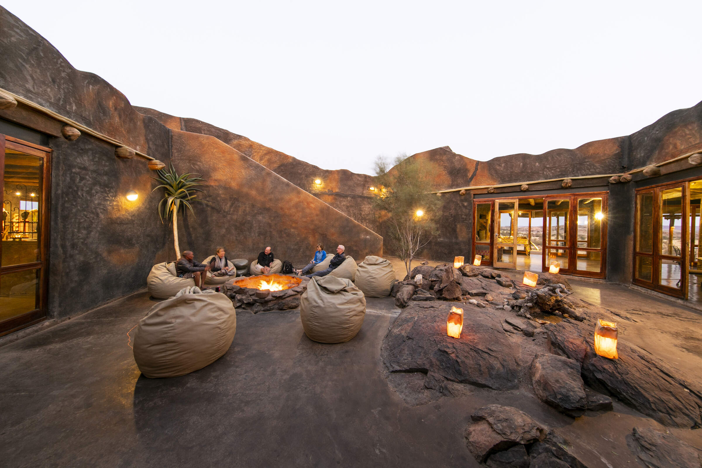
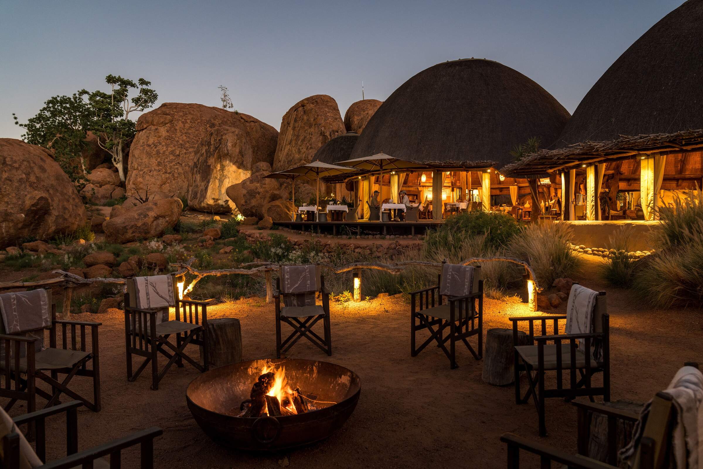
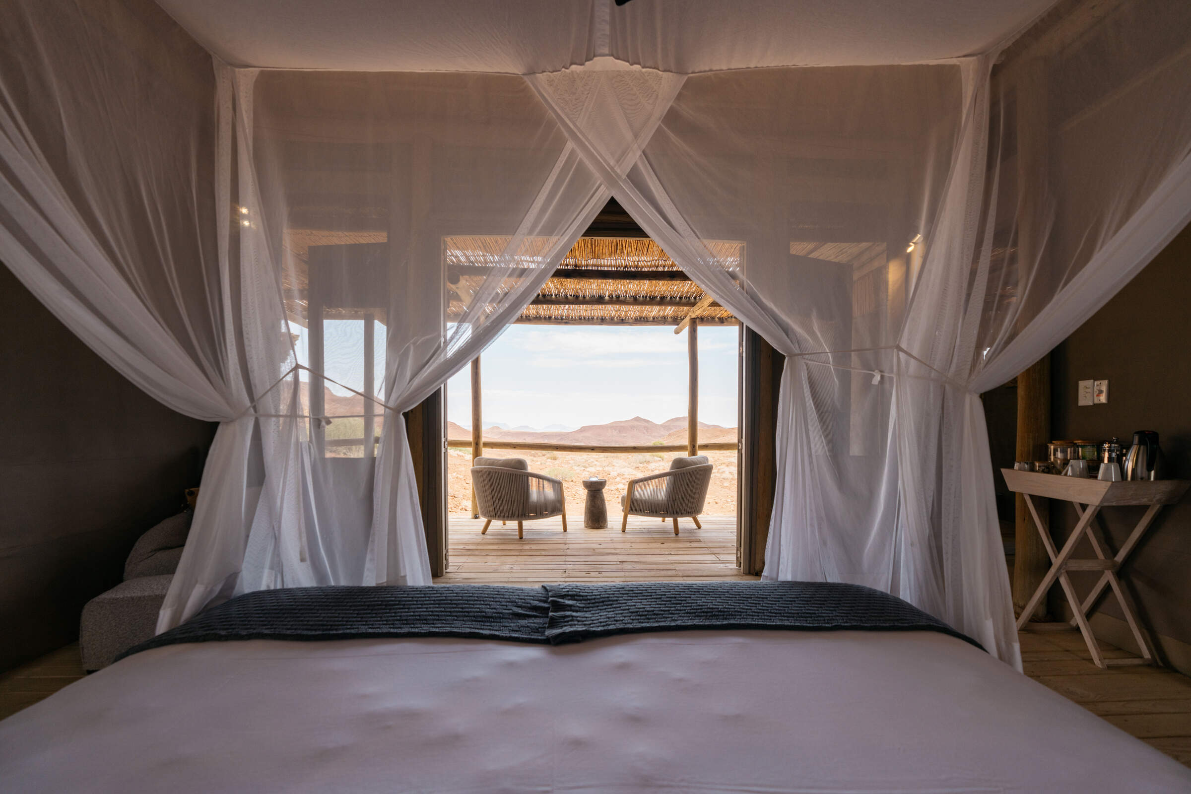
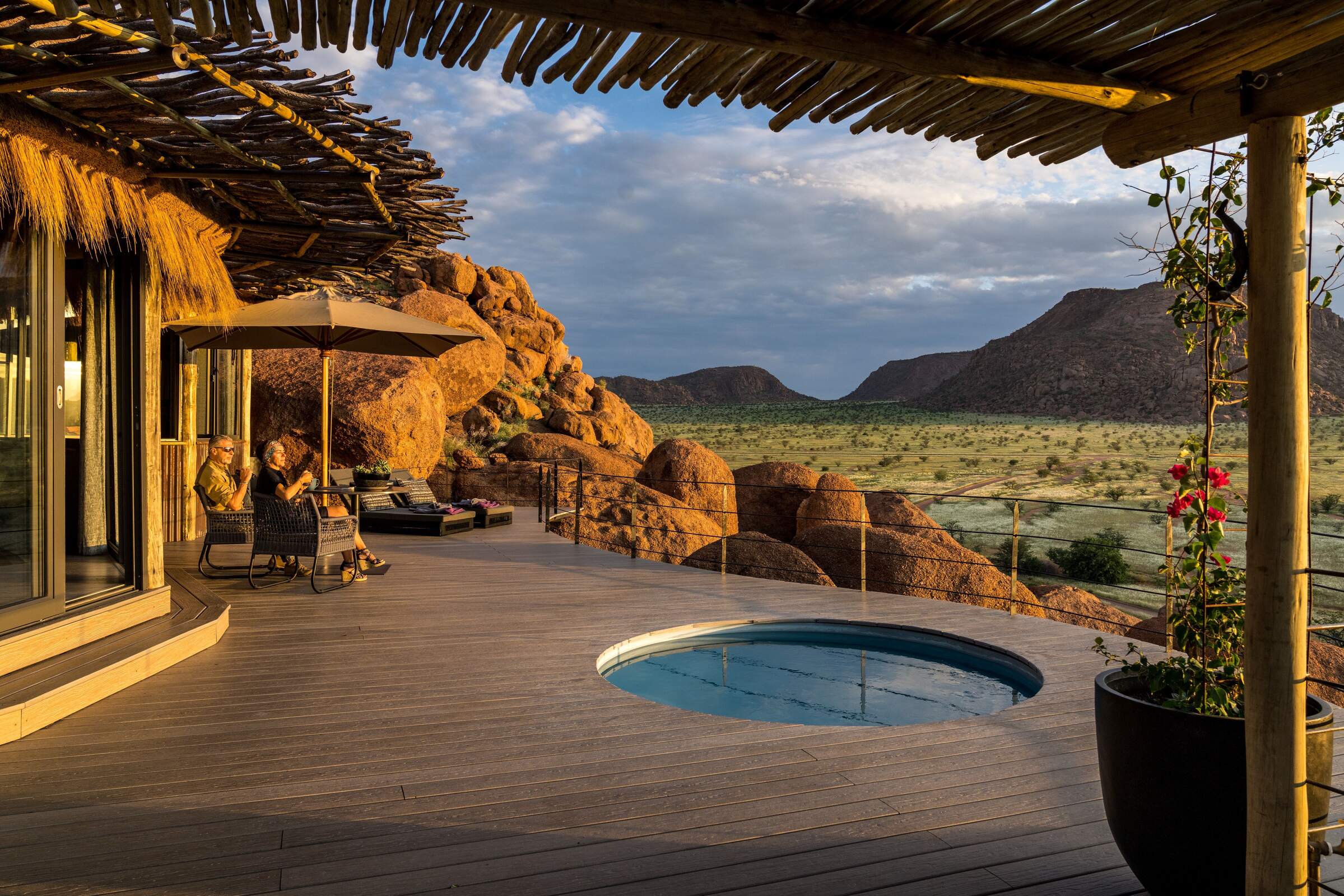
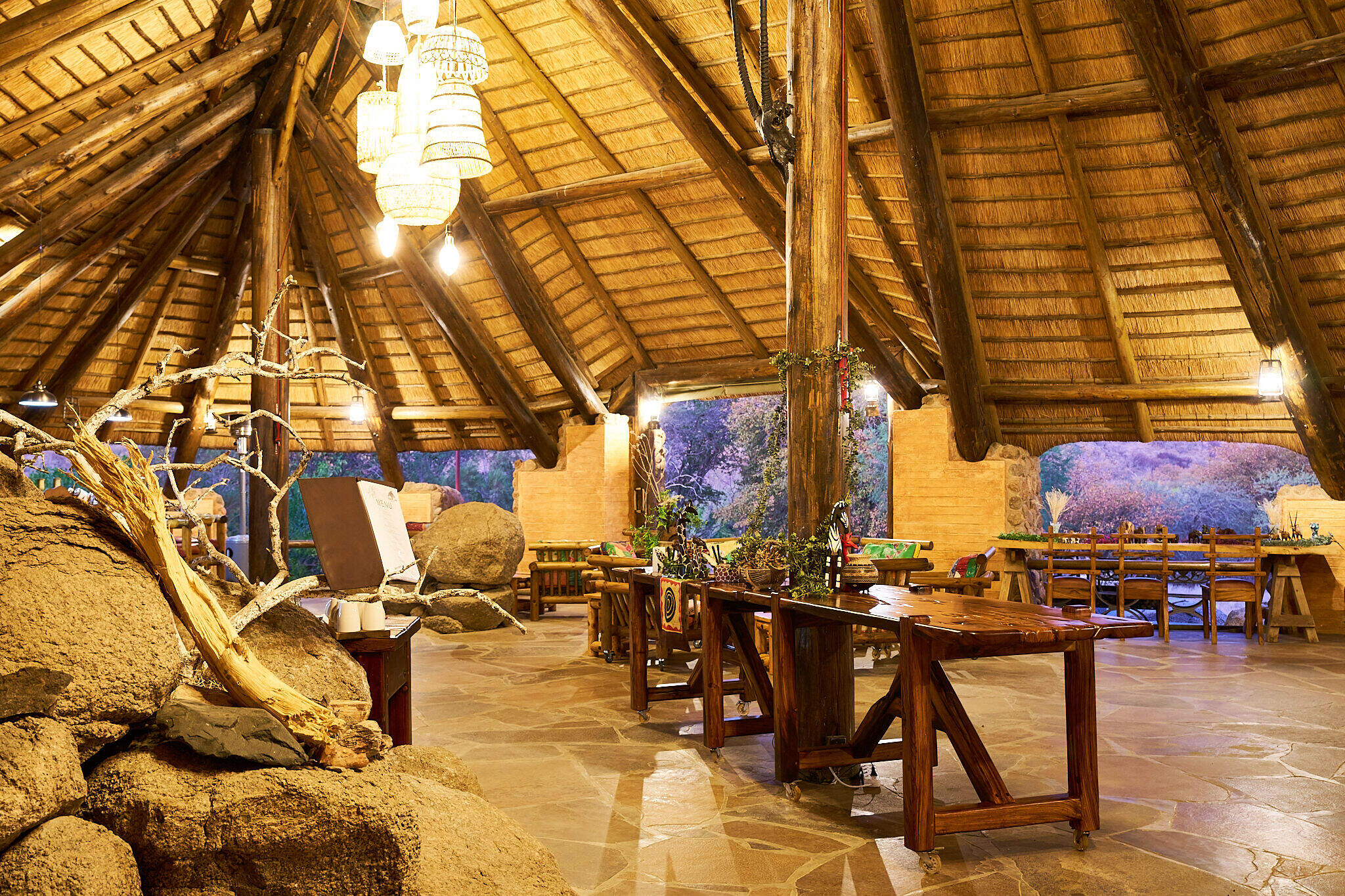
Scattered across the wilderness that is Damaraland, camps and lodges blend seamlessly into its rugged terrain. Against the stark beauty of this ancient landscape, many lodges combine traditional African design with modern comfort, creating an authentic yet often indulgent retreat.
Among the most sought-after locations are the dramatic rock formations of Twyfelfontein and the sweeping vistas of Palmwag. Here, you'll find Doro Nawas, renowned for its panoramic views and stargazing opportunities, and Mowani Mountain Camp, celebrated for its unusual boulder-strewn setting. For those seeking adventure, Desert Rhino Camp offers thrilling rhino-tracking excursions, while Grootberg Lodge boasts breathtaking views from its perch atop the Etendeka Plateau. Each lodge in Damaraland promises an individual encounter with this wilderness region, whether from your private veranda or aboard an open-topped game-drive vehicle.
Doro Nawas
Comfortable rooms and a convenient location make the community run Doro Nawas a great base for exploring Damaraland.
Mowani Mountain Camp
Mowani is a beautiful and stylish mountain retreat in southern Damaraland; it makes a great base for visits toTwyfelfontein.
Damaraland Camp
Setting the standard for community partnerships, Damaraland Camp offers a beautiful location, a range of activities – and a genuine welcome.
Camp Kipwe
With unusual, igloo-like rooms, open-air bathrooms and beautiful scenery, Camp Kipwe is well placed for nature and cultural excursions.
Desert Rhino Camp
Desert Rhino Camp offers a rare opportunity to track black rhino on foot in one of the last true wilderness areas – an amazing experience.
Etendeka Camp
Etendeka is an owner-run camp in the remote and less visited north of Damaraland. The camp is renowned for it's spectacular guided walking trails.
Grootberg Lodge
On the edge of an ancient plateau Grootberg Lodge has a stunning location and arguably the best views of any lodge in Namibia.
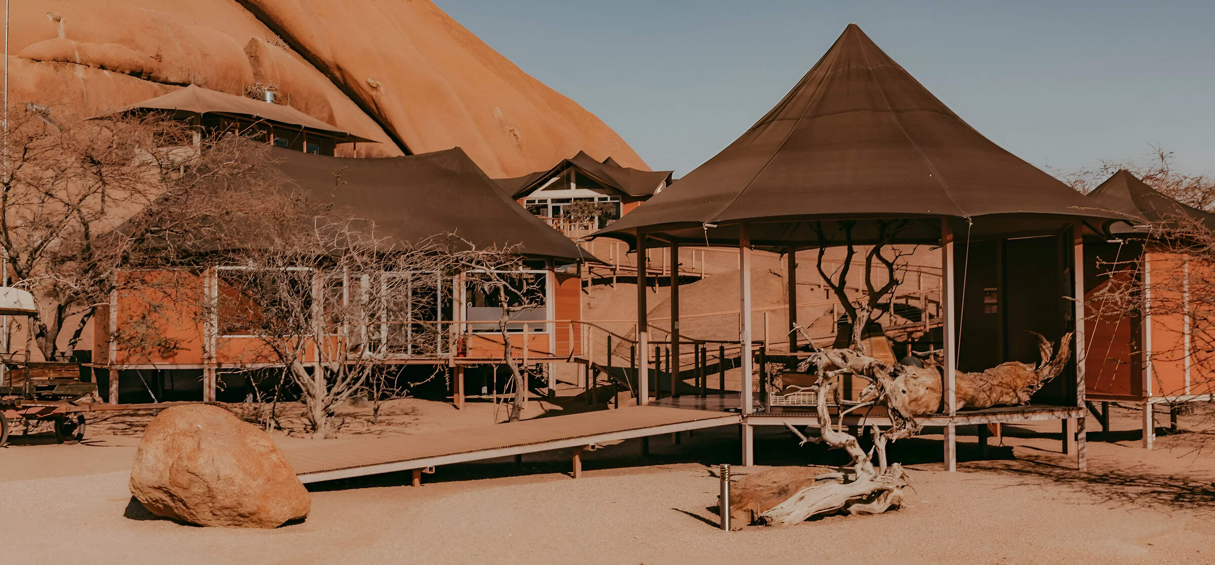
Twyfelfontein C'try Lod.
A large lodge set among the rocks, Twyfelfontein Country Lodge is a convenient base for visiting the rock engravings, which are only 4km away.
Spitzkoppen Lodge
Spitzkoppen Lodge provides stylish accommodation in an area of scenic grandeur with guided access to sites of ancient Bushman rock art.
Palmwag Lodge
Palmwag Lodge has a great location by a spring in the Uniab River and offers access to an area where you can see a variety of desert-dwelling animals.
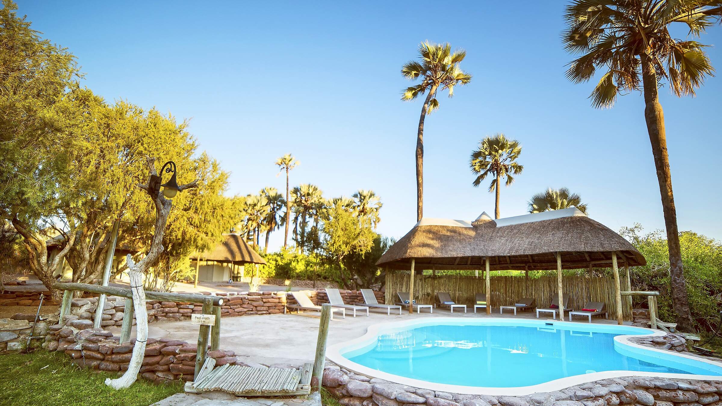
Huab Lodge
Huab is a classic little Namibian Lodge which is slightly off the beaten track in a lesser visited part of Damaraland.
Brandberg White Lady
Brandberg White Lady Lodge, nestled at the foot of its namesake, makes a good base from which to visit bushman rock paintings including the 'White Lady'.

Looking for inspiration on where to travel next?
Visit our trip chooser to explore your options and find inspiration for your perfect African adventure
Inspire me